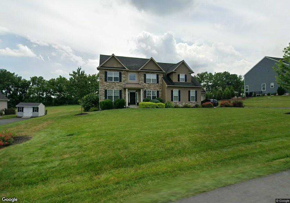
325 Aubrey Rd Unit Lot 14 Nazareth, PA 18064
Estimated Value: $711,000 - $835,000
4
Beds
3
Baths
2,755
Sq Ft
$280/Sq Ft
Est. Value
About This Home
This home is located at 325 Aubrey Rd Unit Lot 14, Nazareth, PA 18064 and is currently estimated at $770,807, approximately $279 per square foot. 325 Aubrey Rd Unit Lot 14 is a home located in Northampton County with nearby schools including Kenneth N Butz Elementary School, Nazareth Area Middle School, and Nazareth Area High School.
Ownership History
Date
Name
Owned For
Owner Type
Purchase Details
Closed on
Jun 26, 2018
Sold by
Spotlot Development Company Inc
Bought by
Polise Michael J and Polise Debra J
Current Estimated Value
Home Financials for this Owner
Home Financials are based on the most recent Mortgage that was taken out on this home.
Original Mortgage
$367,425
Outstanding Balance
$319,133
Interest Rate
4.6%
Mortgage Type
New Conventional
Estimated Equity
$451,674
Purchase Details
Closed on
Jan 12, 2018
Sold by
Silo Drive Llc
Bought by
Spotlot Development Company Inc
Home Financials for this Owner
Home Financials are based on the most recent Mortgage that was taken out on this home.
Original Mortgage
$301,000
Interest Rate
3.9%
Mortgage Type
Construction
Create a Home Valuation Report for This Property
The Home Valuation Report is an in-depth analysis detailing your home's value as well as a comparison with similar homes in the area
Home Values in the Area
Average Home Value in this Area
Purchase History
| Date | Buyer | Sale Price | Title Company |
|---|---|---|---|
| Polise Michael J | $489,900 | None Available | |
| Spotlot Development Company Inc | $117,500 | None Available |
Source: Public Records
Mortgage History
| Date | Status | Borrower | Loan Amount |
|---|---|---|---|
| Open | Polise Michael J | $367,425 | |
| Previous Owner | Spotlot Development Company Inc | $301,000 |
Source: Public Records
Tax History Compared to Growth
Tax History
| Year | Tax Paid | Tax Assessment Tax Assessment Total Assessment is a certain percentage of the fair market value that is determined by local assessors to be the total taxable value of land and additions on the property. | Land | Improvement |
|---|---|---|---|---|
| 2025 | $1,352 | $125,200 | $19,800 | $105,400 |
| 2024 | $8,968 | $118,300 | $19,800 | $98,500 |
| 2023 | $8,884 | $118,300 | $19,800 | $98,500 |
| 2022 | $8,884 | $118,300 | $19,800 | $98,500 |
| 2021 | $8,877 | $118,300 | $19,800 | $98,500 |
| 2020 | $8,540 | $113,800 | $19,800 | $94,000 |
| 2019 | $1,454 | $113,800 | $19,800 | $94,000 |
| 2018 | $1,430 | $19,700 | $19,700 | $0 |
Source: Public Records
Map
Nearby Homes
- 1501 Corkscrew Dr Unit 13
- 228 Cherry Hill Rd
- 207 W Douglasville Rd
- 500 Hall Rd
- 132 Nazareth Dr
- 108 E Douglasville Rd
- 166 Forest Dr
- 0 Forest Dr Unit 744781
- 336 Nazareth Dr
- 130 Longenbach Ave
- 2438 Blue Jay Dr
- 91 Birchwood Dr
- 2152 Amlisa Rd
- 861 Muschlitz Rd
- 51 S Church St
- 49 N Broad St
- 170 S Church St
- 206 S Main St
- 916 Bushkill Center Rd
- 55 Sycamore Dr
- 325 Aubrey Rd Unit Lot 14
- 321 Aubrey Rd
- 329 Aubrey Rd
- 317 Aubrey Rd
- 333 Aubrey Rd
- 225 Abigail Dr Unit Lot 29
- 313 Aubrey Rd
- 221 Abigail Dr Unit Lot 30
- 337 Aubrey Rd
- 213 Abigail Dr Unit 28
- 213 Abigail Dr Unit 32
- 213 Abigail Dr Unit 32
- 226 Abigail Dr Unit 22
- 209 Abigail Dr Unit 29
- 217 Abigail Dr
- 309 Aubrey Rd Unit Lot 18
- 309 Aubrey Rd Unit 18
- 309 Aubrey Rd
- 210 Abigail Dr
- 210 Abigail Dr Unit 26