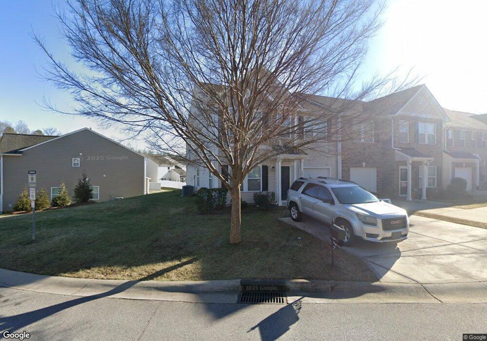
325 Battery Cir Unit 51 Clover, SC 29710
Estimated Value: $330,000 - $344,000
3
Beds
3
Baths
2,017
Sq Ft
$166/Sq Ft
Est. Value
About This Home
This home is located at 325 Battery Cir Unit 51, Clover, SC 29710 and is currently estimated at $334,748, approximately $165 per square foot. 325 Battery Cir Unit 51 is a home located in York County with nearby schools including Crowders Creek Elementary School, Oakridge Middle School, and Clover High School.
Ownership History
Date
Name
Owned For
Owner Type
Purchase Details
Closed on
Jan 15, 2016
Sold by
True Homes Llc
Bought by
Doudak Rizkallah and Doudak Fayzah
Current Estimated Value
Purchase Details
Closed on
Sep 15, 2015
Sold by
Red Pill Investments Llc
Bought by
True Homes Llc
Purchase Details
Closed on
Dec 31, 2014
Sold by
Park Sterling Bank
Bought by
Red Pill Investments Llc
Purchase Details
Closed on
Dec 22, 2009
Sold by
Nvr Inc
Bought by
Olson Development Llc
Purchase Details
Closed on
Sep 30, 2009
Sold by
Olson Development Llc
Bought by
Nvr Inc
Create a Home Valuation Report for This Property
The Home Valuation Report is an in-depth analysis detailing your home's value as well as a comparison with similar homes in the area
Home Values in the Area
Average Home Value in this Area
Purchase History
| Date | Buyer | Sale Price | Title Company |
|---|---|---|---|
| Doudak Rizkallah | $178,000 | -- | |
| True Homes Llc | $21,000 | -- | |
| Red Pill Investments Llc | $175,000 | -- | |
| Olson Development Llc | $68,000 | -- | |
| Nvr Inc | $68,000 | -- |
Source: Public Records
Tax History Compared to Growth
Tax History
| Year | Tax Paid | Tax Assessment Tax Assessment Total Assessment is a certain percentage of the fair market value that is determined by local assessors to be the total taxable value of land and additions on the property. | Land | Improvement |
|---|---|---|---|---|
| 2025 | $5,414 | $13,133 | $2,198 | $10,935 |
| 2024 | $4,578 | $11,419 | $2,097 | $9,322 |
| 2023 | $4,447 | $11,419 | $2,098 | $9,321 |
| 2022 | $3,990 | $11,419 | $2,098 | $9,321 |
| 2021 | -- | $11,419 | $2,098 | $9,321 |
| 2020 | $3,851 | $11,419 | $0 | $0 |
| 2019 | $3,528 | $9,930 | $0 | $0 |
| 2018 | $3,484 | $9,930 | $0 | $0 |
| 2017 | $3,340 | $9,930 | $0 | $0 |
| 2016 | $3,214 | $9,930 | $0 | $0 |
| 2014 | $87 | $2,040 | $2,040 | $0 |
| 2013 | $87 | $2,220 | $2,220 | $0 |
Source: Public Records
Map
Nearby Homes
- 433 Battery Cir
- 431 Battery Cir
- 450 Battery Cir
- 370 Battery Cir Unit 20
- 00 Hwy
- 304 Inland Cove Ct
- 335 Carroll Cove
- 319 Inland Cove Ct
- 1715 Curtis Dr
- 1911 Marlin Dr
- 2678 Landing Pointe Dr
- 447 Leaf Arbor Ct
- 126 Misty Woods Dr
- 121 Misty Woods Dr
- 5141 Sapp Cir
- 1828 Kilkenny Dr
- 2180 Shady Pond Dr
- 5165 Sapp Cir
- 1727 Mineral Springs Rd
- 4211 Maggie Springs Way
- 325 Battery Cir
- 327 Battery Cir Unit 50
- 53 Battery Cir
- 1003B Battery Cir
- 329 Battery Cir
- 451 Battery Cir
- 451 Battery Cir Unit 52
- 449 Battery Cir
- 449 Battery Cir Unit 53
- 331 Battery Cir
- 447 Battery Cir
- 447 Battery Cir Unit 447
- 92 Battery Cir
- 52 Battery Cir
- 320 Battery Cir Unit 1
- 1024D Battery Cir
- 322 Battery Cir
- 322 Battery Cir Unit 2
- 339 Battery Cir Unit 47
- 324 Battery Cir Unit 3