


325 Beartown Rd Jayess, MS 39641
Estimated payment $2,122/month
Highlights
- Waterfront
- Creek On Lot
- Wooded Lot
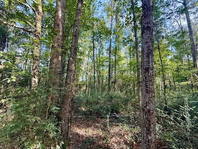
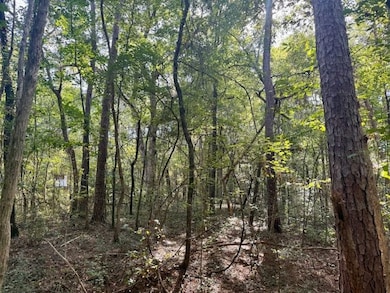
About This Lot
Discover 112 beautiful acres located in the highly regarded Jayess community of Walthall County, Mississippi—an ideal hunting, recreational, and timber investment property offering immediate enjoyment and long-term value. This tract showcases the characteristics that serious outdoorsmen and land investors seek: diverse habitat, quality timber, flowing water, excellent access, and proven wildlife performance. Properties with this combination of features are increasingly difficult to find, making this an exceptional opportunity in one of southwest Mississippi’s most desirable rural areas.
From the moment you arrive, the quality and usability of this property are evident. With paved road frontage and a well-developed internal road system, access is convenient and efficient, allowing you to navigate the property with ease. The rolling terrain enhances both drainage and wildlife movement while creating a visually appealing landscape that feels larger and more dynamic than typical flat tracts. Whether used as a private hunting retreat, a recreational getaway, or a long-term land investment, this property offers versatility without compromise.
The timber composition is a standout feature of this tract. Over 25 acres consist of mature hardwood and pine timber, providing immediate wildlife habitat, natural cover, and long-term timber value. The balance of the property is planted in a healthy 4–5 year old pine plantation, offering strong future income potential and excellent bedding and transition areas for deer and other wildlife. This mix of mature timber and young plantation creates ideal edge habitat—one of the most important factors in consistently productive hunting properties.
A small creek runs through the property, adding a valuable water source and enhancing wildlife attraction throughout the year. Flowing creeks are a premium feature on recreational tracts, supporting deer, turkey, and small game while also improving overall habitat diversity. The presence of Snail Creek further elevates this property’s recreational appeal and long-term desirability.
The area is well known for excellent deer and turkey hunting, and this tract is already set up to take full advantage of that reputation. Established food plots are in place, along with existing deer stands that will remain with the property, allowing a new owner to step right into hunting season with minimal preparation. The internal road system provides easy access to these hunting areas, making it simple to manage food plots, move equipment, and access stands quietly and efficiently.
Several potential camp or cabin sites are located throughout the property, offering flexibility in how the land is enjoyed. With nearby power access, developing a hunting camp, weekend retreat, or future home site is straightforward and cost-effective. Whether your vision includes a simple hunting camp or a more permanent structure, the property provides multiple options to fit your goals.
Beyond its recreational value, this tract stands out as a solid timber and land investment. The young pine plantation represents future income potential, while the mature timber adds immediate value and stability. Land of this quality in Walthall County continues to be in demand, particularly tracts that combine hunting, timber, water features, and access. As development pressures increase elsewhere, properties like this—offering privacy, usability, and natural resources—remain highly sought after.
The Jayess community is known for its rural charm, strong outdoor culture, and deep appreciation for land ownership. This part of Mississippi has long attracted hunters, land managers, and families looking to invest in property that can be enjoyed for generations. The combination of good neighbors, low traffic, and a quiet setting makes this an area where land ownership still holds true meaning.
This property is well suited for a wide range of buyers. Sportsmen will appreciate the proven hunting setup and habitat diversity. Investors will recognize the value of the timber, road system, and location. Families seeking a recreational retreat will enjoy the space, privacy, and opportunity to build lasting memories. Few properties offer this level of balance between immediate recreational use and long-term financial upside.
With paved road frontage, rolling hills, flowing water, established hunting infrastructure, and a strong timber profile, this 112-acre tract checks all the boxes. It offers the rare ability to purchase a property that is ready to use today while still providing significant upside for the future. Whether your goals include hunting, recreation, land management, or investment, this property delivers on every level.
Properties like this do not stay on the market long. If you have been searching for a well-rounded Mississippi hunting and recreational tract in a proven area, this is one you need to see.

Property Details
Property Type
- Land
Lot Details
- Waterfront
- Wooded Lot
- Current uses include hunting/fishing
- Potential uses include hunting/fishing, residential single, timber
Additional Features
- Creek On Lot
- Overhead Utilities
Map
Tax History
| Year | Tax Paid | Tax Assessment Tax Assessment Total Assessment is a certain percentage of the fair market value that is determined by local assessors to be the total taxable value of land and additions on the property. | Land | Improvement |
|---|---|---|---|---|
| 2025 | $496 | $5,341 | $0 | $0 |
| 2024 | $496 | $5,341 | $0 | $0 |
| 2023 | $485 | $5,341 | $0 | $0 |
| 2022 | $466 | $5,341 | $0 | $0 |
| 2021 | $890 | $7,124 | $0 | $0 |
| 2020 | $887 | $7,124 | $0 | $0 |
| 2019 | $887 | $7,124 | $0 | $0 |
| 2018 | $887 | $7,124 | $0 | $0 |
| 2017 | $839 | $6,771 | $0 | $0 |
| 2016 | $364 | $4,514 | $0 | $0 |
| 2015 | -- | $4,514 | $0 | $0 |
| 2014 | -- | $4,522 | $0 | $0 |
| 2013 | -- | $4,358 | $0 | $0 |
Property History
| Date | Event | Price | List to Sale | Price per Sq Ft | Prior Sale |
|---|---|---|---|---|---|
| 02/10/2026 02/10/26 | Price Changed | $389,900 | -14.3% | -- | |
| 10/06/2025 10/06/25 | For Sale | $455,000 | +664.7% | -- | |
| 08/23/2021 08/23/21 | Sold | -- | -- | -- | View Prior Sale |
| 05/28/2020 05/28/20 | Pending | -- | -- | -- | |
| 01/08/2019 01/08/19 | For Sale | $59,500 | -- | $51 / Sq Ft |
- 0 Beartown Rd
- 1636 Mississippi 583
- 182 Highway 44
- 0 Hwy 583 N Unit LotWP001 19718421
- 0 Hwy 583 N Unit LotWP001 19718422
- 0 Hwy 583 N Unit LotWP001 19872463
- 0000 C D Rayborn Rd
- 182 Hwy 44 None
- 239 Mississippi 44
- 23 Topeka Jayess Rd
- 6045 Mississippi 44
- 4027 Silverton Trail SE
- 0 Highway 44 Unit LotWP001
- Leonard Rd
- 4190 Mississippi 44
- 182 Hwy 44
- 3231 Mallalieu Dr SE
- 722 Holmesville Rd
- 7019 W Topisaw S
- 8001 W Topisaw S
- 218 Lawrence Reid Rd
- 7 Willie Roberts Rd
- 144 Old Highway 98 W Unit 4
- 840 Marion Ave
- 100 Marilyn Butler Dr
- 1300 14th St
- 1210 Parklane Rd
- 5575 Robin Wood Rd
- 1328 Parklane Rd
- 3018 Wardlaw Rd
- 2083 Martin Rd
- 530 N Jackson St Unit A
- 156 W Enterprise St Unit A
- 156 W Enterprise St Unit B
- 800 Magee Dr
- 1291 Field Lark Ln NE
- 902 Lafayette St
- 2018 Stewart Ln
- 21 Mount Zion Rd
Ask me questions while you tour the home.