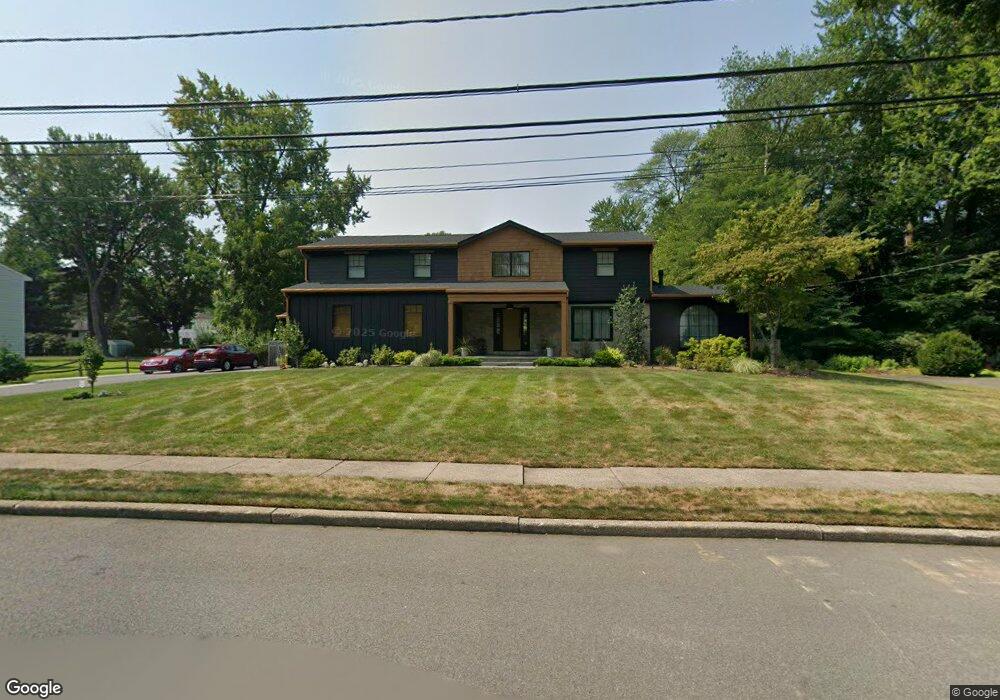
325 Bohny Dr Wyckoff, NJ 07481
Estimated Value: $1,427,000 - $1,737,000
4
Beds
4
Baths
3,423
Sq Ft
$456/Sq Ft
Est. Value
About This Home
This home is located at 325 Bohny Dr, Wyckoff, NJ 07481 and is currently estimated at $1,562,447, approximately $456 per square foot. 325 Bohny Dr is a home located in Bergen County with nearby schools including Dwight D Eisenhower Middle School, Ramapo High School, and Indian Hills High School.
Ownership History
Date
Name
Owned For
Owner Type
Purchase Details
Closed on
Sep 29, 2020
Sold by
Bolton David G and Bolton Leigh D
Bought by
Maresca Phillip and Mathew Minu
Current Estimated Value
Home Financials for this Owner
Home Financials are based on the most recent Mortgage that was taken out on this home.
Original Mortgage
$724,000
Interest Rate
2.8%
Mortgage Type
New Conventional
Purchase Details
Closed on
Jul 19, 1996
Sold by
Foote James and Foote Diane
Bought by
Bolton Dave and Bolton Leigh
Home Financials for this Owner
Home Financials are based on the most recent Mortgage that was taken out on this home.
Original Mortgage
$340,000
Interest Rate
8.37%
Purchase Details
Closed on
Oct 28, 1993
Sold by
Smithline Martin
Bought by
Foote James and Foote Diane
Home Financials for this Owner
Home Financials are based on the most recent Mortgage that was taken out on this home.
Original Mortgage
$200,000
Interest Rate
6.79%
Create a Home Valuation Report for This Property
The Home Valuation Report is an in-depth analysis detailing your home's value as well as a comparison with similar homes in the area
Home Values in the Area
Average Home Value in this Area
Purchase History
| Date | Buyer | Sale Price | Title Company |
|---|---|---|---|
| Maresca Phillip | $905,000 | Chicago Title Insurance Co | |
| Bolton Dave | $435,000 | -- | |
| Foote James | $442,500 | -- |
Source: Public Records
Mortgage History
| Date | Status | Borrower | Loan Amount |
|---|---|---|---|
| Previous Owner | Maresca Phillip | $724,000 | |
| Previous Owner | Bolton Dave | $340,000 | |
| Previous Owner | Foote James | $200,000 |
Source: Public Records
Tax History Compared to Growth
Tax History
| Year | Tax Paid | Tax Assessment Tax Assessment Total Assessment is a certain percentage of the fair market value that is determined by local assessors to be the total taxable value of land and additions on the property. | Land | Improvement |
|---|---|---|---|---|
| 2025 | $26,766 | $1,372,600 | $468,000 | $904,600 |
| 2024 | $17,836 | $1,372,600 | $468,000 | $904,600 |
| 2023 | $17,355 | $942,200 | $468,000 | $474,200 |
| 2022 | $17,355 | $942,200 | $468,000 | $474,200 |
| 2021 | $17,468 | $942,200 | $468,000 | $474,200 |
| 2020 | $17,289 | $942,200 | $468,000 | $474,200 |
| 2019 | $17,054 | $942,200 | $468,000 | $474,200 |
| 2018 | $16,790 | $942,200 | $468,000 | $474,200 |
| 2017 | $16,583 | $942,200 | $468,000 | $474,200 |
| 2016 | $16,319 | $942,200 | $468,000 | $474,200 |
| 2015 | $16,140 | $942,200 | $468,000 | $474,200 |
| 2014 | $16,205 | $1,021,100 | $518,000 | $503,100 |
Source: Public Records
Map
Nearby Homes
- 484 Caldwell Dr
- 374 Cedar Hill Ave
- 144 Emeline Dr
- 427 Grandview Ave
- 300 Merrywood Dr
- 306 Sunset Blvd
- 190 Madison Ave
- 120 Ravine Ave
- 732 Terrace Heights
- 352 Amherst St
- 80 Mary Ann Ln
- 137 Elmwood Place
- 400 Goffle Hill Rd
- 50 Faner Rd
- 113 Highview Ter Land
- 510 Sicomac Ave
- 535 Lafayette Ave
- 11 Surrey Place Unit 1
- 11 Surrey Place
- 113 Highview Terrace