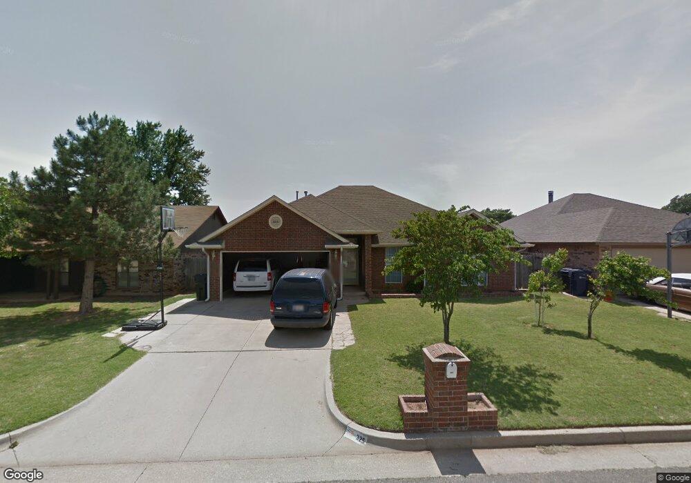
325 Conestoga Dr Yukon, OK 73099
West Watch NeighborhoodEstimated Value: $233,000 - $258,000
4
Beds
2
Baths
1,715
Sq Ft
$140/Sq Ft
Est. Value
About This Home
This home is located at 325 Conestoga Dr, Yukon, OK 73099 and is currently estimated at $240,035, approximately $139 per square foot. 325 Conestoga Dr is a home located in Canadian County with nearby schools including Mustang Creek Elementary School, Meadow Brook Intermediate School, and Mustang Central Middle School.
Ownership History
Date
Name
Owned For
Owner Type
Purchase Details
Closed on
Apr 2, 1999
Sold by
Weed Family Ltd Ptnrshp The
Bought by
John Mathew and John Jaya
Current Estimated Value
Purchase Details
Closed on
Mar 17, 1997
Sold by
Weed,Billy L Trustee
Purchase Details
Closed on
Jul 15, 1996
Sold by
Weed Billy L
Purchase Details
Closed on
Jul 12, 1996
Sold by
Weed Forest A and Weed Joy
Purchase Details
Closed on
Jul 11, 1996
Sold by
Weed Gary A
Purchase Details
Closed on
Dec 14, 1995
Sold by
Weed Billy and Weed Opal
Create a Home Valuation Report for This Property
The Home Valuation Report is an in-depth analysis detailing your home's value as well as a comparison with similar homes in the area
Home Values in the Area
Average Home Value in this Area
Purchase History
| Date | Buyer | Sale Price | Title Company |
|---|---|---|---|
| John Mathew | $10,000 | -- | |
| -- | -- | -- | |
| -- | -- | -- | |
| -- | -- | -- | |
| -- | -- | -- | |
| -- | -- | -- |
Source: Public Records
Tax History Compared to Growth
Tax History
| Year | Tax Paid | Tax Assessment Tax Assessment Total Assessment is a certain percentage of the fair market value that is determined by local assessors to be the total taxable value of land and additions on the property. | Land | Improvement |
|---|---|---|---|---|
| 2024 | $2,063 | $19,793 | $1,440 | $18,353 |
| 2023 | $2,063 | $19,216 | $1,440 | $17,776 |
| 2022 | $2,029 | $18,657 | $1,440 | $17,217 |
| 2021 | $1,960 | $18,113 | $1,440 | $16,673 |
| 2020 | $2,001 | $18,297 | $1,440 | $16,857 |
| 2019 | $1,941 | $17,791 | $1,440 | $16,351 |
| 2018 | $1,915 | $17,273 | $1,440 | $15,833 |
| 2017 | $1,832 | $16,770 | $1,440 | $15,330 |
| 2016 | $1,771 | $16,770 | $1,440 | $15,330 |
| 2015 | $1,675 | $15,807 | $1,440 | $14,367 |
| 2014 | $1,675 | $15,347 | $1,440 | $13,907 |
Source: Public Records
Map
Nearby Homes
- 311 Tumbleweed Rd
- 418 Palo Verde Dr
- 708 Cactus Ct
- 12127 SW 4th St
- 1000 Redwood Creek Dr
- 1004 Redwood Creek Dr
- 1008 Redwood Creek Dr
- 1012 Redwood Creek Dr
- 1016 Redwood Creek Dr
- 1005 Redwood Creek Dr
- 1009 Redwood Creek Dr
- 1013 Redwood Creek Dr
- 1017 Redwood Creek Dr
- 1105 Redwood Creek Dr
- 1100 Redwood Creek Dr
- 1101 Redwood Creek Dr
- 1113 Redwood Creek Dr
- 1109 Redwood Creek Dr
- 1108 Redwood Creek Dr
- 1104 Redwood Creek Dr
- 321 Conestoga Dr
- 401 Conestoga Dr
- 405 Conestoga Dr
- 404 Sage Brush Rd
- 317 Conestoga Dr
- 314 Sage Brush Rd
- 408 Sage Brush Rd
- 316 Conestoga Dr
- 400 Conestoga Dr
- 313 Conestoga Dr
- 409 Conestoga Dr
- 404 Conestoga Dr
- 312 Conestoga Dr
- 412 Sage Brush Rd
- 308 Sage Brush Rd
- 408 Conestoga Dr
- 309 Conestoga Dr
- 308 Conestoga Dr
- 413 Conestoga Dr
- 233 Out West Trail