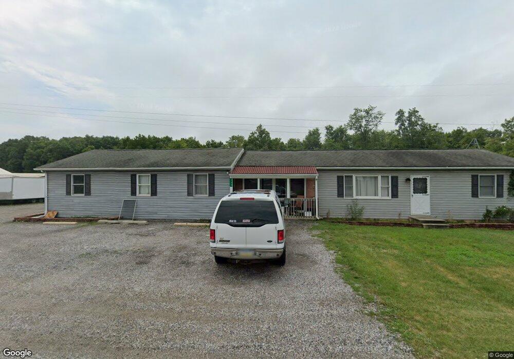
325 Gettysburg Rd Unit 2 Littlestown, PA 17340
Estimated Value: $429,380 - $567,000
3
Beds
2
Baths
2,232
Sq Ft
$220/Sq Ft
Est. Value
About This Home
This home is located at 325 Gettysburg Rd Unit 2, Littlestown, PA 17340 and is currently estimated at $492,095, approximately $220 per square foot. 325 Gettysburg Rd Unit 2 is a home located in Adams County with nearby schools including Rolling Acres El School, Maple Avenue Middle School, and Littlestown Senior High School.
Ownership History
Date
Name
Owned For
Owner Type
Purchase Details
Closed on
Sep 14, 2020
Sold by
Smith Ronald W and Smith Deanna G
Bought by
Maccall Dale L
Current Estimated Value
Purchase Details
Closed on
Jun 16, 2006
Sold by
Matthews George F and Matthews Barbara A
Bought by
Maccall Dale L
Home Financials for this Owner
Home Financials are based on the most recent Mortgage that was taken out on this home.
Original Mortgage
$320,000
Interest Rate
6.59%
Mortgage Type
New Conventional
Create a Home Valuation Report for This Property
The Home Valuation Report is an in-depth analysis detailing your home's value as well as a comparison with similar homes in the area
Home Values in the Area
Average Home Value in this Area
Purchase History
| Date | Buyer | Sale Price | Title Company |
|---|---|---|---|
| Maccall Dale L | $50,000 | None Available | |
| Maccall Dale L | $400,000 | -- |
Source: Public Records
Mortgage History
| Date | Status | Borrower | Loan Amount |
|---|---|---|---|
| Previous Owner | Maccall Dale L | $320,000 |
Source: Public Records
Tax History Compared to Growth
Tax History
| Year | Tax Paid | Tax Assessment Tax Assessment Total Assessment is a certain percentage of the fair market value that is determined by local assessors to be the total taxable value of land and additions on the property. | Land | Improvement |
|---|---|---|---|---|
| 2025 | $5,680 | $300,100 | $136,400 | $163,700 |
| 2024 | $5,460 | $300,100 | $136,400 | $163,700 |
| 2023 | $5,322 | $300,100 | $136,400 | $163,700 |
| 2022 | $5,284 | $300,100 | $136,400 | $163,700 |
| 2021 | $5,096 | $300,100 | $136,400 | $163,700 |
| 2020 | $5,022 | $300,100 | $136,400 | $163,700 |
| 2019 | $4,914 | $300,100 | $136,400 | $163,700 |
| 2018 | $4,768 | $300,100 | $136,400 | $163,700 |
| 2017 | $4,619 | $300,100 | $136,400 | $163,700 |
| 2016 | -- | $300,100 | $136,400 | $163,700 |
| 2015 | -- | $300,100 | $136,400 | $163,700 |
| 2014 | -- | $300,100 | $136,400 | $163,700 |
Source: Public Records
Map
Nearby Homes
- 1024 Frederick Pike Unit 6
- 0 Hershey Rd Unit PALA2058618
- 0 Conestoga Blvd Unit PALA2080682
- 2238 Harney Rd Unit 3
- 161 Stoners Cir
- 58 Windsor Ct
- 20c Locust Dr
- 0 Locust Dr Unit PAAD2015910
- 37 Amanda Dr Unit 14
- 440 N Queen St
- 140 Apple Grove Ln Unit 425
- 22 Rita Marie Ave
- 15 Yorktowne Ct Unit 97
- 464 Locust Ln
- 117 Charles St
- 162 Newark St
- 115 Charles St
- 22 Cemetery St
- 61 E King St
- 106 E King St
- 324 Gettysburg Rd Unit 16
- 340 Gettysburg Rd Unit 15
- 350 Gettysburg Rd Unit 14
- 314 Gettysburg Rd Unit 1
- 290 Gettysburg Rd Unit 17
- Lot M Street
- Lot 9 Lori Ln
- Lot 8 Lori Ln
- Lots Crosswinds Dr
- 270 Gettysburg Rd
- 405 Gettysburg Rd Unit 1
- 250 Gettysburg Rd Unit 15
- 240 Gettysburg Rd
- 436 Gettysburg Rd
- 75 Saint Johns Rd W Unit 20
- 220 Gettysburg Rd Unit 2
- 29 Saint Johns Rd W
- 490 Gettysburg Rd Unit 12
- 105 Saint Johns Rd W
- 70 Saint Johns Rd W