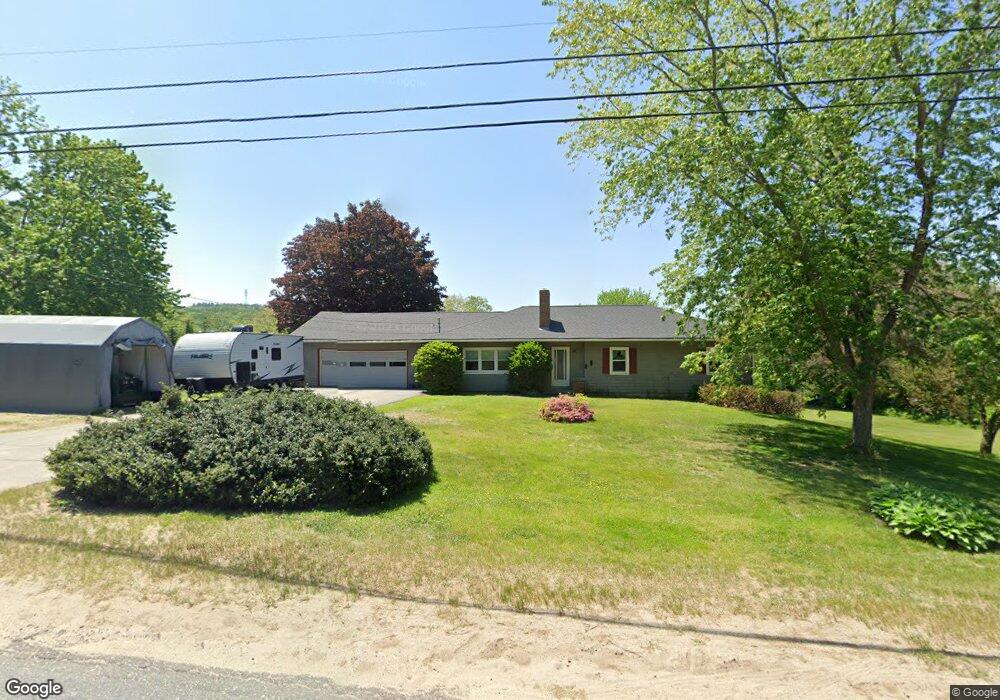
325 Gibbs Mill Rd Livermore, ME 04253
Estimated Value: $368,000 - $561,000
3
Beds
2
Baths
1,404
Sq Ft
$327/Sq Ft
Est. Value
About This Home
This home is located at 325 Gibbs Mill Rd, Livermore, ME 04253 and is currently estimated at $459,271, approximately $327 per square foot. 325 Gibbs Mill Rd is a home located in Androscoggin County with nearby schools including Spruce Mountain Primary School, Spruce Mountain Elementary School, and Spruce Mountain Middle School.
Ownership History
Date
Name
Owned For
Owner Type
Purchase Details
Closed on
Apr 28, 2011
Sold by
Leach Richard D and Leach Linda D
Bought by
Hiscock Todd L and Hiscock Lisa E
Current Estimated Value
Home Financials for this Owner
Home Financials are based on the most recent Mortgage that was taken out on this home.
Original Mortgage
$144,500
Outstanding Balance
$99,145
Interest Rate
4.76%
Mortgage Type
Purchase Money Mortgage
Estimated Equity
$360,126
Create a Home Valuation Report for This Property
The Home Valuation Report is an in-depth analysis detailing your home's value as well as a comparison with similar homes in the area
Home Values in the Area
Average Home Value in this Area
Purchase History
| Date | Buyer | Sale Price | Title Company |
|---|---|---|---|
| Hiscock Todd L | -- | -- |
Source: Public Records
Mortgage History
| Date | Status | Borrower | Loan Amount |
|---|---|---|---|
| Open | Hiscock Todd L | $144,500 |
Source: Public Records
Tax History Compared to Growth
Tax History
| Year | Tax Paid | Tax Assessment Tax Assessment Total Assessment is a certain percentage of the fair market value that is determined by local assessors to be the total taxable value of land and additions on the property. | Land | Improvement |
|---|---|---|---|---|
| 2025 | $4,872 | $257,752 | $142,500 | $115,252 |
| 2024 | $4,408 | $257,752 | $142,500 | $115,252 |
| 2023 | $4,188 | $257,752 | $142,500 | $115,252 |
| 2022 | $4,124 | $257,752 | $142,500 | $115,252 |
| 2021 | $4,124 | $257,752 | $142,500 | $115,252 |
| 2020 | $3,931 | $257,752 | $142,500 | $115,252 |
| 2019 | $3,909 | $240,561 | $148,500 | $92,061 |
| 2018 | $3,849 | $240,561 | $148,500 | $92,061 |
| 2017 | $3,945 | $240,561 | $148,500 | $92,061 |
| 2016 | $3,849 | $240,561 | $148,500 | $92,061 |
| 2015 | $3,849 | $240,561 | $148,500 | $92,061 |
| 2014 | $3,416 | $240,561 | $148,500 | $92,061 |
Source: Public Records
Map
Nearby Homes
- Lot 9B Pulsifer Rd
- 9 Pulsifer Rd
- 21 Stonewall Dr
- 881 River Rd
- 642 Federal Rd
- 1081 Federal Rd
- 614 Federal Rd
- 0 Gibbs Mill Rd
- 21 Hathaway Hill Rd
- 62 Norton Rd
- 171 Park St
- 1076 Park St
- 146 Karn Rd
- Lot 13 Tbd Foundry Rd
- 11 Oak St
- 309 Strickland Ferry Rd
- 36 Sewall St
- 1 Beaulieu Rd
- 4 Sewall St
- 8 Millett St
- 320 Gibbs Mill Rd
- 329 Gibbs Mill Rd
- 317 Gibbs Mill Rd
- 334 Gibbs Mill Rd
- 341 Gibbs Mill Rd
- 340 Gibbs Mill Rd
- 10 Demoras Way
- 3 Fish Meadow Rd
- 4 Norlands Rd
- 4 Norlands Rd
- 305 Gibbs Mill Rd
- 0 Fish Meadow
- 0 Off Fish Meadow Rd Unit 1135890
- 0 Norlands
- 6 Demoras Way
- 301 Gibbs Mill Rd
- 17 Norlands Rd
- 306 Gibbs Mill Rd
- 296 Gibbs Mill Rd
- 15 Fish Meadow Rd