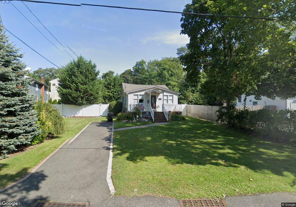
325 Madison St West Islip, NY 11795
Estimated Value: $496,425 - $766,000
2
Beds
1
Bath
--
Sq Ft
6,970
Sq Ft Lot
About This Home
This home is located at 325 Madison St, West Islip, NY 11795 and is currently estimated at $613,356. 325 Madison St is a home located in Suffolk County with nearby schools including Paul J Bellew Elementary School, Udall Road Middle School, and West Islip Senior High School.
Ownership History
Date
Name
Owned For
Owner Type
Purchase Details
Closed on
Aug 23, 2016
Sold by
Annibell Lisa
Bought by
Peragine Andrew and Peragine Isabell
Current Estimated Value
Home Financials for this Owner
Home Financials are based on the most recent Mortgage that was taken out on this home.
Original Mortgage
$240,000
Interest Rate
3.48%
Mortgage Type
New Conventional
Purchase Details
Closed on
Jan 26, 1998
Sold by
Annibell Frank and Annibell Kathleen
Bought by
Annibell Lisa
Home Financials for this Owner
Home Financials are based on the most recent Mortgage that was taken out on this home.
Original Mortgage
$63,000
Interest Rate
6.95%
Purchase Details
Closed on
Nov 7, 1997
Sold by
Morton Louise and Burwick Ruth
Bought by
Annibell Frank and Annibell Kathleen
Purchase Details
Closed on
Aug 4, 1997
Sold by
Notter Mary F and Notter Mary M
Bought by
Morton Louise and Burwick Ruth
Create a Home Valuation Report for This Property
The Home Valuation Report is an in-depth analysis detailing your home's value as well as a comparison with similar homes in the area
Home Values in the Area
Average Home Value in this Area
Purchase History
| Date | Buyer | Sale Price | Title Company |
|---|---|---|---|
| Peragine Andrew | $300,000 | None Available | |
| Annibell Lisa | $87,000 | Fidelity National Title | |
| Annibell Frank | $87,000 | Fidelity National Title Ins | |
| Morton Louise | $92,000 | Fidelity National Title Ins |
Source: Public Records
Mortgage History
| Date | Status | Borrower | Loan Amount |
|---|---|---|---|
| Previous Owner | Peragine Andrew | $240,000 | |
| Previous Owner | Annibell Lisa | $63,000 |
Source: Public Records
Tax History Compared to Growth
Tax History
| Year | Tax Paid | Tax Assessment Tax Assessment Total Assessment is a certain percentage of the fair market value that is determined by local assessors to be the total taxable value of land and additions on the property. | Land | Improvement |
|---|---|---|---|---|
| 2024 | $8,410 | $27,800 | $6,500 | $21,300 |
| 2023 | $8,410 | $27,800 | $6,500 | $21,300 |
| 2022 | $7,882 | $27,800 | $6,500 | $21,300 |
| 2021 | $7,882 | $27,800 | $6,500 | $21,300 |
| 2020 | $7,351 | $27,800 | $6,500 | $21,300 |
| 2019 | $7,882 | $0 | $0 | $0 |
| 2018 | -- | $27,800 | $6,500 | $21,300 |
| 2017 | $7,740 | $27,800 | $6,500 | $21,300 |
| 2016 | $7,753 | $27,800 | $6,500 | $21,300 |
| 2015 | -- | $27,800 | $6,500 | $21,300 |
| 2014 | -- | $27,800 | $6,500 | $21,300 |
Source: Public Records
Map
Nearby Homes
- 8 Gerek Ave
- 170 Wickfield Ln
- 14 Gerek Ave
- 409 Capri Rd
- 43 Hitherdell Ln
- 274 Edmunton Dr Unit K8
- 265 Edmunton Dr Unit I-12
- 205 Edmunton Dr Unit H17
- 214 Edmunton Dr Unit J3
- 192 Edmunton Dr Unit D1
- 134 Veronica Ln
- 182 Edmunton Dr Unit D3
- 47 Village Line Rd
- 15 Anthony Dr
- 72 Edmunton Dr Unit B-7
- 62 Edmunton Dr Unit B11
- 71 Edmunton Dr Unit F10
- 643 Deer Park Ave
- 144 Scott Ave
- 372 Hamilton Place