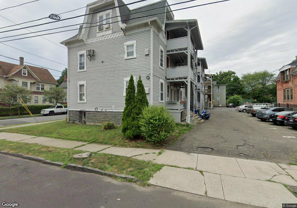
325 Mytrle Ave Unit 1204 Bridgeport, CT 06604
South End NeighborhoodEstimated Value: $167,000 - $186,020
1
Bed
1
Bath
950
Sq Ft
$184/Sq Ft
Est. Value
About This Home
This home is located at 325 Mytrle Ave Unit 1204, Bridgeport, CT 06604 and is currently estimated at $175,255, approximately $184 per square foot. 325 Mytrle Ave Unit 1204 is a home located in Fairfield County with nearby schools including Roosevelt School, Bassick High School, and New Beginnings Family Academy.
Ownership History
Date
Name
Owned For
Owner Type
Purchase Details
Closed on
Jan 12, 2015
Sold by
Chfa
Bought by
Zou Xun and Cho Narae
Current Estimated Value
Purchase Details
Closed on
Dec 26, 2013
Sold by
Bursk Catherine
Bought by
Chfa
Purchase Details
Closed on
Aug 25, 2008
Sold by
S&S Property Llc
Bought by
Bursk Jonathan H
Home Financials for this Owner
Home Financials are based on the most recent Mortgage that was taken out on this home.
Original Mortgage
$16,300
Interest Rate
6.4%
Create a Home Valuation Report for This Property
The Home Valuation Report is an in-depth analysis detailing your home's value as well as a comparison with similar homes in the area
Home Values in the Area
Average Home Value in this Area
Purchase History
| Date | Buyer | Sale Price | Title Company |
|---|---|---|---|
| Zou Xun | $61,200 | -- | |
| Zou Xun | $61,200 | -- | |
| Chfa | -- | -- | |
| Chfa | -- | -- | |
| Bursk Jonathan H | $235,000 | -- | |
| Bursk Jonathan H | $235,000 | -- |
Source: Public Records
Mortgage History
| Date | Status | Borrower | Loan Amount |
|---|---|---|---|
| Previous Owner | Bursk Jonathan H | $16,300 |
Source: Public Records
Tax History Compared to Growth
Tax History
| Year | Tax Paid | Tax Assessment Tax Assessment Total Assessment is a certain percentage of the fair market value that is determined by local assessors to be the total taxable value of land and additions on the property. | Land | Improvement |
|---|---|---|---|---|
| 2025 | $2,752 | $63,330 | $0 | $63,330 |
| 2024 | $2,752 | $63,330 | $0 | $63,330 |
| 2023 | $2,752 | $63,330 | $0 | $63,330 |
| 2022 | $2,752 | $63,330 | $0 | $63,330 |
| 2021 | $2,752 | $63,330 | $0 | $63,330 |
| 2020 | $3,543 | $65,630 | $0 | $65,630 |
| 2019 | $3,543 | $65,630 | $0 | $65,630 |
| 2018 | $3,568 | $65,630 | $0 | $65,630 |
| 2017 | $3,568 | $65,630 | $0 | $65,630 |
| 2016 | $3,568 | $65,630 | $0 | $65,630 |
| 2015 | $4,525 | $107,230 | $0 | $107,230 |
| 2014 | $4,525 | $107,230 | $0 | $107,230 |
Source: Public Records
Map
Nearby Homes
- 95 Austin St
- 325 Lafayette St Unit 5102
- 325 Lafayette St Unit 3303
- 59 Myrtle Ave Unit 61
- 10-12 Cottage Place
- 59 Rennell St Unit 19
- 160 E Main St
- 373 Iranistan Ave
- 68 Cole St
- 22 Sims St
- 850 Atlantic St Unit 208
- 21 Little St
- 70 Sims St
- 103 Sims St
- 881 Lafayette Blvd Unit 5K
- 881 Lafayette Blvd Unit 1A
- 201 Lewis St Unit 203
- 217 Alsace St
- 221 Alsace St
- 144 Cottage St
- 378 Atlantic St Unit 8
- 378 Atlantic St Unit 7
- 378 Atlantic St Unit 6
- 378 Atlantic St Unit 5
- 378 Atlantic St Unit 4
- 378 Atlantic St Unit 3
- 378 Atlantic St Unit 1
- 325 Myrtle Ave Unit 1302A
- 325 Myrtle Ave Unit 1402
- 325 Myrtle Ave Unit 1401
- 325 Myrtle Ave Unit 1302
- 325 Myrtle Ave Unit 1206
- 325 Myrtle Ave Unit 1205
- 325 Myrtle Ave Unit 1204
- 325 Myrtle Ave Unit 1203
- 325 Myrtle Ave Unit 1202
- 325 Myrtle Ave Unit 1201
- 325 Myrtle Ave Unit 1106
- 325 Myrtle Ave Unit 1105
- 325 Myrtle Ave Unit 1104