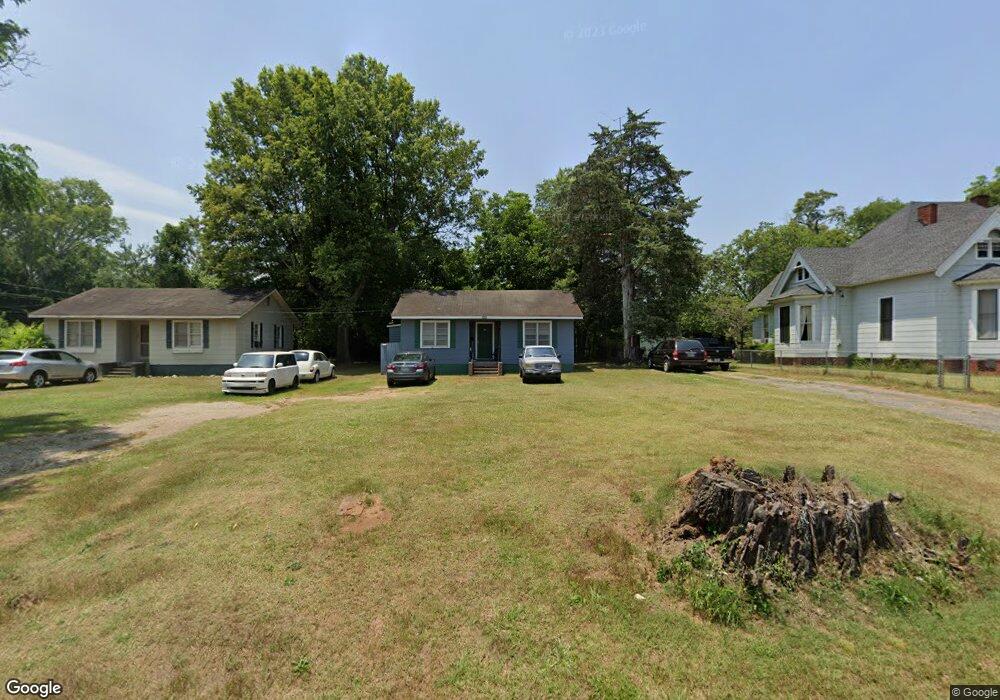
325 N Maple Ave Eatonton, GA 31024
Estimated Value: $101,000 - $176,000
2
Beds
1
Bath
958
Sq Ft
$143/Sq Ft
Est. Value
About This Home
This home is located at 325 N Maple Ave, Eatonton, GA 31024 and is currently estimated at $136,550, approximately $142 per square foot. 325 N Maple Ave is a home located in Putnam County with nearby schools including Putnam County Primary School, Putnam County Elementary School, and Putnam County Middle School.
Ownership History
Date
Name
Owned For
Owner Type
Purchase Details
Closed on
Apr 22, 2013
Sold by
Sec Of Housing & U
Bought by
Beckham Financial Enterprises
Current Estimated Value
Purchase Details
Closed on
Jul 3, 2012
Sold by
Bank Of America
Bought by
Sec Of Housing & Urban
Purchase Details
Closed on
May 29, 2008
Sold by
Not Provided
Bought by
Griffin Rachel
Home Financials for this Owner
Home Financials are based on the most recent Mortgage that was taken out on this home.
Original Mortgage
$91,661
Interest Rate
6%
Mortgage Type
FHA
Purchase Details
Closed on
May 17, 2006
Sold by
Not Provided
Bought by
Griffin Rachel
Create a Home Valuation Report for This Property
The Home Valuation Report is an in-depth analysis detailing your home's value as well as a comparison with similar homes in the area
Home Values in the Area
Average Home Value in this Area
Purchase History
| Date | Buyer | Sale Price | Title Company |
|---|---|---|---|
| Beckham Financial Enterprises | $18,500 | -- | |
| Sec Of Housing & Urban | $116,253 | -- | |
| Bank Of America | $116,253 | -- | |
| Griffin Rachel | $93,100 | -- | |
| Griffin Rachel | $73,000 | -- |
Source: Public Records
Mortgage History
| Date | Status | Borrower | Loan Amount |
|---|---|---|---|
| Previous Owner | Griffin Rachel | $91,661 |
Source: Public Records
Tax History Compared to Growth
Tax History
| Year | Tax Paid | Tax Assessment Tax Assessment Total Assessment is a certain percentage of the fair market value that is determined by local assessors to be the total taxable value of land and additions on the property. | Land | Improvement |
|---|---|---|---|---|
| 2024 | $739 | $27,704 | $6,000 | $21,704 |
| 2023 | $739 | $22,045 | $6,000 | $16,045 |
| 2022 | $736 | $23,572 | $6,000 | $17,572 |
| 2021 | $613 | $18,906 | $4,320 | $14,586 |
| 2020 | $636 | $18,796 | $4,320 | $14,476 |
| 2019 | $637 | $16,416 | $4,320 | $12,096 |
| 2018 | $568 | $16,416 | $4,320 | $12,096 |
| 2017 | $535 | $16,416 | $4,320 | $12,096 |
| 2016 | $536 | $16,416 | $4,320 | $12,096 |
| 2015 | $490 | $16,416 | $4,320 | $12,096 |
| 2014 | $489 | $16,416 | $4,320 | $12,096 |
Source: Public Records
Map
Nearby Homes
- 0 Phillips Dr Unit 67007
- 409 N Jefferson Ave
- 300 E Magnolia St
- 300 Carriage Way
- 194 Phillips Dr
- 204 N Madison Ave
- 307 Wayne St
- 113 N Jefferson Ave
- 156 Anchor Pointe
- 116 SE Hazelwood Dr
- 338 Anchor Pointe
- 105 Brookwood Dr
- 104 Blackberry Ln
- 106 Putnam Ave
- 110 Westminster Dr
- 157 Overlook Dr
- 139 Overlook Dr
- 0 Maple St N Unit 7036580
- 325 N Maple Ave
- 323 N Maple Ave
- 323 N Maple Ave
- 403 N Maple Ave
- 504 N Jefferson Ave
- 405 N Maple Ave
- 600 N Jefferson Ave
- 502 N Jefferson Ave
- 602 N Jefferson Ave
- 103 High St
- 502 N Jefferson Ave
- 324 N Maple Ave
- 500 N Jefferson Ave
- N Jefferson and Imperial Mill Rd
- 604 N Jefferson Ave
- 101 Swan Dr
- 320 N Maple Ave
- 104 High St
- 505 N Jefferson Ave