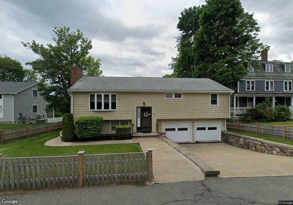
325 Nahant Rd Nahant, MA 01908
Estimated Value: $783,000 - $1,004,000
3
Beds
2
Baths
1,786
Sq Ft
$486/Sq Ft
Est. Value
About This Home
This home is located at 325 Nahant Rd, Nahant, MA 01908 and is currently estimated at $868,076, approximately $486 per square foot. 325 Nahant Rd is a home located in Essex County with nearby schools including Johnson Elementary School, Swampscott Middle School, and Swampscott High School.
Ownership History
Date
Name
Owned For
Owner Type
Purchase Details
Closed on
Aug 28, 2020
Sold by
325 Nahant Road Rt and Capano
Bought by
Capano Residence T and Capano
Current Estimated Value
Purchase Details
Closed on
Jan 8, 2010
Sold by
Capano Vittorio E and Capano Marion E
Bought by
Capano Tr Vittorio E
Home Financials for this Owner
Home Financials are based on the most recent Mortgage that was taken out on this home.
Original Mortgage
$200,000
Interest Rate
5%
Mortgage Type
Purchase Money Mortgage
Purchase Details
Closed on
Dec 17, 2009
Sold by
325 Nahant Road Nt and Capano
Bought by
Capano Vittorio E
Home Financials for this Owner
Home Financials are based on the most recent Mortgage that was taken out on this home.
Original Mortgage
$200,000
Interest Rate
5%
Mortgage Type
Purchase Money Mortgage
Create a Home Valuation Report for This Property
The Home Valuation Report is an in-depth analysis detailing your home's value as well as a comparison with similar homes in the area
Home Values in the Area
Average Home Value in this Area
Purchase History
| Date | Buyer | Sale Price | Title Company |
|---|---|---|---|
| Capano Residence T | -- | None Available | |
| Capano Residence T | -- | None Available | |
| Capano Residence T | -- | None Available | |
| Capano Tr Vittorio E | -- | -- | |
| Capano Tr Vittorio E | -- | -- | |
| Capano Vittorio E | -- | -- | |
| Capano Vittorio E | -- | -- |
Source: Public Records
Mortgage History
| Date | Status | Borrower | Loan Amount |
|---|---|---|---|
| Previous Owner | Capano Vittorio E | $200,000 |
Source: Public Records
Tax History Compared to Growth
Tax History
| Year | Tax Paid | Tax Assessment Tax Assessment Total Assessment is a certain percentage of the fair market value that is determined by local assessors to be the total taxable value of land and additions on the property. | Land | Improvement |
|---|---|---|---|---|
| 2025 | $6,942 | $758,700 | $475,900 | $282,800 |
| 2024 | $6,698 | $738,500 | $455,700 | $282,800 |
| 2023 | $6,024 | $662,700 | $405,000 | $257,700 |
| 2022 | $5,749 | $587,200 | $344,300 | $242,900 |
| 2021 | $5,755 | $547,600 | $324,000 | $223,600 |
| 2020 | $5,648 | $514,900 | $324,000 | $190,900 |
| 2019 | $5,268 | $482,900 | $303,800 | $179,100 |
| 2018 | $4,840 | $472,200 | $303,800 | $168,400 |
| 2017 | $4,944 | $472,200 | $303,800 | $168,400 |
| 2016 | $4,394 | $417,700 | $263,300 | $154,400 |
| 2015 | $4,285 | $392,400 | $238,000 | $154,400 |
| 2014 | $4,388 | $397,800 | $238,000 | $159,800 |
Source: Public Records
Map
Nearby Homes
- 303 Nahant Rd
- 51 Cliff St
- 3 Cliff St
- 66 Ocean St
- 2 Goddard Dr
- 183 Bass Point Rd
- 17 Pearl Rd
- 23 Phillips Rd
- 43 Maple Ave
- 9 Little Nahant Rd
- 36 Lennox Rd
- 9 Beach Rd Unit 4
- 45 Tudor St Unit 3-8
- 41 Tudor St
- 300 Lynn Shore Dr Unit 612
- 12 Chancery Ct Unit 205
- 12 Chancery Ct Unit 207
- 285 Lynn Shore Dr Unit 508
- 285 Lynn Shore Dr Unit 203
- 281 Lynn Shore Dr Unit 4
- 327 Nahant Rd
- 321 Nahant Rd
- 11 Christopher Dr
- 331 Nahant Rd
- 315 Nahant Rd
- 8 Desmond Dr
- 9 Christopher Dr
- 324 Nahant Rd
- 10 Christopher Dr
- 333 Nahant Rd
- 332 Nahant Rd
- 332 Nahant Rd Unit 2
- 332 Nahant Rd Unit 2R
- 328 Nahant Rd
- 6 Desmond Dr
- 7 Christopher Dr
- 311 Nahant Rd
- 316 Nahant Rd
- 8 Christopher Dr
- 4 Harmony Ct