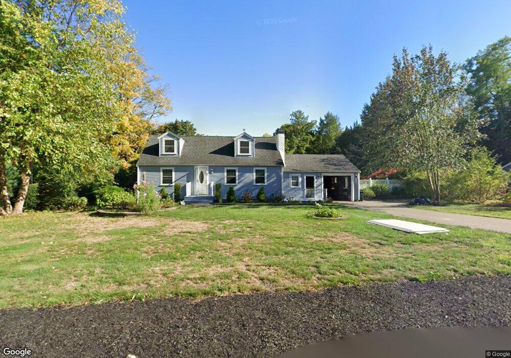
325 South St Wrentham, MA 02093
Estimated Value: $486,000 - $565,117
1
Bed
2
Baths
1,296
Sq Ft
$405/Sq Ft
Est. Value
About This Home
This home is located at 325 South St, Wrentham, MA 02093 and is currently estimated at $525,029, approximately $405 per square foot. 325 South St is a home located in Norfolk County with nearby schools including Delaney Elementary School and Charles E Roderick.
Ownership History
Date
Name
Owned For
Owner Type
Purchase Details
Closed on
Jun 15, 1979
Bought by
Keegan Thomas G and Keegan Anne B
Current Estimated Value
Create a Home Valuation Report for This Property
The Home Valuation Report is an in-depth analysis detailing your home's value as well as a comparison with similar homes in the area
Home Values in the Area
Average Home Value in this Area
Purchase History
| Date | Buyer | Sale Price | Title Company |
|---|---|---|---|
| Keegan Thomas G | -- | -- |
Source: Public Records
Mortgage History
| Date | Status | Borrower | Loan Amount |
|---|---|---|---|
| Open | Keegan Thomas G | $240,000 | |
| Closed | Keegan Thomas G | $50,000 | |
| Closed | Keegan Thomas G | $105,000 |
Source: Public Records
Tax History Compared to Growth
Tax History
| Year | Tax Paid | Tax Assessment Tax Assessment Total Assessment is a certain percentage of the fair market value that is determined by local assessors to be the total taxable value of land and additions on the property. | Land | Improvement |
|---|---|---|---|---|
| 2025 | $5,656 | $488,000 | $244,600 | $243,400 |
| 2024 | $5,435 | $452,900 | $244,600 | $208,300 |
| 2023 | $5,244 | $415,500 | $222,400 | $193,100 |
| 2022 | $5,145 | $376,400 | $216,300 | $160,100 |
| 2021 | $4,985 | $354,300 | $202,100 | $152,200 |
| 2020 | $4,768 | $334,600 | $154,300 | $180,300 |
| 2019 | $4,595 | $325,400 | $154,300 | $171,100 |
| 2018 | $4,061 | $285,200 | $154,500 | $130,700 |
| 2017 | $3,829 | $268,700 | $151,500 | $117,200 |
| 2016 | $3,767 | $263,800 | $147,200 | $116,600 |
| 2015 | $3,658 | $244,200 | $141,500 | $102,700 |
| 2014 | $3,599 | $235,100 | $136,100 | $99,000 |
Source: Public Records
Map
Nearby Homes
- 11 Earle Stewart Ln
- Lot 3 - 14 Earle Stewart Ln
- Lot 1 - Blueberry 2 Car Plan at King Philip Estates
- Lot 8 - Blueberry 2 Car Plan at King Philip Estates
- Lot 5 - Hughes 2 car Plan at King Philip Estates
- Lot 6 - Blueberry 3 Car Plan at King Philip Estates
- Lot 2 - Camden 2 Car Plan at King Philip Estates
- Lot 7 - Cedar Plan at King Philip Estates
- Lot 4 - Hemingway 2 Car Plan at King Philip Estates
- Lot 3 - Blueberry 2 Car Plan at King Philip Estates
- 131 Creek St Unit 7
- 319 Taunton St
- 10 Nature View Dr
- 15 Nature View Dr
- 791 South St Unit 5
- 570 Franklin St
- 155 Clark Rd Unit 155
- 362 East St
- 1 Lorraine Metcalf Dr
- 270 Dedham St