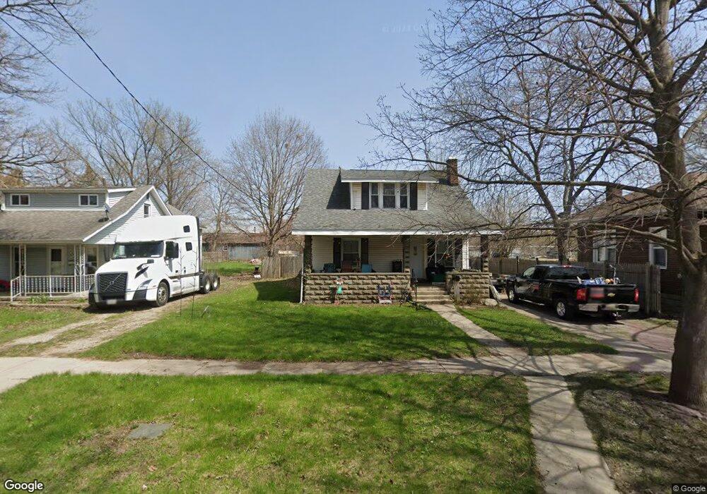
325 State St Owosso, MI 48867
Estimated Value: $107,000 - $135,000
3
Beds
1
Bath
--
Sq Ft
8,712
Sq Ft Lot
About This Home
This home is located at 325 State St, Owosso, MI 48867 and is currently estimated at $119,801. 325 State St is a home located in Shiawassee County with nearby schools including Owosso High School, Salem Lutheran School, and St. Paul School.
Ownership History
Date
Name
Owned For
Owner Type
Purchase Details
Closed on
Nov 8, 2011
Sold by
Joshua Harvest Ministries
Bought by
Miller Dale W and Miller Deborah M
Current Estimated Value
Purchase Details
Closed on
Oct 4, 2011
Sold by
Us Bank Na
Bought by
Joshua Harvest Ministries
Purchase Details
Closed on
Sep 7, 2011
Sold by
Us Bank Na
Bought by
Us Bank Na
Purchase Details
Closed on
Feb 9, 2011
Sold by
Bates Edward W and Bates Michelle C
Bought by
Us Bank National Association
Create a Home Valuation Report for This Property
The Home Valuation Report is an in-depth analysis detailing your home's value as well as a comparison with similar homes in the area
Home Values in the Area
Average Home Value in this Area
Purchase History
| Date | Buyer | Sale Price | Title Company |
|---|---|---|---|
| Miller Dale W | $19,800 | -- | |
| Joshua Harvest Ministries | -- | -- | |
| Us Bank Na | -- | -- | |
| Us Bank National Association | $27,200 | -- |
Source: Public Records
Tax History Compared to Growth
Tax History
| Year | Tax Paid | Tax Assessment Tax Assessment Total Assessment is a certain percentage of the fair market value that is determined by local assessors to be the total taxable value of land and additions on the property. | Land | Improvement |
|---|---|---|---|---|
| 2025 | $2,037 | $46,700 | $0 | $0 |
| 2024 | $2,037 | $43,000 | $0 | $0 |
| 2023 | $904 | $38,600 | $0 | $0 |
| 2022 | $1,962 | $34,700 | $0 | $0 |
| 2021 | $1,872 | $32,600 | $0 | $0 |
| 2020 | $1,907 | $31,400 | $0 | $0 |
| 2019 | $1,873 | $28,900 | $0 | $0 |
| 2018 | -- | $28,700 | $0 | $0 |
| 2017 | -- | $28,300 | $0 | $0 |
| 2016 | -- | $28,300 | $0 | $0 |
| 2015 | -- | $28,100 | $0 | $0 |
| 2014 | -- | $27,900 | $0 | $0 |
Source: Public Records
Map
Nearby Homes
- 214 S Cedar St
- 821 Ryan St
- 618 Clinton St
- 911 Beehler St
- 117 Elliot St
- 1408 W Main St
- 206 N Howell St
- 817 S Chipman St
- 523 Fletcher St
- 214 N Elm St
- 428 Cass St
- V/L W South (1 6) Acres St
- V/L W South - Lot#11 St
- 528 River St
- 522 River St
- 415 Genesee St
- 314 Michigan Ave
- 717 Nafus St
- 700 Nafus St
- Vacant W Oliver St