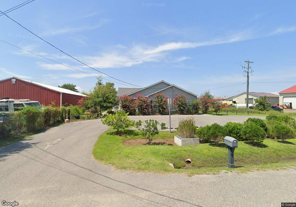
325 State St Stevensville, MD 21666
Estimated Value: $255,000
4
Beds
1
Bath
1,248
Sq Ft
$204/Sq Ft
Est. Value
About This Home
This home is located at 325 State St, Stevensville, MD 21666 and is currently priced at $255,000, approximately $204 per square foot. 325 State St is a home located in Queen Anne's County with nearby schools including Kent Island Elementary School, Bayside Elementary School, and Stevensville Middle School.
Ownership History
Date
Name
Owned For
Owner Type
Purchase Details
Closed on
Feb 2, 2016
Sold by
Queen Annes County Housing Authority
Bought by
The County Commissioners Of Queen Annes
Current Estimated Value
Purchase Details
Closed on
Nov 17, 2009
Sold by
Owen Shawn M and Owen Lori A
Bought by
Queen Anne'S County Housing Authority
Purchase Details
Closed on
Jun 13, 2002
Sold by
Jones Florence M
Bought by
Owen Shawn M and Owen Lori A
Purchase Details
Closed on
Jun 6, 1996
Sold by
Fisher Florence
Bought by
Jones Florence M and Jones Samuel E
Create a Home Valuation Report for This Property
The Home Valuation Report is an in-depth analysis detailing your home's value as well as a comparison with similar homes in the area
Home Values in the Area
Average Home Value in this Area
Purchase History
| Date | Buyer | Sale Price | Title Company |
|---|---|---|---|
| The County Commissioners Of Queen Annes | -- | Attorney | |
| Queen Anne'S County Housing Authority | $338,000 | -- | |
| Owen Shawn M | $95,000 | -- | |
| Jones Florence M | -- | -- |
Source: Public Records
Tax History Compared to Growth
Tax History
| Year | Tax Paid | Tax Assessment Tax Assessment Total Assessment is a certain percentage of the fair market value that is determined by local assessors to be the total taxable value of land and additions on the property. | Land | Improvement |
|---|---|---|---|---|
| 2025 | -- | $446,500 | $0 | $0 |
| 2024 | $0 | $445,500 | $0 | $0 |
| 2023 | $0 | $444,500 | $107,400 | $337,100 |
| 2022 | $0 | $439,467 | $0 | $0 |
| 2021 | $0 | $434,433 | $0 | $0 |
| 2020 | $0 | $429,400 | $107,400 | $322,000 |
| 2019 | $4,067 | $424,033 | $0 | $0 |
| 2018 | $4,015 | $418,667 | $0 | $0 |
| 2017 | $1,921 | $194,100 | $0 | $0 |
| 2016 | -- | $194,100 | $0 | $0 |
| 2015 | -- | $194,100 | $0 | $0 |
| 2014 | -- | $195,400 | $0 | $0 |
Source: Public Records
Map
Nearby Homes
- 619 Love Point Rd
- 515 Love Point Rd
- 134 Benton Rd
- 102 Bobbitt Ct
- 122 E Main St
- 620 Old Love Point Rd
- 325 Larch Place
- 335 Larch Place
- 1839 Harbor Dr
- 117 Redstart Dr
- 1 UNIT 2 Compass Cir
- 241 Jessica Lyn Ave
- 206 Ringneck Ct Unit 78
- 519 Warbler Way
- 306 Teal Ct
- 312 Teal Ct Unit F
- 154 Harrier Way
- 527 Warbler Way
- 527 Warbler Way
- 205 Anchor Ln
- 323 State St
- 321 State St
- 351 State St
- 0 State St Unit 1003004150
- 0 State St
- 0 State St Unit 1004569412
- 200 Old Love Point Rd
- 104 Old Love Point Rd
- 319 State St
- 334 State St
- 2 Old Love Point Rd
- 100 Old Love Point Rd
- 620 Love Point Rd
- 210 Old Love Point Rd
- 201 Old Love Point Rd
- 317B State St
- 614 Love Point Rd
- 203 Old Love Point Rd
- 207 Old Love Point Rd
- 317 State St