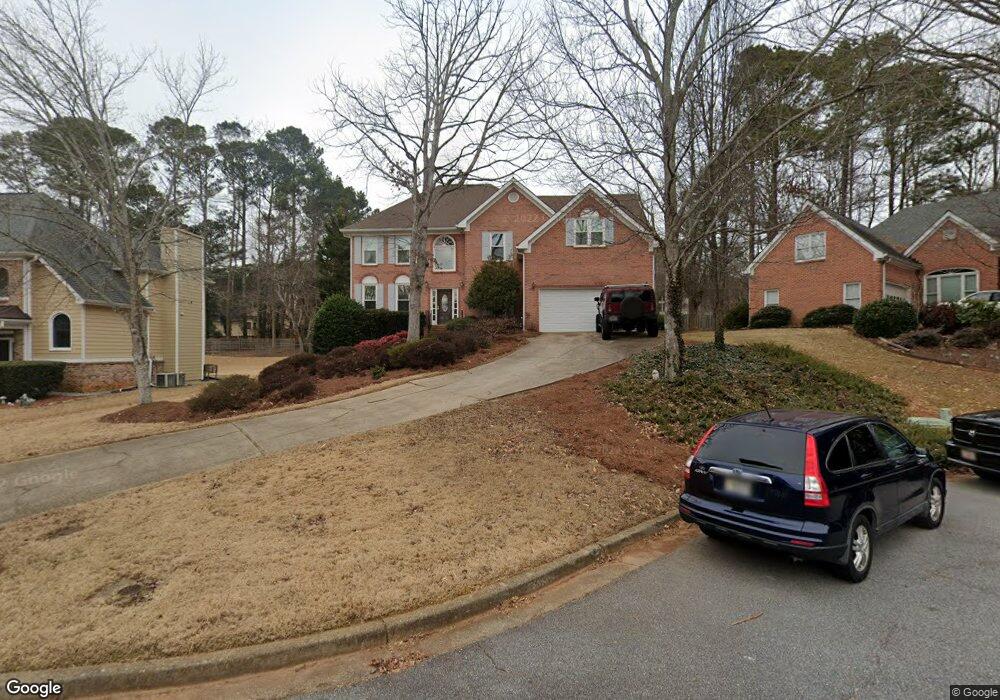
325 Wesfork Way Unit 2 Suwanee, GA 30024
Estimated Value: $459,000 - $537,000
4
Beds
3
Baths
2,430
Sq Ft
$202/Sq Ft
Est. Value
About This Home
This home is located at 325 Wesfork Way Unit 2, Suwanee, GA 30024 and is currently estimated at $490,888, approximately $202 per square foot. 325 Wesfork Way Unit 2 is a home located in Gwinnett County with nearby schools including Walnut Grove Elementary School, Creekland Middle School, and Collins Hill High School.
Ownership History
Date
Name
Owned For
Owner Type
Purchase Details
Closed on
Jul 1, 2004
Sold by
Roberts Cynthia M
Bought by
Davis Mark A
Current Estimated Value
Home Financials for this Owner
Home Financials are based on the most recent Mortgage that was taken out on this home.
Original Mortgage
$237,000
Outstanding Balance
$106,174
Interest Rate
4.87%
Mortgage Type
New Conventional
Estimated Equity
$384,714
Create a Home Valuation Report for This Property
The Home Valuation Report is an in-depth analysis detailing your home's value as well as a comparison with similar homes in the area
Home Values in the Area
Average Home Value in this Area
Purchase History
| Date | Buyer | Sale Price | Title Company |
|---|---|---|---|
| Davis Mark A | $296,300 | -- |
Source: Public Records
Mortgage History
| Date | Status | Borrower | Loan Amount |
|---|---|---|---|
| Open | Davis Mark A | $237,000 |
Source: Public Records
Tax History Compared to Growth
Tax History
| Year | Tax Paid | Tax Assessment Tax Assessment Total Assessment is a certain percentage of the fair market value that is determined by local assessors to be the total taxable value of land and additions on the property. | Land | Improvement |
|---|---|---|---|---|
| 2025 | $5,243 | $194,080 | $28,000 | $166,080 |
| 2024 | $5,353 | $192,240 | $44,000 | $148,240 |
| 2023 | $5,353 | $177,400 | $40,400 | $137,000 |
| 2022 | $4,577 | $156,240 | $35,200 | $121,040 |
| 2021 | $4,110 | $130,480 | $27,600 | $102,880 |
| 2020 | $3,895 | $119,160 | $25,400 | $93,760 |
| 2019 | $3,790 | $119,160 | $25,400 | $93,760 |
| 2018 | $3,796 | $119,160 | $25,400 | $93,760 |
| 2016 | $3,547 | $106,640 | $20,040 | $86,600 |
| 2015 | $3,351 | $96,320 | $19,600 | $76,720 |
| 2014 | -- | $96,320 | $19,600 | $76,720 |
Source: Public Records
Map
Nearby Homes
- 2315 Prosperity Way Unit 2
- 318 Arbour Way Unit 4
- 327 Lee Miller Dr
- 318 Lee Miller Dr
- 267 Arbour Way
- 2372 Merrymount Dr Unit 2
- 2140 Deer Trail
- 2265 Wildwood Lake Dr
- 2124 York River Way Unit 1
- 1953 Frisco Way
- 2538 Brynfield Cove
- 619 Kenridge Way
- 2305 Compton Place
- 2370 Cape Courage Way
- 487 Danville Ave
- 2067 York River Way
- 335 Wesfork Way
- 315 Wesfork Way Unit 2
- 345 Wesfork Way
- 440 Shore Dr
- 430 Shore Dr Unit 1
- 305 Wesfork Way
- 450 Shore Dr
- 450 Shore Dr Unit 56
- 340 Wesfork Way
- 310 Wesfork Way
- 340 Wesfork Way NW
- 355 Wesfork Way
- 355 Wesfork Way NW
- 420 Shore Dr
- 300 Wesfork Way
- 0 Wesfork Way NW Unit 7044136
- 350 Wesfork Way
- 460 Shore Dr
- 365 Wesfork Way
- 441 Shore Dr