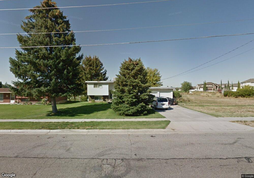
3250 S 1000 W Syracuse, UT 84075
Estimated Value: $357,000 - $541,000
2
Beds
1
Bath
987
Sq Ft
$462/Sq Ft
Est. Value
About This Home
This home is located at 3250 S 1000 W, Syracuse, UT 84075 and is currently estimated at $455,719, approximately $461 per square foot. 3250 S 1000 W is a home located in Davis County with nearby schools including Bluff Ridge Elementary, Legacy Junior High School, and Clearfield High School.
Ownership History
Date
Name
Owned For
Owner Type
Purchase Details
Closed on
Aug 23, 2001
Sold by
Baker Francis Allan and Baker Francies Allan
Bought by
Merrill James R and Merrill Lenette G
Current Estimated Value
Home Financials for this Owner
Home Financials are based on the most recent Mortgage that was taken out on this home.
Original Mortgage
$87,550
Outstanding Balance
$34,300
Interest Rate
7.21%
Estimated Equity
$421,419
Purchase Details
Closed on
Nov 3, 1998
Sold by
Baker Connie
Bought by
Baker Francies Allan and Baker Connie L
Home Financials for this Owner
Home Financials are based on the most recent Mortgage that was taken out on this home.
Original Mortgage
$72,500
Interest Rate
6.61%
Create a Home Valuation Report for This Property
The Home Valuation Report is an in-depth analysis detailing your home's value as well as a comparison with similar homes in the area
Home Values in the Area
Average Home Value in this Area
Purchase History
| Date | Buyer | Sale Price | Title Company |
|---|---|---|---|
| Merrill James R | -- | Mountain View Title & Escrow | |
| Baker Francies Allan | -- | Equity Title Agency |
Source: Public Records
Mortgage History
| Date | Status | Borrower | Loan Amount |
|---|---|---|---|
| Open | Merrill James R | $87,550 | |
| Previous Owner | Baker Francies Allan | $72,500 |
Source: Public Records
Tax History
| Year | Tax Paid | Tax Assessment Tax Assessment Total Assessment is a certain percentage of the fair market value that is determined by local assessors to be the total taxable value of land and additions on the property. | Land | Improvement |
|---|---|---|---|---|
| 2025 | $1,967 | $189,750 | $121,581 | $68,169 |
| 2024 | $1,931 | $187,549 | $122,195 | $65,354 |
| 2023 | $1,802 | $175,450 | $93,301 | $82,148 |
| 2022 | $1,916 | $338,000 | $174,846 | $163,154 |
| 2021 | $1,624 | $244,000 | $143,336 | $100,664 |
| 2020 | $1,458 | $212,000 | $119,541 | $92,459 |
| 2019 | $1,435 | $206,000 | $123,386 | $82,614 |
| 2018 | $1,291 | $184,000 | $115,608 | $68,392 |
| 2016 | $1,030 | $77,000 | $44,134 | $32,866 |
| 2015 | $1,012 | $71,995 | $44,134 | $27,861 |
| 2014 | $961 | $69,728 | $44,134 | $25,594 |
| 2013 | -- | $80,452 | $42,196 | $38,256 |
Source: Public Records
Map
Nearby Homes
- 1282 W 3150 S
- 3506 S Kite St
- 3528 S Finch St
- 2955 S 1375 W
- 3570 S Creek Side Ln
- 3067 S Old Emigrant Rd Unit B
- 3047 S Old Emigrant Rd
- 3448 S 550 W
- 921 W 2700 S
- 3488 S Sugar Pine Dr
- 1407 W Silver Hollow Rd
- 1596 W Parkview Dr
- 3074 S Edgewater Ln
- 1661 W Ross Rd
- 1651 W White Pine Dr
- 1137 W 2500 S
- 1664 2975 S Unit B
- 2734 S Allison Way Unit 213
- 1694 2975 S Unit D
- 34 S 3600 W
Your Personal Tour Guide
Ask me questions while you tour the home.