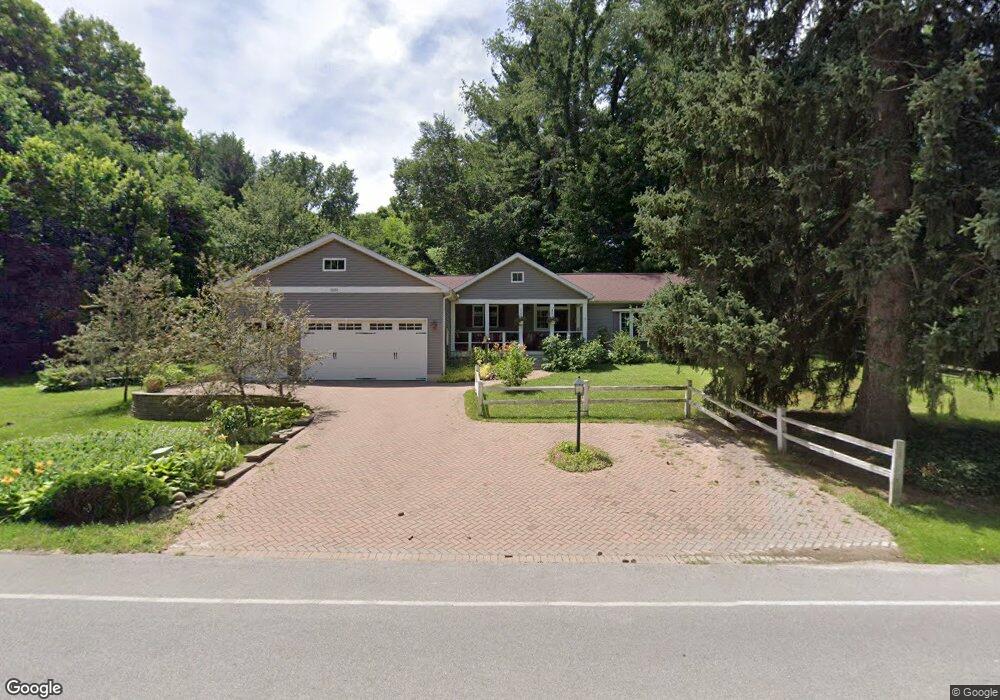
3252 N Fail Rd La Porte, IN 46350
Estimated Value: $300,268 - $316,000
3
Beds
2
Baths
1,676
Sq Ft
$183/Sq Ft
Est. Value
About This Home
This home is located at 3252 N Fail Rd, La Porte, IN 46350 and is currently estimated at $307,317, approximately $183 per square foot. 3252 N Fail Rd is a home located in LaPorte County with nearby schools including New Prairie High School.
Ownership History
Date
Name
Owned For
Owner Type
Purchase Details
Closed on
May 1, 2020
Sold by
Schult Trust
Bought by
Schult Robert C and Schult Ruth L
Current Estimated Value
Purchase Details
Closed on
Apr 9, 2020
Sold by
Schult Robert C and Schult Ruth L
Bought by
Schult Trust
Purchase Details
Closed on
Jul 13, 2015
Sold by
Schult Robert C and Schult Ruth L
Bought by
Schult Robert C and Revocabl Ruth
Create a Home Valuation Report for This Property
The Home Valuation Report is an in-depth analysis detailing your home's value as well as a comparison with similar homes in the area
Home Values in the Area
Average Home Value in this Area
Purchase History
| Date | Buyer | Sale Price | Title Company |
|---|---|---|---|
| Schult Robert C | -- | None Available | |
| Schult Trust | -- | None Available | |
| Schult Robert C | -- | None Available |
Source: Public Records
Tax History Compared to Growth
Tax History
| Year | Tax Paid | Tax Assessment Tax Assessment Total Assessment is a certain percentage of the fair market value that is determined by local assessors to be the total taxable value of land and additions on the property. | Land | Improvement |
|---|---|---|---|---|
| 2024 | $1,636 | $203,500 | $33,000 | $170,500 |
| 2023 | $1,557 | $189,900 | $33,000 | $156,900 |
| 2022 | $1,800 | $185,600 | $33,000 | $152,600 |
| 2021 | $1,800 | $172,000 | $33,000 | $139,000 |
| 2020 | $1,721 | $172,000 | $33,000 | $139,000 |
| 2019 | $1,678 | $154,600 | $33,000 | $121,600 |
| 2018 | $1,571 | $154,600 | $33,000 | $121,600 |
| 2017 | $1,411 | $146,000 | $27,500 | $118,500 |
| 2016 | $1,223 | $146,700 | $27,500 | $119,200 |
| 2014 | $1,121 | $130,100 | $22,000 | $108,100 |
| 2013 | -- | $128,200 | $27,500 | $100,700 |
Source: Public Records
Map
Nearby Homes
- 4233 N Blueridge Dr
- 2088 N 150 E
- 2027 N Coachlight Dr
- 4951 N Meadow Ct
- 201 E 200 N
- 0 W 250 N
- 1083 E State Road 2 Unit 559
- 4755 N Range Rd
- 6864 N Nature Ln
- 6862 N Nature Ln
- 5223 N Barclay
- 0 Route 20 Unit 155390
- 3202 N 300 E
- Lots 41-44 Campbell
- 5405 N Campbell
- 865 W 200 N
- 2945 N Morning Glory Ave Unit 73
- 2983 N Morning Glory Ave Unit 72
- 2979 N Morning Glory Ave
- 2893 N Morning Glory Ave