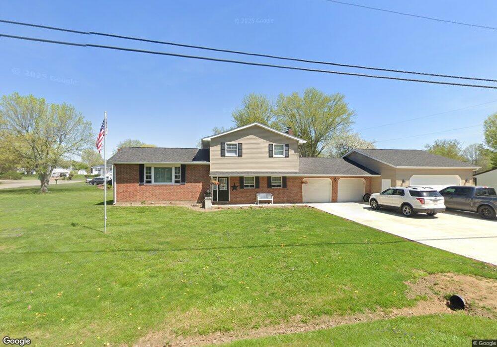
3255 Creamery Rd Nashport, OH 43830
Estimated Value: $314,000 - $351,000
3
Beds
2
Baths
1,920
Sq Ft
$174/Sq Ft
Est. Value
About This Home
This home is located at 3255 Creamery Rd, Nashport, OH 43830 and is currently estimated at $334,996, approximately $174 per square foot. 3255 Creamery Rd is a home located in Muskingum County with nearby schools including Tri-Valley High School.
Ownership History
Date
Name
Owned For
Owner Type
Purchase Details
Closed on
Aug 20, 2004
Sold by
Petrill Michael L and Petrill Peggy J
Bought by
Newell Ronnie E
Current Estimated Value
Home Financials for this Owner
Home Financials are based on the most recent Mortgage that was taken out on this home.
Original Mortgage
$107,200
Outstanding Balance
$56,647
Interest Rate
7%
Mortgage Type
Stand Alone First
Estimated Equity
$278,349
Purchase Details
Closed on
Dec 11, 2003
Sold by
The Bank Of New York
Bought by
Petrill Michael L and Petrill Peggy J
Home Financials for this Owner
Home Financials are based on the most recent Mortgage that was taken out on this home.
Original Mortgage
$99,750
Interest Rate
5.84%
Mortgage Type
Purchase Money Mortgage
Purchase Details
Closed on
Sep 2, 2003
Sold by
Wheeler Norman J
Bought by
Bank Of New York
Create a Home Valuation Report for This Property
The Home Valuation Report is an in-depth analysis detailing your home's value as well as a comparison with similar homes in the area
Home Values in the Area
Average Home Value in this Area
Purchase History
| Date | Buyer | Sale Price | Title Company |
|---|---|---|---|
| Newell Ronnie E | $134,000 | -- | |
| Petrill Michael L | $105,000 | -- | |
| Bank Of New York | $107,552 | -- |
Source: Public Records
Mortgage History
| Date | Status | Borrower | Loan Amount |
|---|---|---|---|
| Open | Newell Ronnie E | $107,200 | |
| Previous Owner | Petrill Michael L | $99,750 | |
| Closed | Newell Ronnie E | $26,800 |
Source: Public Records
Tax History Compared to Growth
Tax History
| Year | Tax Paid | Tax Assessment Tax Assessment Total Assessment is a certain percentage of the fair market value that is determined by local assessors to be the total taxable value of land and additions on the property. | Land | Improvement |
|---|---|---|---|---|
| 2024 | $2,815 | $82,775 | $10,745 | $72,030 |
| 2023 | $2,265 | $61,985 | $7,700 | $54,285 |
| 2022 | $2,034 | $57,120 | $7,700 | $49,420 |
| 2021 | $2,004 | $57,120 | $7,700 | $49,420 |
| 2020 | $1,775 | $49,630 | $6,685 | $42,945 |
| 2019 | $1,775 | $49,630 | $6,685 | $42,945 |
| 2018 | $1,369 | $49,630 | $6,685 | $42,945 |
| 2017 | $1,535 | $40,180 | $6,685 | $33,495 |
| 2016 | $1,455 | $40,190 | $6,690 | $33,500 |
| 2015 | $1,493 | $40,190 | $6,690 | $33,500 |
| 2013 | $1,682 | $40,190 | $6,690 | $33,500 |
Source: Public Records
Map
Nearby Homes
- 3865 Creamery Rd
- 3755 Gorsuch Rd
- 6180 Arnies Dr
- 6705 Frazeysburg Rd
- 4321 Creamery Rd
- 6008 Shala Cir
- 2505 Kenlo Woods Dr
- 6705 Frazeysburd Rd
- 3204 Maple Creek Dr
- 3168 Maple Creek Dr
- 2695 Ash Meadows Blvd
- 1560 Coachlite Cir
- 2530 Monnie Place
- 0 Sheffield Circle-9 4 Acres Unit 224009901
- 0 E Sheffield Cir
- 0 Newark Rd
- 1650 Richvale Rd
- 5020 Wilshire Dr
- 5295 Stonegate Dr
- 5285 Stonegate Dr
- 6020 Saad Ct
- 6005 Rollins Dr
- 3245 Creamery Rd
- 3280 Creamery Rd
- 3315 Creamery Rd
- 6025 Rollins Dr
- 3310 Creamery Rd
- 6025 Saad Ct
- 3260 Creamery Rd
- 6045 Rollins Dr
- 5990 Rollins Dr
- 6050 Saad Ct
- 6045 Saad Ct
- 3240 Creamery Rd
- 6285 Rollins Dr
- 3340 Creamery Rd
- 6055 Saad Ct
- 6010 Rollins Dr
- 6065 Rollins Dr
- 6020 Rollins Dr