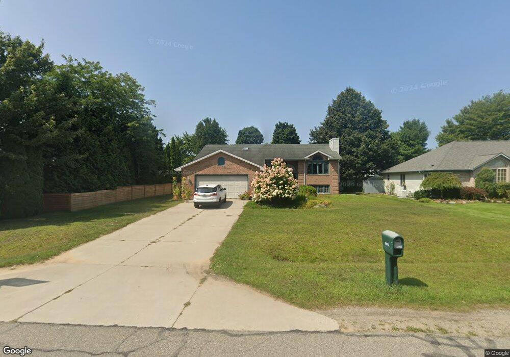
3257 Amberwood Dr Unit Bldg-Unit Port Huron, MI 48060
Estimated Value: $380,000 - $420,000
--
Bed
3
Baths
2,727
Sq Ft
$146/Sq Ft
Est. Value
About This Home
This home is located at 3257 Amberwood Dr Unit Bldg-Unit, Port Huron, MI 48060 and is currently estimated at $397,697, approximately $145 per square foot. 3257 Amberwood Dr Unit Bldg-Unit is a home located in St. Clair County with nearby schools including Michigamme Elementary School, Central Middle School, and Port Huron High School.
Ownership History
Date
Name
Owned For
Owner Type
Purchase Details
Closed on
Jul 11, 2018
Sold by
Kinney and Christine
Bought by
Thiede Nicole
Current Estimated Value
Home Financials for this Owner
Home Financials are based on the most recent Mortgage that was taken out on this home.
Original Mortgage
$239,400
Outstanding Balance
$206,604
Interest Rate
4.5%
Mortgage Type
New Conventional
Estimated Equity
$191,093
Create a Home Valuation Report for This Property
The Home Valuation Report is an in-depth analysis detailing your home's value as well as a comparison with similar homes in the area
Home Values in the Area
Average Home Value in this Area
Purchase History
| Date | Buyer | Sale Price | Title Company |
|---|---|---|---|
| Thiede Nicole | $252,000 | Liberty Title |
Source: Public Records
Mortgage History
| Date | Status | Borrower | Loan Amount |
|---|---|---|---|
| Open | Thiede Nicole | $239,400 |
Source: Public Records
Tax History Compared to Growth
Tax History
| Year | Tax Paid | Tax Assessment Tax Assessment Total Assessment is a certain percentage of the fair market value that is determined by local assessors to be the total taxable value of land and additions on the property. | Land | Improvement |
|---|---|---|---|---|
| 2025 | $4,236 | $157,200 | $0 | $0 |
| 2024 | $2,229 | $148,000 | $0 | $0 |
| 2023 | $2,057 | $136,300 | $0 | $0 |
| 2022 | $3,801 | $127,700 | $0 | $0 |
| 2021 | $3,484 | $119,700 | $0 | $0 |
| 2020 | $3,484 | $120,700 | $0 | $120,700 |
| 2019 | $3,415 | $101,900 | $0 | $0 |
| 2018 | $3,077 | $101,900 | $0 | $0 |
| 2017 | $3,058 | $99,100 | $0 | $0 |
| 2016 | $1,548 | $99,100 | $0 | $0 |
| 2015 | -- | $89,400 | $15,000 | $74,400 |
| 2014 | -- | $88,500 | $88,500 | $0 |
| 2013 | -- | $85,800 | $0 | $0 |
Source: Public Records
Map
Nearby Homes
- 4224 Atkins Rd
- 3115 Spruce Dr
- 3152 Spruce Dr
- 4361 Peck Rd
- 3230 Range Rd
- 3345 Beach Rd
- 4608 Huntington Dr
- 4460 Cambridge Dr
- 3971 N River Rd
- 3993 N River Rd
- 2863 Beach Rd
- 4167 N River Rd
- 0000 W Water St
- 4224 N River Rd
- 3610 State Rd
- 3580 Angus Rd
- 4570 Atkins Rd
- 3625 Angus Rd
- 4911 Castlewood Dr
- 2940 Westland Dr
- 3257 Amberwood Dr
- 3265 Amberwood Dr
- 4230 Juniper Ln
- 3256 Cottonwood Dr
- 4240 Juniper Ln
- 3254 Amberwood Dr
- 3246 Amberwood Dr
- 3262 Amberwood Dr
- 4250 Juniper Ln
- 3273 Amberwood Dr
- 3238 Amberwood Dr
- 3274 Cottonwood Dr Unit Bldg-Unit
- 3274 Cottonwood Dr
- 3266 Cottonwood Dr
- 3270 Amberwood Dr
- 3278 Amberwood Dr
- 3230 Amberwood Dr
- 4249 Conifer Ln
- 4237 Juniper Ln
- 4275 Meadow Ct