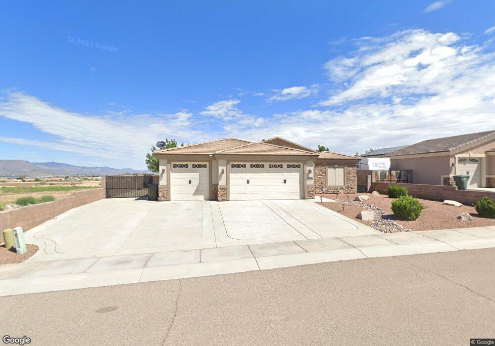
3259 Motherload Rd Kingman, AZ 86401
Estimated Value: $375,646 - $399,000
3
Beds
1
Bath
1,650
Sq Ft
$235/Sq Ft
Est. Value
About This Home
This home is located at 3259 Motherload Rd, Kingman, AZ 86401 and is currently estimated at $387,162, approximately $234 per square foot. 3259 Motherload Rd is a home located in Mohave County with nearby schools including Hualapai Elementary School, White Cliffs Middle School, and Lee Williams High School.
Ownership History
Date
Name
Owned For
Owner Type
Purchase Details
Closed on
Aug 16, 2022
Sold by
Austin and Jenny
Bought by
Engberg Todd K
Current Estimated Value
Home Financials for this Owner
Home Financials are based on the most recent Mortgage that was taken out on this home.
Original Mortgage
$209,000
Outstanding Balance
$200,112
Interest Rate
5.7%
Mortgage Type
New Conventional
Estimated Equity
$187,050
Purchase Details
Closed on
Mar 28, 2015
Sold by
Fripps Mohave Land
Bought by
Fripps Mohave Construction
Purchase Details
Closed on
Jan 13, 2015
Sold by
Fripps Mohave Construction
Bought by
Austin Otis and Austin Jenny
Create a Home Valuation Report for This Property
The Home Valuation Report is an in-depth analysis detailing your home's value as well as a comparison with similar homes in the area
Home Values in the Area
Average Home Value in this Area
Purchase History
| Date | Buyer | Sale Price | Title Company |
|---|---|---|---|
| Engberg Todd K | $386,750 | Chicago Title | |
| Fripps Mohave Construction | -- | Chicago Title Agency Inc | |
| Austin Otis | $184,500 | Chicago Title Agency Inc |
Source: Public Records
Mortgage History
| Date | Status | Borrower | Loan Amount |
|---|---|---|---|
| Open | Engberg Todd K | $209,000 |
Source: Public Records
Tax History Compared to Growth
Tax History
| Year | Tax Paid | Tax Assessment Tax Assessment Total Assessment is a certain percentage of the fair market value that is determined by local assessors to be the total taxable value of land and additions on the property. | Land | Improvement |
|---|---|---|---|---|
| 2026 | $665 | -- | -- | -- |
| 2025 | $1,371 | $28,853 | $0 | $0 |
| 2024 | $1,371 | $28,396 | $0 | $0 |
| 2023 | $1,371 | $26,364 | $0 | $0 |
| 2022 | $1,255 | $22,150 | $0 | $0 |
| 2021 | $1,331 | $20,906 | $0 | $0 |
| 2019 | $1,200 | $17,578 | $0 | $0 |
| 2018 | $1,252 | $16,958 | $0 | $0 |
| 2017 | $1,135 | $16,604 | $0 | $0 |
| 2016 | $1,092 | $16,286 | $0 | $0 |
| 2015 | $164 | $2,981 | $0 | $0 |
Source: Public Records
Map
Nearby Homes
- 3280 Whitehead Ave
- 3300 Cherri Ave
- 3376 Motherlode Rd
- LOT 068 Hualapai Mountain Rd
- 321-04-018E Hualapai Mountain Rd
- 2303 Indigo St
- 3316 Producers Mine Rd
- 2144 Old Miners Rd
- 2303 Wildflower St
- Lot 164 Hualapai Mountain Rd
- 3323 Karen Ave
- 2347 Ginger St
- 3059 Mallory Loop
- 3098 Amanda Cir
- 2070 Buena Vista Dr
- 000 Ranch Rd
- 3064 Brenda Cir
- 3354 Isador Ave
- 3201 Rio Grande Ave
- 00 Cheyenne Ave
- 3259 Motherlode Rd
- 3259 Motherlode Rd
- 3271 Motherlode Rd
- 3271 Motherlode Rd
- 3271 Motherlode Rd
- 3260 Whitehead Ave
- 3260 Whitehead Ave
- 3272 Whitehead Ave
- 3272 Whitehead Ave
- 3279 Motherlode Rd
- 3279 Motherlode Rd
- 3279 Motherlode Rd
- 3258 Motherlode Rd
- 3258 Motherlode Rd
- 3258 Motherload Rd
- 3270 Motherlode Rd
- 3280 Whitehead Ave
- 3270 Motherload Rd
- 2227 Producers Mine Rd
- 2227 Producers Mine Rd