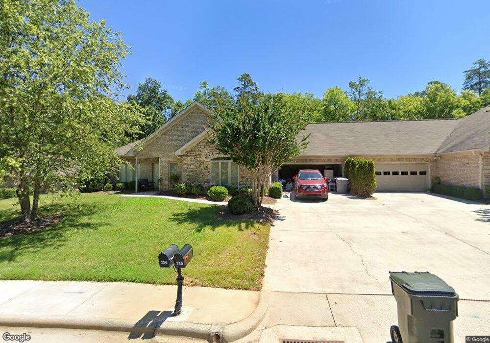
326 Cannon Ct Asheboro, NC 27205
Estimated Value: $491,000 - $494,000
--
Bed
2
Baths
2,452
Sq Ft
$201/Sq Ft
Est. Value
About This Home
This home is located at 326 Cannon Ct, Asheboro, NC 27205 and is currently estimated at $492,270, approximately $200 per square foot. 326 Cannon Ct is a home located in Randolph County with nearby schools including Charles W. McCrary Elementary School, North Asheboro Middle School, and Asheboro High School.
Ownership History
Date
Name
Owned For
Owner Type
Purchase Details
Closed on
May 5, 2025
Sold by
Smith Ragsdale Martha
Bought by
Crawford Charles H and Crawford Geraldine T
Current Estimated Value
Purchase Details
Closed on
Sep 7, 2018
Sold by
Ragsdale Martha Smith and Estate Of Ola M Smith
Bought by
Ragsdale Martha Smith
Purchase Details
Closed on
Mar 13, 2003
Bought by
Smith Ola M
Create a Home Valuation Report for This Property
The Home Valuation Report is an in-depth analysis detailing your home's value as well as a comparison with similar homes in the area
Home Values in the Area
Average Home Value in this Area
Purchase History
| Date | Buyer | Sale Price | Title Company |
|---|---|---|---|
| Crawford Charles H | $485,000 | None Listed On Document | |
| Crawford Charles H | $485,000 | None Listed On Document | |
| Ragsdale Martha Smith | $65,000 | None Available | |
| Smith Ola M | $240,000 | -- |
Source: Public Records
Tax History Compared to Growth
Tax History
| Year | Tax Paid | Tax Assessment Tax Assessment Total Assessment is a certain percentage of the fair market value that is determined by local assessors to be the total taxable value of land and additions on the property. | Land | Improvement |
|---|---|---|---|---|
| 2025 | $5,120 | $386,340 | $50,000 | $336,340 |
| 2024 | $5,120 | $386,340 | $50,000 | $336,340 |
| 2023 | $5,120 | $386,340 | $50,000 | $336,340 |
| 2022 | $4,449 | $308,600 | $45,000 | $263,600 |
| 2021 | $4,449 | $308,600 | $45,000 | $263,600 |
| 2020 | $4,449 | $308,600 | $45,000 | $263,600 |
| 2019 | $4,449 | $308,600 | $45,000 | $263,600 |
| 2018 | $3,902 | $265,920 | $30,000 | $235,920 |
| 2016 | $3,902 | $265,922 | $30,000 | $235,922 |
| 2015 | $3,909 | $265,922 | $30,000 | $235,922 |
| 2014 | -- | $265,922 | $30,000 | $235,922 |
Source: Public Records
Map
Nearby Homes
- 1263 Winslow Ave Unit A, B & C
- 923 Arnold St
- 135 West St
- 830 Sunset Ave
- 627 Oakmont Dr
- 435 Peachtree St
- 711 Sunset Ave Unit E
- 516 and 518 Peachtree St
- 612 Sunset Ave Unit 6
- 866 Mountain Rd
- 1110 Park Dr
- 401 Uwharrie St
- 135 Dixon St
- TBD Oakland Ave
- 0000 Little Gate Dr
- 0 Highwood Dr
- 1011 Westmont Dr
- 1582 Westmont Dr
- 617 Uwharrie St Unit N
- 330 W Presnell St Unit 37
- 320 Cannon Ct
- 334 Cannon Ct
- 340 Cannon Ct
- 314 Cannon Ct
- 323 Cannon Ct
- 317 Cannon Ct
- 333 Cannon Ct
- 238 Southway Rd
- 308 Cannon Ct
- 339 Cannon Ct
- 311 Cannon Ct
- 232 Southway Rd
- 305 Cannon Ct
- 1164 Lexington Commons Dr
- 345 Cannon Ct
- 351 Cannon Ct
- 226 Southway Rd
- 1162 Lexington Commons Dr
- 300 Southway Rd
- 1137 Timbal Ct