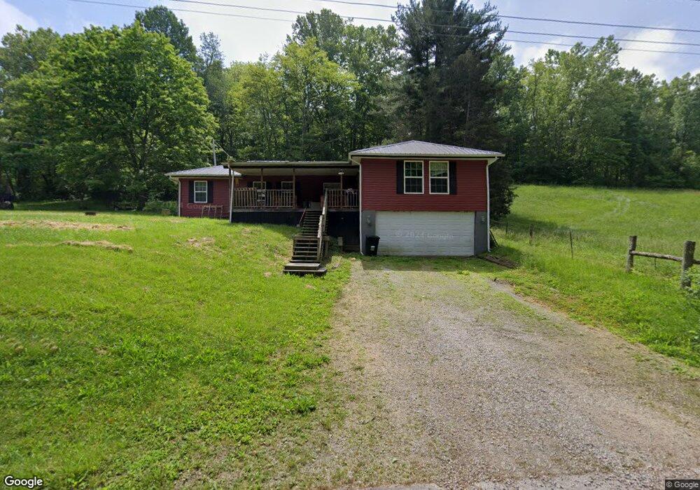
326 Cliff Run Rd Bainbridge, OH 45612
Estimated Value: $146,851 - $255,000
3
Beds
2
Baths
1,792
Sq Ft
$112/Sq Ft
Est. Value
About This Home
This home is located at 326 Cliff Run Rd, Bainbridge, OH 45612 and is currently estimated at $200,213, approximately $111 per square foot. 326 Cliff Run Rd is a home located in Ross County with nearby schools including McClain High School.
Ownership History
Date
Name
Owned For
Owner Type
Purchase Details
Closed on
Jun 25, 2020
Sold by
Wildermess East
Bought by
The Highlands Nature Sanctuary Inc
Current Estimated Value
Purchase Details
Closed on
Jan 22, 2015
Sold by
Us Bank National Association
Bought by
Davis James D
Purchase Details
Closed on
Apr 29, 2014
Sold by
Williamson Theresa L
Bought by
Us Bank National Association
Purchase Details
Closed on
Oct 11, 2007
Sold by
Williamson Richard and Williamson Richard L
Bought by
Williamson Theresa L
Purchase Details
Closed on
Apr 20, 2005
Sold by
Kye Bank Usa
Bought by
Williamson Richard and Williamson Theresa L
Home Financials for this Owner
Home Financials are based on the most recent Mortgage that was taken out on this home.
Original Mortgage
$25,000
Interest Rate
7.09%
Mortgage Type
Future Advance Clause Open End Mortgage
Create a Home Valuation Report for This Property
The Home Valuation Report is an in-depth analysis detailing your home's value as well as a comparison with similar homes in the area
Purchase History
| Date | Buyer | Sale Price | Title Company |
|---|---|---|---|
| The Highlands Nature Sanctuary Inc | $270,000 | Washington Title | |
| Davis James D | $9,000 | Landcastle Title Llc | |
| Us Bank National Association | $75,000 | Attorney | |
| Williamson Theresa L | -- | Attorney | |
| Williamson Richard | $20,500 | Rels Title |
Source: Public Records
Mortgage History
| Date | Status | Borrower | Loan Amount |
|---|---|---|---|
| Previous Owner | Williamson Richard | $25,000 |
Source: Public Records
Tax History
| Year | Tax Paid | Tax Assessment Tax Assessment Total Assessment is a certain percentage of the fair market value that is determined by local assessors to be the total taxable value of land and additions on the property. | Land | Improvement |
|---|---|---|---|---|
| 2024 | $1,408 | $38,540 | $2,550 | $35,990 |
| 2023 | $1,341 | $36,740 | $2,550 | $34,190 |
| 2022 | $1,415 | $36,740 | $2,550 | $34,190 |
| 2021 | $1,086 | $28,090 | $2,380 | $25,710 |
| 2020 | $1,098 | $28,090 | $2,380 | $25,710 |
| 2019 | $1,127 | $28,090 | $2,380 | $25,710 |
| 2018 | $1,049 | $25,980 | $2,290 | $23,690 |
| 2017 | $721 | $17,780 | $2,290 | $15,490 |
| 2016 | $705 | $17,780 | $2,290 | $15,490 |
| 2015 | $698 | $17,090 | $2,290 | $14,800 |
| 2014 | $702 | $17,090 | $2,290 | $14,800 |
| 2013 | $704 | $17,090 | $2,290 | $14,800 |
Source: Public Records
Map
Nearby Homes
- 839 Falls Rd
- 1314 U S 50
- 1314 US Highway 50 W
- 14703 Brier Rd
- 2241 Brier Rd
- 316 W Main St
- 500 S Quarry St
- 304 E 2nd St
- 2589 Tong Hollow Rd
- 119 Shawnee St
- 0000 Mount Olive Rd
- 0 Turkey Ridge Rd
- 4790 Jester Hill Rd
- 0 Upper Twin Rd Unit 226009082
- 0 Upper Twin Rd Unit 5196300
- 42 Barrett Mill Rd
- 0 Lower Twin Rd
- 14505 State Route 41 S
- 812 S Washington St
- 534 Waddell St
- 358 Cliff Run Rd
- 347 Cliff Run Rd
- 404 Cliff Run Rd
- 252 Cliff Run Rd
- 434 Cliff Run Rd
- 615 Cliff Run Rd
- 1744 Rapid Forge Rd
- 704 Cliff Run Rd
- 695 Cliff Run Rd
- 896 Cliff Run Rd
- 0 Rapid Forge Rd Unit 224025841
- 0 Rapid Forge Rd
- 0 Rapid Forge Rd Unit 222019150
- 0 Rapid Forge Rd Unit 865081
- 0 Rapid Forge Rd Unit 1741062
- 0 Rapid Forge Rd Unit 221041974
- 0 Rapid Forge Rd Unit 852344
- 0 Rapid Forge Rd Unit 1719607
- 1191 Cliff Run Rd
- 1360 Paugh Rd
Your Personal Tour Guide
Ask me questions while you tour the home.