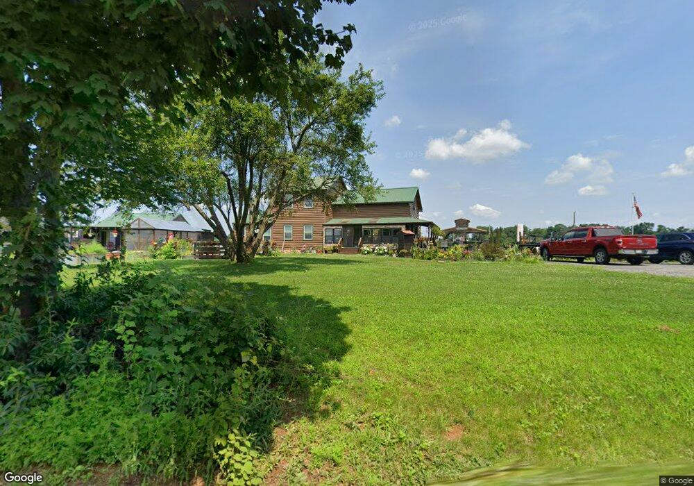
326 High Rock Rd Airville, PA 17302
Estimated Value: $311,609 - $359,000
2
Beds
1
Bath
1,668
Sq Ft
$201/Sq Ft
Est. Value
About This Home
This home is located at 326 High Rock Rd, Airville, PA 17302 and is currently estimated at $335,902, approximately $201 per square foot. 326 High Rock Rd is a home located in York County with nearby schools including Clearview Elementary School, Red Lion Area Junior High School, and Red Lion Area Senior High School.
Ownership History
Date
Name
Owned For
Owner Type
Purchase Details
Closed on
May 18, 2006
Sold by
Tompkins Robin
Bought by
Tompkins Kevin and Tompkins Robin
Current Estimated Value
Home Financials for this Owner
Home Financials are based on the most recent Mortgage that was taken out on this home.
Original Mortgage
$135,000
Interest Rate
8.75%
Mortgage Type
New Conventional
Purchase Details
Closed on
Apr 1, 2004
Sold by
Melhorn William E and Melhorn Dorothy O
Bought by
Tompkins Robin
Home Financials for this Owner
Home Financials are based on the most recent Mortgage that was taken out on this home.
Original Mortgage
$99,000
Interest Rate
7.15%
Mortgage Type
Purchase Money Mortgage
Create a Home Valuation Report for This Property
The Home Valuation Report is an in-depth analysis detailing your home's value as well as a comparison with similar homes in the area
Home Values in the Area
Average Home Value in this Area
Purchase History
| Date | Buyer | Sale Price | Title Company |
|---|---|---|---|
| Tompkins Kevin | -- | None Available | |
| Tompkins Robin | $21,000 | -- |
Source: Public Records
Mortgage History
| Date | Status | Borrower | Loan Amount |
|---|---|---|---|
| Closed | Tompkins Kevin | $135,000 | |
| Closed | Tompkins Robin | $99,000 |
Source: Public Records
Tax History Compared to Growth
Tax History
| Year | Tax Paid | Tax Assessment Tax Assessment Total Assessment is a certain percentage of the fair market value that is determined by local assessors to be the total taxable value of land and additions on the property. | Land | Improvement |
|---|---|---|---|---|
| 2025 | $5,734 | $182,860 | $36,750 | $146,110 |
| 2024 | $5,555 | $182,860 | $36,750 | $146,110 |
| 2023 | $5,537 | $182,860 | $36,750 | $146,110 |
| 2022 | $5,537 | $182,860 | $36,750 | $146,110 |
| 2021 | $5,354 | $182,860 | $36,750 | $146,110 |
| 2020 | $5,354 | $182,860 | $36,750 | $146,110 |
| 2019 | $5,317 | $182,860 | $36,750 | $146,110 |
| 2018 | $5,317 | $182,860 | $36,750 | $146,110 |
| 2017 | $5,312 | $182,860 | $36,750 | $146,110 |
| 2016 | $0 | $182,860 | $36,750 | $146,110 |
| 2015 | -- | $182,860 | $36,750 | $146,110 |
| 2014 | -- | $182,860 | $36,750 | $146,110 |
Source: Public Records
Map
Nearby Homes
- 370 High Rock Rd
- 3 Locust Ln
- 9377 Hickory Rd
- 1081 Bridgeton Rd
- 2733 Manor Furnace Rd
- 2727 Manor Furnace Rd
- Lot 4 Ridge Rd
- 15792 Cross Mill Rd
- 1864 Main Street Extension
- 1931 Main Street Extension
- 387 Garvine Mill Rd
- 60 Hemlock Dr
- 12064 Lucky Rd
- 8290 Woodbine Rd
- 1059 Main Street Extension
- 4360 Battlehill Rd
- 18 Oriole Cir
- 151 Cold Stream Trail
- 360 Pine Valley Dr
- 42 Brook Hollow Ave
- 327 High Rock Rd
- 0 High Rock Rd
- 344 High Rock Rd
- Lot 28A Muddy Creek Forks Rd
- Lot 2 Muddy Creek Forks Rd
- 812 Frosty Hill Rd
- 383 High Rock Rd
- 797 Frosty Hill Rd
- 1031 Muddy Creek Forks Rd
- 776 Frosty Hill Rd
- 1052 Muddy Creek Rd
- 851 Good Rd
- 762 Frosty Hill Rd
- 1009 Muddy Creek Forks Rd
- 754 Frosty Hill Rd
- 448 High Rock Rd
- 476 High Rock Rd
- 1215 Muddy Creek Forks Rd
- 486 High Rock Rd
- 1254 & 131 Muddy Creek Forks Rd