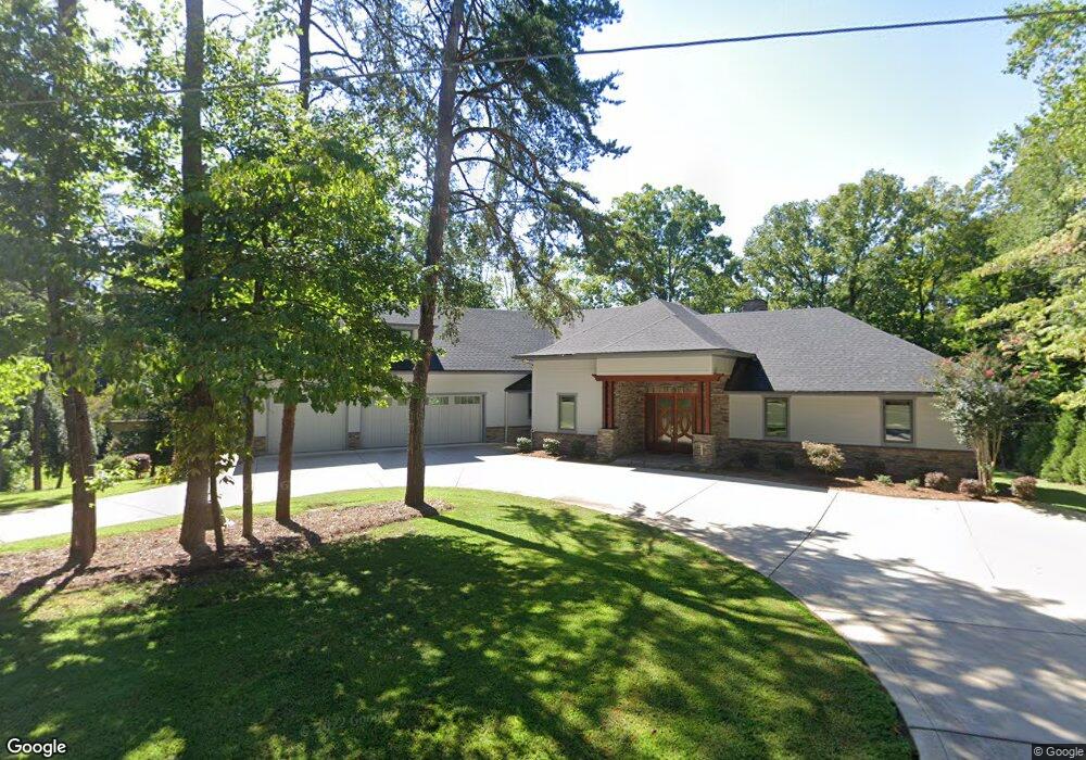
326 Southfork Rd Unit Lot 6 Mooresville, NC 28117
Estimated Value: $1,856,000 - $3,475,373
3
Beds
5
Baths
5,255
Sq Ft
$535/Sq Ft
Est. Value
About This Home
This home is located at 326 Southfork Rd Unit Lot 6, Mooresville, NC 28117 and is currently estimated at $2,811,458, approximately $535 per square foot. 326 Southfork Rd Unit Lot 6 is a home located in Iredell County with nearby schools including Woodland Heights Elementary School and Lake Norman High School.
Ownership History
Date
Name
Owned For
Owner Type
Purchase Details
Closed on
Feb 6, 2013
Sold by
Estokes Llc
Bought by
Stokes William Samuel and Stokes Ruth Anne
Current Estimated Value
Purchase Details
Closed on
Mar 31, 2011
Sold by
Willis Thomas H and Willis Anna T
Bought by
Estokes Llc
Home Financials for this Owner
Home Financials are based on the most recent Mortgage that was taken out on this home.
Original Mortgage
$200,000
Interest Rate
4.95%
Mortgage Type
Seller Take Back
Purchase Details
Closed on
Feb 1, 1997
Purchase Details
Closed on
Nov 1, 1996
Purchase Details
Closed on
Jul 1, 1996
Purchase Details
Closed on
Aug 1, 1984
Create a Home Valuation Report for This Property
The Home Valuation Report is an in-depth analysis detailing your home's value as well as a comparison with similar homes in the area
Home Values in the Area
Average Home Value in this Area
Purchase History
| Date | Buyer | Sale Price | Title Company |
|---|---|---|---|
| Stokes William Samuel | -- | None Available | |
| Estokes Llc | $400,000 | None Available | |
| -- | $157,500 | -- | |
| -- | $152,200 | -- | |
| -- | $150,000 | -- | |
| -- | $99,500 | -- |
Source: Public Records
Mortgage History
| Date | Status | Borrower | Loan Amount |
|---|---|---|---|
| Previous Owner | Estokes Llc | $200,000 |
Source: Public Records
Tax History Compared to Growth
Tax History
| Year | Tax Paid | Tax Assessment Tax Assessment Total Assessment is a certain percentage of the fair market value that is determined by local assessors to be the total taxable value of land and additions on the property. | Land | Improvement |
|---|---|---|---|---|
| 2024 | $18,791 | $2,985,670 | $506,250 | $2,479,420 |
| 2023 | $17,675 | $2,985,670 | $506,250 | $2,479,420 |
| 2022 | $13,785 | $2,187,920 | $356,250 | $1,831,670 |
| 2021 | $13,785 | $2,187,920 | $356,250 | $1,831,670 |
| 2020 | $13,785 | $2,187,920 | $356,250 | $1,831,670 |
| 2019 | $13,332 | $2,150,010 | $356,250 | $1,793,760 |
| 2018 | $10,354 | $1,724,120 | $300,000 | $1,424,120 |
| 2017 | $10,354 | $1,724,120 | $300,000 | $1,424,120 |
| 2016 | $4,314 | $713,320 | $300,000 | $413,320 |
| 2015 | $2,222 | $363,120 | $300,000 | $63,120 |
| 2014 | $2,066 | $362,830 | $300,000 | $62,830 |
Source: Public Records
Map
Nearby Homes
- 254 & 258 Southfork Rd
- 143 Agnew Rd
- 139 E Callicutt Trail
- 379 Indian Trail
- 117 Pine Bluff Dr
- 142 Magnolia Farms Ln
- 127 Pine Bluff Dr
- 115 Jonquil Ct
- 134 Lake Spring Loop
- 0 Brook Dr
- 301 Agnew Rd
- 108 Great Point Dr
- 166 Atlantic Way
- 139 Poplar Grove Rd
- 121 Poplar Grove Rd Unit 2
- 135 Poplar Grove Rd Unit 4
- 117 Indian Trail
- 166 White Horse Dr
- 121 Marstons Mill Dr
- 274 Cove Creek Loop
- 326 Southfork Rd
- 324 Southfork Rd
- 346 Southfork Rd
- 112 Jack Pine Ct Unit L-221
- 112 Jack Pine Ct
- 318 Southfork Rd
- 356 Southfork Rd
- 110 Jack Pine Ct
- 111 Jack Pine Ct
- 109 Mccauley Ct
- 109 Mcauley Ct
- 108 Mccauley Ct
- 306 Southfork Rd
- 145 Ragsdale Trail
- 104 Jack Pine Ct
- 138 Seagrove Ln
- 107 Mccauley Ct
- 107 Mcauley Ct
- 140 Seagrove Ln
- 140 Seagrove Ln