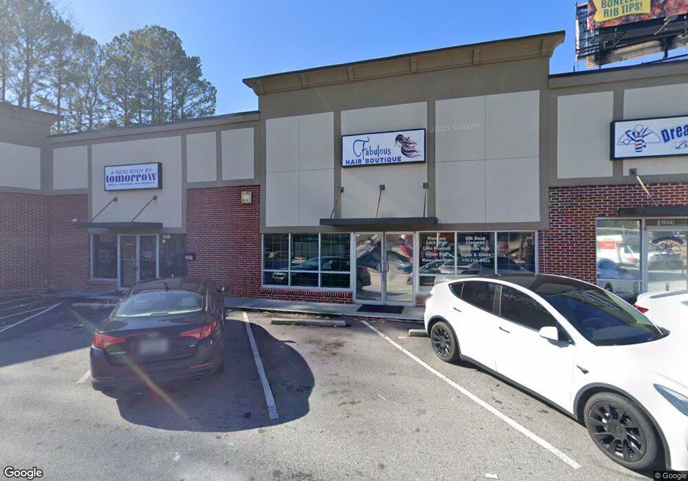
3261 Camp Creek Pkwy East Point, GA 30344
Estimated Value: $387,000 - $679,625
--
Bed
--
Bath
2,592
Sq Ft
$206/Sq Ft
Est. Value
About This Home
This home is located at 3261 Camp Creek Pkwy, East Point, GA 30344 and is currently estimated at $533,313, approximately $205 per square foot. 3261 Camp Creek Pkwy is a home located in Fulton County with nearby schools including Asa Hilliard G. Elementary School, Woodland Middle School, and The Main Street Academy.
Ownership History
Date
Name
Owned For
Owner Type
Purchase Details
Closed on
Nov 6, 2018
Sold by
Campcreek Pkwy Holding Llc
Bought by
3261 Camp Creek Pkwy Llc
Current Estimated Value
Purchase Details
Closed on
Dec 16, 2013
Sold by
Bank Of The Ozarks
Bought by
Campcreek Pkwy Holding Llc
Home Financials for this Owner
Home Financials are based on the most recent Mortgage that was taken out on this home.
Original Mortgage
$168,000
Interest Rate
4.38%
Mortgage Type
New Conventional
Purchase Details
Closed on
Mar 5, 2013
Sold by
Bank Of The Ozarks
Bought by
Bank Of The Ozarks
Purchase Details
Closed on
Jan 23, 2003
Sold by
Collier Ann E
Bought by
Colonial System/Riverside
Home Financials for this Owner
Home Financials are based on the most recent Mortgage that was taken out on this home.
Original Mortgage
$28,800
Interest Rate
5.98%
Mortgage Type
Commercial
Create a Home Valuation Report for This Property
The Home Valuation Report is an in-depth analysis detailing your home's value as well as a comparison with similar homes in the area
Home Values in the Area
Average Home Value in this Area
Purchase History
| Date | Buyer | Sale Price | Title Company |
|---|---|---|---|
| 3261 Camp Creek Pkwy Llc | -- | -- | |
| 3261 Camp Creek Pkwy Llc | $365,000 | -- | |
| Campcreek Pkwy Holding Llc | $200,000 | -- | |
| Bank Of The Ozarks | $125,000 | -- | |
| Colonial System/Riverside | -- | -- |
Source: Public Records
Mortgage History
| Date | Status | Borrower | Loan Amount |
|---|---|---|---|
| Previous Owner | Campcreek Pkwy Holding Llc | $168,000 | |
| Previous Owner | Colonial System/Riverside | $28,800 |
Source: Public Records
Tax History Compared to Growth
Tax History
| Year | Tax Paid | Tax Assessment Tax Assessment Total Assessment is a certain percentage of the fair market value that is determined by local assessors to be the total taxable value of land and additions on the property. | Land | Improvement |
|---|---|---|---|---|
| 2025 | $2,279 | $132,920 | $124,880 | $8,040 |
| 2023 | $2,279 | $150,920 | $124,880 | $26,040 |
| 2022 | $4,725 | $150,920 | $124,880 | $26,040 |
| 2021 | $7,177 | $146,000 | $118,760 | $27,240 |
| 2020 | $5,339 | $146,000 | $118,760 | $27,240 |
| 2019 | $1,068 | $146,000 | $118,760 | $27,240 |
| 2018 | $3,190 | $96,000 | $46,080 | $49,920 |
| 2017 | $3,281 | $96,000 | $46,080 | $49,920 |
| 2016 | $2,735 | $80,000 | $46,080 | $33,920 |
| 2015 | $3,944 | $80,000 | $46,080 | $33,920 |
| 2014 | $2,852 | $80,000 | $46,080 | $33,920 |
Source: Public Records
Map
Nearby Homes
- 3519 Prince George St
- 3499 Prince George St
- 5675 Laurel Ridge Cir
- 5622 Laurel Ridge Dr
- 5626 Laurel Ridge Dr
- 0 Redwine Ct
- 0 Redwine Rd Unit 7382983
- 2933 Arlington Rd
- 2985 Duke of Gloucester
- 4014 Washington Rd
- 2950 Duke of Gloucester
- 2904 Ridgeview Dr SW
- 0 Hammarskjold Dr Unit 7669785
- 0 Hammarskjold Dr Unit 7669778
- 0 Hammarskjold Dr Unit 7669772
- 3177 Meadowstone Ln SW
- 0 Washington Rd Unit 10518578
- 2812 Arlington Rd
- 1112 Highwood Ln
- 507 Highwood Ln
- 3222 Kenelworth Dr
- 3550 N Desert Dr
- 3251 Camp Creek Pkwy
- 3185 Camp Creek Pkwy
- 3140 Young Dr
- 3131 Young Dr
- N N Desert Dr
- 3156 Prince Williheme Terrace
- 3120 Young Dr
- 3148 Prince Williheme Terrace
- 3595 Prince George St
- 3161 Prince Williheme Terrace
- 3117 Young Dr
- 3110 Young Dr
- 3573 Prince George St
- 3592 Prince George St
- 3200 Desert Dr
- 3200 Desert Dr
- 3157 Prince Williheme Terrace
- 3584 Prince George St
