Estimated Value: $217,582 - $398,000
Studio
--
Bath
1,712
Sq Ft
$181/Sq Ft
Est. Value
About This Home
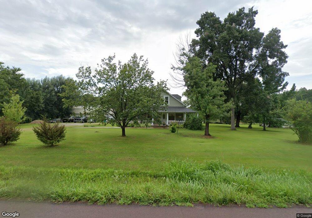
This home is located at 3264 Highway P, Cuba, MO 65453 and is currently estimated at $309,861, approximately $180 per square foot. 3264 Highway P is a home with nearby schools including Cuba Elementary School, Cuba Middle School, and Cuba High School.
Ownership History
Date
Name
Owned For
Owner Type
Purchase Details
Closed on
Jul 6, 2020
Sold by
Golden Dale
Bought by
Golden Dale and Hill-Golden Elgeana
Current Estimated Value
Home Financials for this Owner
Home Financials are based on the most recent Mortgage that was taken out on this home.
Original Mortgage
$155,500
Outstanding Balance
$136,961
Interest Rate
3.1%
Mortgage Type
New Conventional
Estimated Equity
$172,900
Purchase Details
Closed on
Aug 18, 2009
Sold by
Limbaugh Harold R
Bought by
Cunningham Development Company Llc
Home Financials for this Owner
Home Financials are based on the most recent Mortgage that was taken out on this home.
Original Mortgage
$80,000
Interest Rate
5.2%
Mortgage Type
Future Advance Clause Open End Mortgage
Create a Home Valuation Report for This Property
The Home Valuation Report is an in-depth analysis detailing your home's value as well as a comparison with similar homes in the area
Purchase History
| Date | Buyer | Sale Price | Title Company |
|---|---|---|---|
| Golden Dale | -- | None Available | |
| Cunningham Development Company Llc | -- | None Available |
Source: Public Records
Mortgage History
| Date | Status | Borrower | Loan Amount |
|---|---|---|---|
| Open | Golden Dale | $155,500 | |
| Previous Owner | Cunningham Development Company Llc | $80,000 |
Source: Public Records
Tax History
| Year | Tax Paid | Tax Assessment Tax Assessment Total Assessment is a certain percentage of the fair market value that is determined by local assessors to be the total taxable value of land and additions on the property. | Land | Improvement |
|---|---|---|---|---|
| 2025 | $872 | $20,290 | $0 | $0 |
| 2024 | $872 | $20,290 | $0 | $0 |
| 2023 | $870 | $20,290 | $0 | $0 |
| 2022 | $865 | $20,290 | $0 | $0 |
| 2021 | $758 | $17,820 | $0 | $0 |
| 2020 | $726 | $16,870 | $0 | $0 |
| 2019 | $726 | $16,870 | $0 | $0 |
| 2018 | $710 | $16,490 | $0 | $0 |
| 2017 | $673 | $16,490 | $0 | $0 |
| 2016 | $658 | $16,490 | $0 | $0 |
| 2015 | -- | $16,490 | $0 | $0 |
| 2014 | -- | $16,490 | $0 | $0 |
| 2013 | -- | $16,490 | $0 | $0 |
Source: Public Records
Map
Nearby Homes
- 4115 State Highway P
- 105 Oakdale Cir
- 4944 Highway 19
- 0 Old Route 66 & Hwy Uu Rd Unit 23032474
- 0 Trainer Rd Unit MIS25069427
- 238 Autumn Ridge Dr
- 4218 Oak Hill Rd
- 0 1 21 Acres Northwood Dr
- 3020 Sycamore St
- 1005 Sycamore St
- 5870 Old 66
- 3621 Highway 19
- 000 Hollingshead Rd
- 222 Valley View Dr
- 106 Trainer Ave
- 3056 Highway Dd
- 900 E Grand Ave
- 701 E Grand Ave
- 5 Burr Oak Ct
- 212 N Mapleshade Rd
- 3210 Highway P
- 3087 Highway P
- 3418 Highway P
- 177 Cedar Crest Ln
- 34 Murphy Ln
- 40 Murphy Ln
- 3564 Highway P
- 163 Arrowhead Ln
- 0 Hwy P Unit 18013450
- 0 Hwy P Unit 18008212
- 0 Hwy P Unit 13027499
- 0 Hwy P Unit 17059302
- 0 Hwy P Unit 90002329
- 0 Hwy P Unit 107783
- 0 Hwy P Unit 22014500
- 0 Hwy P Unit 106550
- 0 Hwy P Unit 21011692
- 0 Hwy P Unit 19054915
- 2922 Highway P
Your Personal Tour Guide
Ask me questions while you tour the home.