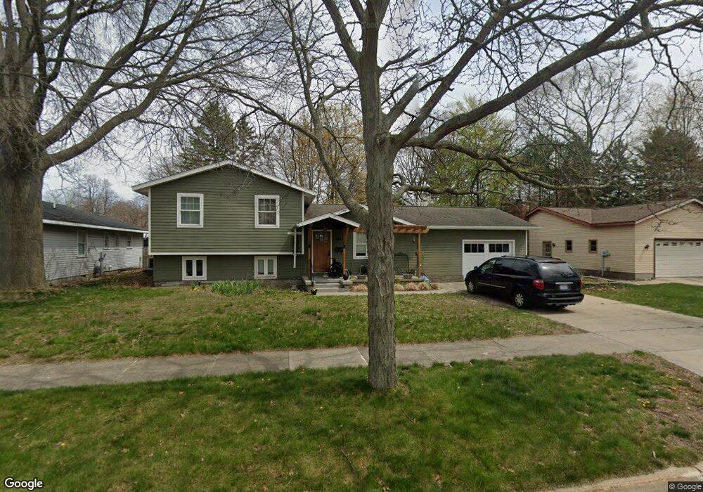
3268 Glenside Blvd Muskegon, MI 49441
Roosevelt Park NeighborhoodEstimated Value: $337,736 - $377,000
4
Beds
3
Baths
2,224
Sq Ft
$160/Sq Ft
Est. Value
About This Home
This home is located at 3268 Glenside Blvd, Muskegon, MI 49441 and is currently estimated at $356,184, approximately $160 per square foot. 3268 Glenside Blvd is a home located in Muskegon County with nearby schools including Mona Shores High School, Edgewood Elementary Academy, and Dr. Martin Luther King Academy.
Ownership History
Date
Name
Owned For
Owner Type
Purchase Details
Closed on
Oct 11, 2023
Sold by
Abraham Lisa M and Abraham Patrick J
Bought by
Abraham Lisa M and Lisa M Abraham Trust
Current Estimated Value
Purchase Details
Closed on
Mar 19, 2010
Sold by
Glover Bernadette and Glover Mark
Bought by
Abraham Patrick
Home Financials for this Owner
Home Financials are based on the most recent Mortgage that was taken out on this home.
Original Mortgage
$84,300
Interest Rate
5.02%
Mortgage Type
New Conventional
Create a Home Valuation Report for This Property
The Home Valuation Report is an in-depth analysis detailing your home's value as well as a comparison with similar homes in the area
Home Values in the Area
Average Home Value in this Area
Purchase History
| Date | Buyer | Sale Price | Title Company |
|---|---|---|---|
| Abraham Lisa M | -- | None Listed On Document | |
| Abraham Patrick | $138,000 | Rei |
Source: Public Records
Mortgage History
| Date | Status | Borrower | Loan Amount |
|---|---|---|---|
| Previous Owner | Abraham Patrick | $84,300 |
Source: Public Records
Tax History Compared to Growth
Tax History
| Year | Tax Paid | Tax Assessment Tax Assessment Total Assessment is a certain percentage of the fair market value that is determined by local assessors to be the total taxable value of land and additions on the property. | Land | Improvement |
|---|---|---|---|---|
| 2025 | $3,724 | $158,000 | $0 | $0 |
| 2024 | $1,429 | $143,900 | $0 | $0 |
| 2023 | $1,367 | $130,300 | $0 | $0 |
| 2022 | $3,396 | $111,800 | $0 | $0 |
| 2021 | $3,234 | $102,100 | $0 | $0 |
| 2020 | $3,197 | $95,600 | $0 | $0 |
| 2019 | $3,138 | $91,900 | $0 | $0 |
| 2018 | $3,065 | $81,000 | $0 | $0 |
| 2017 | $2,994 | $81,200 | $0 | $0 |
| 2016 | $1,137 | $70,900 | $0 | $0 |
| 2015 | -- | $60,300 | $0 | $0 |
| 2014 | -- | $67,900 | $0 | $0 |
| 2013 | -- | $63,400 | $0 | $0 |
Source: Public Records
Map
Nearby Homes
- 3320 Davis Rd
- 3246 Royal Oak Rd
- 1045 Le Roux Rd Unit 178
- 1243 Crandall Ave
- 1448 Marlboro Rd
- 1480 Marlboro Rd
- 1012 Beechtree Ct
- 1059 W Summit Ave
- 1377 Princeton Rd
- 3684 Harris Dr
- 1582 Haverhill Rd
- 3681 Brentwood St Unit 24
- 893 Post Rd
- 1521 Cornell Rd
- 1733 Woodside Rd
- 868 Post Rd
- 2881 Cornell Ct
- 1744 W Norton Ave
- 1650 Bonneville Dr
- 1689 Bonneville Dr
- 3256 Glenside Blvd
- 3280 Glenside Blvd
- 3269 Davis Rd
- 3244 Glenside Blvd
- 3255 Davis Rd
- 3267 Glenside Blvd
- 3279 Glenside Blvd
- 3245 Davis Rd
- 3293 Davis Rd
- 3272 Davis Rd
- 3230 Glenside Blvd
- 3241 Glenside Blvd
- 3260 Davis Rd
- 3291 Glenside Blvd
- 3231 Davis Rd
- 3304 Glenside Blvd
- 3246 Davis Rd
- 3258 Rockland Rd
- 3244 Rockland Rd
- 3268 Rockland Rd