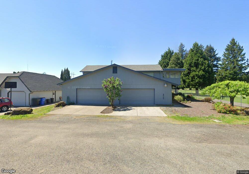
327 36th St Washougal, WA 98671
Estimated Value: $428,000 - $760,000
3
Beds
3
Baths
3,049
Sq Ft
$211/Sq Ft
Est. Value
About This Home
This home is located at 327 36th St, Washougal, WA 98671 and is currently estimated at $642,645, approximately $210 per square foot. 327 36th St is a home located in Clark County with nearby schools including Columbia River Gorge Elementary School, Jemtegaard Middle School, and Washougal High School.
Ownership History
Date
Name
Owned For
Owner Type
Purchase Details
Closed on
Jun 6, 2025
Sold by
Hurt Rhonda C
Bought by
Hurt Revocable Living Trust and Hurt
Current Estimated Value
Purchase Details
Closed on
Mar 13, 2002
Sold by
Hickey Leo F and Hickey Alberta A
Bought by
Hurt Lloyd L and Hurt Rhonda C
Home Financials for this Owner
Home Financials are based on the most recent Mortgage that was taken out on this home.
Original Mortgage
$176,800
Interest Rate
6.85%
Create a Home Valuation Report for This Property
The Home Valuation Report is an in-depth analysis detailing your home's value as well as a comparison with similar homes in the area
Home Values in the Area
Average Home Value in this Area
Purchase History
| Date | Buyer | Sale Price | Title Company |
|---|---|---|---|
| Hurt Revocable Living Trust | $313 | None Listed On Document | |
| Hurt Rhonda C | $313 | None Listed On Document | |
| Hurt Lloyd L | $221,000 | First American Title Ins Co |
Source: Public Records
Mortgage History
| Date | Status | Borrower | Loan Amount |
|---|---|---|---|
| Previous Owner | Hurt Lloyd L | $176,800 |
Source: Public Records
Tax History Compared to Growth
Tax History
| Year | Tax Paid | Tax Assessment Tax Assessment Total Assessment is a certain percentage of the fair market value that is determined by local assessors to be the total taxable value of land and additions on the property. | Land | Improvement |
|---|---|---|---|---|
| 2025 | $6,096 | $588,921 | $144,484 | $444,437 |
| 2024 | $5,662 | $641,288 | $189,888 | $451,400 |
| 2023 | $5,495 | $623,032 | $189,888 | $433,144 |
| 2022 | $5,602 | $592,168 | $182,719 | $409,449 |
| 2021 | $5,375 | $523,925 | $163,601 | $360,324 |
| 2020 | $4,782 | $471,702 | $150,458 | $321,244 |
| 2019 | $4,586 | $426,069 | $144,484 | $281,585 |
| 2018 | $5,150 | $432,088 | $0 | $0 |
| 2017 | $4,154 | $400,723 | $0 | $0 |
| 2016 | $1,958 | $354,840 | $0 | $0 |
| 2015 | $3,792 | $305,882 | $0 | $0 |
| 2014 | -- | $294,556 | $0 | $0 |
| 2013 | -- | $257,445 | $0 | $0 |
Source: Public Records
Map
Nearby Homes