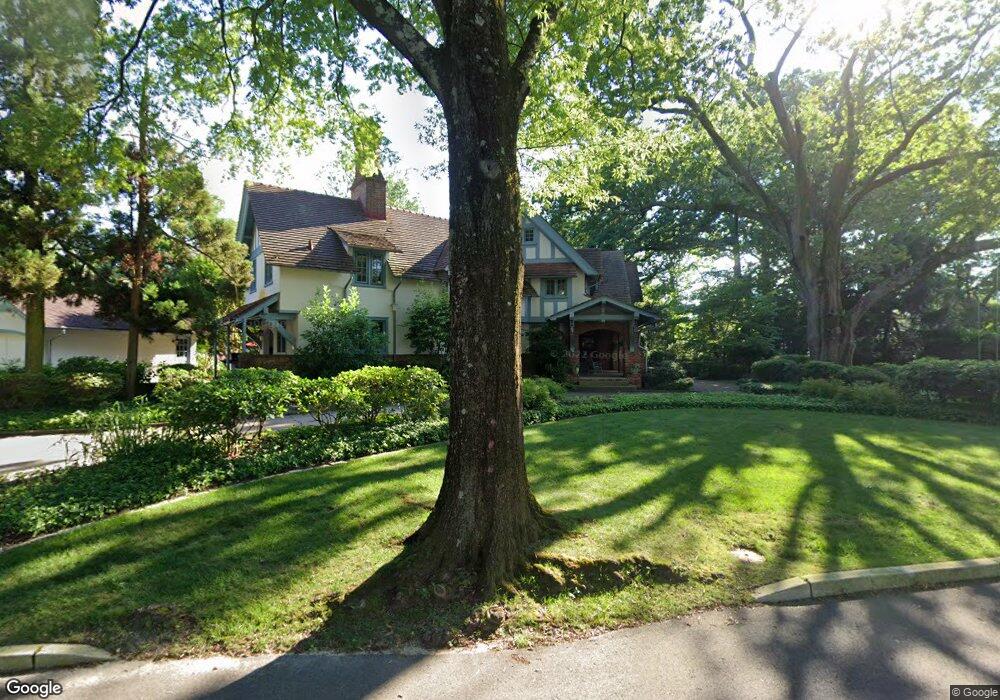
327 Knolltop Ln Haddonfield, NJ 08033
Estimated Value: $2,266,269 - $2,727,000
Studio
--
Bath
6,126
Sq Ft
$412/Sq Ft
Est. Value
About This Home
This home is located at 327 Knolltop Ln, Haddonfield, NJ 08033 and is currently estimated at $2,522,756, approximately $411 per square foot. 327 Knolltop Ln is a home located in Camden County with nearby schools including Haddonfield Memorial High School, Haddonfield Friends School, and Brookfield Elementary School.
Ownership History
Date
Name
Owned For
Owner Type
Purchase Details
Closed on
Mar 31, 1998
Sold by
Stonhard Inc
Bought by
Schlitt Dr Michael T and Hill Dr Cynthia
Current Estimated Value
Home Financials for this Owner
Home Financials are based on the most recent Mortgage that was taken out on this home.
Original Mortgage
$340,000
Outstanding Balance
$63,865
Interest Rate
6.98%
Mortgage Type
Purchase Money Mortgage
Estimated Equity
$2,458,891
Purchase Details
Closed on
Nov 4, 1995
Sold by
Rushton Harold
Bought by
Reif Sandra
Create a Home Valuation Report for This Property
The Home Valuation Report is an in-depth analysis detailing your home's value as well as a comparison with similar homes in the area
Home Values in the Area
Average Home Value in this Area
Purchase History
| Date | Buyer | Sale Price | Title Company |
|---|---|---|---|
| Schlitt Dr Michael T | $800,000 | -- | |
| Reif Sandra | $715,000 | -- |
Source: Public Records
Mortgage History
| Date | Status | Borrower | Loan Amount |
|---|---|---|---|
| Open | Schlitt Dr Michael T | $340,000 |
Source: Public Records
Tax History
| Year | Tax Paid | Tax Assessment Tax Assessment Total Assessment is a certain percentage of the fair market value that is determined by local assessors to be the total taxable value of land and additions on the property. | Land | Improvement |
|---|---|---|---|---|
| 2025 | $46,850 | $1,450,000 | $527,200 | $922,800 |
| 2024 | $47,820 | $1,450,000 | $527,200 | $922,800 |
| 2023 | $47,820 | $1,500,000 | $527,200 | $972,800 |
| 2022 | $47,445 | $1,500,000 | $527,200 | $972,800 |
| 2021 | $51,671 | $1,641,900 | $527,200 | $1,114,700 |
| 2020 | $51,309 | $1,641,900 | $527,200 | $1,114,700 |
| 2019 | $509 | $1,641,900 | $527,200 | $1,114,700 |
| 2018 | $50,291 | $1,641,900 | $527,200 | $1,114,700 |
| 2017 | $49,093 | $1,641,900 | $527,200 | $1,114,700 |
| 2016 | $47,993 | $1,641,900 | $527,200 | $1,114,700 |
| 2015 | $46,663 | $1,641,900 | $527,200 | $1,114,700 |
| 2014 | $45,628 | $1,641,900 | $527,200 | $1,114,700 |
Source: Public Records
Map
Nearby Homes
- 344 Knolltop Ln
- 370 Station Ave
- 38 Birchall Dr
- 75 Birchall Dr
- 127 W Cottage Ave
- 109 W Euclid Ave
- 125 W Cottage Ave
- 33 Estaugh Ave
- 35 Estaugh Ave
- 233 E Kings Hwy
- 313 Woodland Ave
- 139 Treaty Elm Ln
- 25 W Euclid Ave
- 100 3rd Ave
- 109 S Atlantic Ave
- 104 Treaty Elm Ln
- 302 3rd Ave
- 47 E Kings Hwy
- 13 Wilkins Ave
- 103 White Horse Pike
- 319 Knolltop Ln
- 315 Knolltop Ln
- 331 Knolltop Ln
- 368 Kings Hwy W
- 17 S Hinchman Ave
- 372 Kings Hwy W
- 336 Knolltop Ln
- 27 S Hinchman Ave
- 311 Knolltop Ln
- 340 Knolltop Ln
- 332 Knolltop Ln
- 11 S Hinchman Ave
- 328 Knolltop Ln
- 350 Kings Hwy W
- 307 Knolltop Ln
- 320 Knolltop Ln
- 324 Knolltop Ln
- 380 Kings Hwy W
- 316 Knolltop Ln
- 24 S Hinchman Ave
Your Personal Tour Guide
Ask me questions while you tour the home.