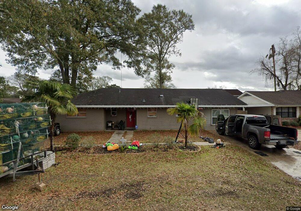
327 Saint Anthony St Luling, LA 70070
Estimated Value: $223,000 - $251,000
3
Beds
2
Baths
1,515
Sq Ft
$158/Sq Ft
Est. Value
About This Home
This home is located at 327 Saint Anthony St, Luling, LA 70070 and is currently estimated at $239,972, approximately $158 per square foot. 327 Saint Anthony St is a home located in St. Charles Parish with nearby schools including Lakewood Elementary School, Hahnville High School, and Life Church Academy.
Ownership History
Date
Name
Owned For
Owner Type
Purchase Details
Closed on
Feb 22, 2006
Sold by
Collings James J and Collins Elana M Zirkle
Bought by
Plkey Amanda M
Current Estimated Value
Home Financials for this Owner
Home Financials are based on the most recent Mortgage that was taken out on this home.
Original Mortgage
$145,000
Outstanding Balance
$81,096
Interest Rate
6.09%
Mortgage Type
New Conventional
Estimated Equity
$158,876
Create a Home Valuation Report for This Property
The Home Valuation Report is an in-depth analysis detailing your home's value as well as a comparison with similar homes in the area
Home Values in the Area
Average Home Value in this Area
Purchase History
| Date | Buyer | Sale Price | Title Company |
|---|---|---|---|
| Plkey Amanda M | $145,000 | Delta Title Of Metairie |
Source: Public Records
Mortgage History
| Date | Status | Borrower | Loan Amount |
|---|---|---|---|
| Open | Plkey Amanda M | $145,000 |
Source: Public Records
Tax History Compared to Growth
Tax History
| Year | Tax Paid | Tax Assessment Tax Assessment Total Assessment is a certain percentage of the fair market value that is determined by local assessors to be the total taxable value of land and additions on the property. | Land | Improvement |
|---|---|---|---|---|
| 2024 | $1,210 | $19,290 | $6,330 | $12,960 |
| 2023 | $1,210 | $15,180 | $4,640 | $10,540 |
| 2022 | $1,775 | $15,180 | $4,640 | $10,540 |
| 2021 | $1,388 | $11,765 | $4,176 | $7,589 |
| 2020 | $1,793 | $15,180 | $4,640 | $10,540 |
| 2019 | $1,499 | $12,645 | $3,500 | $9,145 |
| 2018 | $1,488 | $12,645 | $3,500 | $9,145 |
| 2017 | $1,486 | $12,645 | $3,500 | $9,145 |
| 2016 | $1,492 | $12,645 | $3,500 | $9,145 |
| 2015 | $482 | $11,600 | $1,961 | $9,639 |
| 2014 | $464 | $11,600 | $1,961 | $9,639 |
| 2013 | $466 | $11,600 | $1,961 | $9,639 |
Source: Public Records
Map
Nearby Homes
- 321 Saint Anthony St
- 319 Wanda St
- 330 Saint Nicholas St
- 320 Monsanto Ave
- 102 Flowerwood Ct
- 125 Lakewood Dr
- 426 River Oaks Dr
- 123 Braden Dr
- 192 Lakewood Dr
- 115 Lake Catherine Dr
- 420 Lakewood Dr
- 111 Lake Carolyn Dr
- 130 Sophia Dr
- 502 Kellogg Dr
- Broussard Plan at Heather Oaks
- Gramercy Plan at Heather Oaks
- LaCroix Plan at Heather Oaks
- Burnside Plan at Heather Oaks
- Springfield Plan at Heather Oaks
- Stanton Plan at Heather Oaks
- 329 Saint Anthony St
- 326 Saint Nicholas St
- 331 Saint Anthony St
- 325 Saint Anthony St
- 328 Saint Anthony St
- 324 Saint Anthony St
- 322 Saint Nicholas St
- 330 Saint Nicholas St
- 330 Saint Anthony St
- 333 Saint Anthony St
- 320 Saint Nicholas St
- 320 Saint Anthony St
- 325 Saint Nicholas St
- 319 Saint Anthony St
- 331 Saint Nicholas St
- 323 Saint Nicholas St
- 337 Wanda St
- 332 Saint Nicholas St
- 335 Wanda St
- 302 Primrose Dr