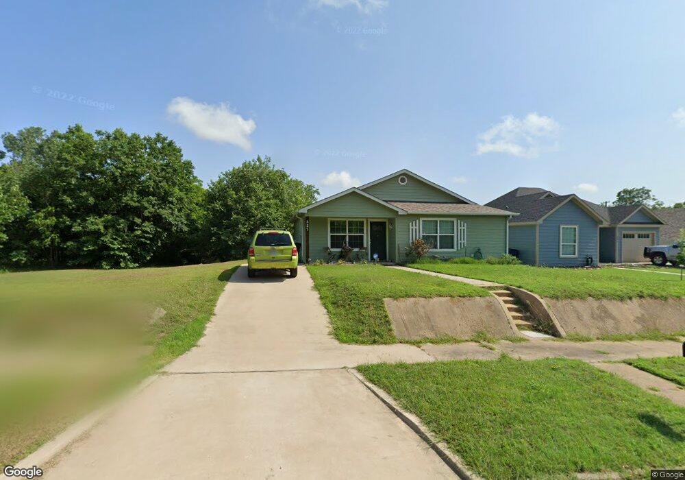
327 W Bond St Denison, TX 75020
Estimated Value: $225,720 - $235,000
3
Beds
2
Baths
1,157
Sq Ft
$199/Sq Ft
Est. Value
About This Home
This home is located at 327 W Bond St, Denison, TX 75020 and is currently estimated at $230,360, approximately $199 per square foot. 327 W Bond St is a home located in Grayson County with nearby schools including Terrell Elementary School, Scott Middle School, and Denison High School.
Ownership History
Date
Name
Owned For
Owner Type
Purchase Details
Closed on
Nov 18, 2019
Sold by
Williams Billy and Williams Paula
Bought by
Buller Matthew I and Abshire Darlena G
Current Estimated Value
Home Financials for this Owner
Home Financials are based on the most recent Mortgage that was taken out on this home.
Original Mortgage
$147,283
Outstanding Balance
$132,071
Interest Rate
4.62%
Mortgage Type
FHA
Estimated Equity
$98,289
Purchase Details
Closed on
Apr 12, 2016
Sold by
Srader Mike C
Bought by
Stewart Paula M
Home Financials for this Owner
Home Financials are based on the most recent Mortgage that was taken out on this home.
Original Mortgage
$105,000
Interest Rate
3.64%
Mortgage Type
VA
Create a Home Valuation Report for This Property
The Home Valuation Report is an in-depth analysis detailing your home's value as well as a comparison with similar homes in the area
Home Values in the Area
Average Home Value in this Area
Purchase History
| Date | Buyer | Sale Price | Title Company |
|---|---|---|---|
| Buller Matthew I | -- | None Available | |
| Stewart Paula M | -- | Grayson County Title |
Source: Public Records
Mortgage History
| Date | Status | Borrower | Loan Amount |
|---|---|---|---|
| Open | Buller Matthew I | $147,283 | |
| Previous Owner | Stewart Paula M | $105,000 |
Source: Public Records
Tax History
| Year | Tax Paid | Tax Assessment Tax Assessment Total Assessment is a certain percentage of the fair market value that is determined by local assessors to be the total taxable value of land and additions on the property. | Land | Improvement |
|---|---|---|---|---|
| 2025 | $5,624 | $240,143 | $67,431 | $172,712 |
| 2024 | $5,624 | $242,054 | $67,431 | $174,623 |
| 2023 | $5,332 | $235,325 | $52,446 | $182,879 |
| 2022 | $5,007 | $210,720 | $37,462 | $173,258 |
| 2021 | $3,930 | $155,829 | $29,969 | $125,860 |
| 2020 | $3,874 | $146,869 | $17,982 | $128,887 |
| 2019 | $3,748 | $136,202 | $14,985 | $121,217 |
Source: Public Records
Map
Nearby Homes
- 315 W Walker St
- 305 W Morton St Unit 307
- 716 N Rusk Ave
- 521 E Fannin E
- 205 W Bond St
- 409 W Johnson St
- 425 W Johnson St
- 522 N Austin Ave
- 121 W Morton St
- 114 W Morton St
- 1201 N Mirick Ave
- 1200 N Mirick Ave
- 110 W Morton St
- 526 W Elm St
- 624 W Walker St
- 629 W Walker St
- 631 W Walker St
- 610 W Elm St
- 615 W Gandy St
- 712 W Bond St
- 321 W Bond St
- 319 W Bond St
- 315 W Bond St
- 612 N Burnett Ave
- 520 N Burnett Ave
- 316 W Walker St
- 311 W Bond St
- 403 W Bond St
- 320 W Bond St
- 314 W Bond St
- 518 N Burnett Ave
- 316 W Bond St
- 303 W Bond St
- 310 W Walker St
- 516 N Burnett Ave
- 409 W Bond St
- 402 W Walker St
- 308 W Bond St
- 301 W Bond St
- 665 N Rusk Ave
Your Personal Tour Guide
Ask me questions while you tour the home.