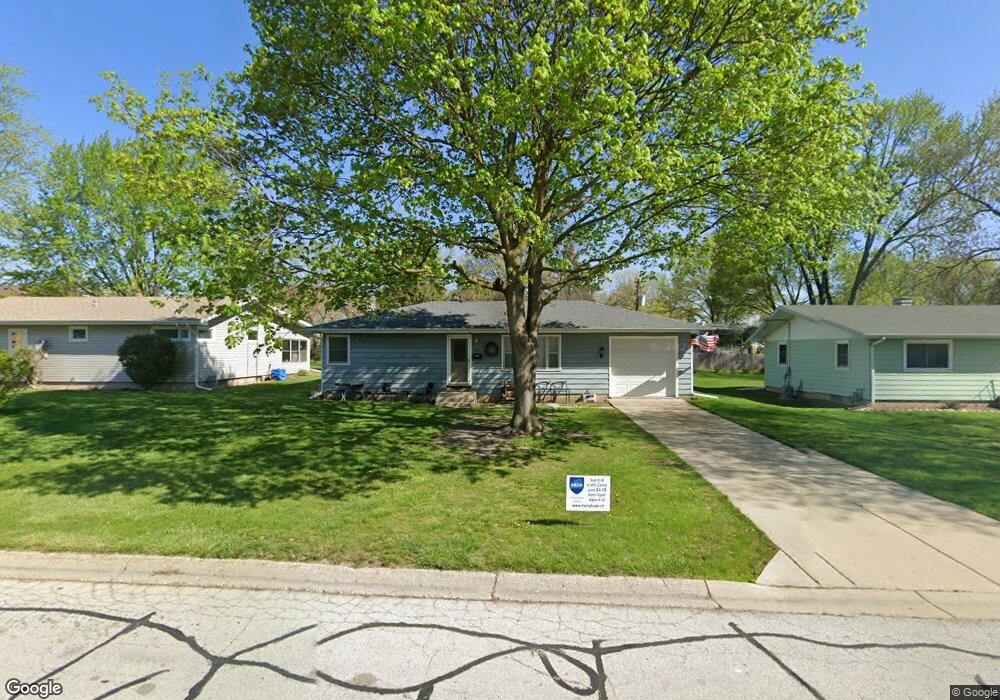
327 W State St North Aurora, IL 60542
Estimated Value: $250,000 - $304,000
3
Beds
1
Bath
1,040
Sq Ft
$272/Sq Ft
Est. Value
About This Home
This home is located at 327 W State St, North Aurora, IL 60542 and is currently estimated at $282,606, approximately $271 per square foot. 327 W State St is a home located in Kane County with nearby schools including Goodwin Elementary School, Jewel Middle School, and West Aurora High School.
Ownership History
Date
Name
Owned For
Owner Type
Purchase Details
Closed on
Jan 29, 1999
Sold by
Erickson Robert W and Erickson Delores E
Bought by
Striedl Michael P
Current Estimated Value
Home Financials for this Owner
Home Financials are based on the most recent Mortgage that was taken out on this home.
Original Mortgage
$99,847
Outstanding Balance
$23,653
Interest Rate
6.75%
Mortgage Type
FHA
Estimated Equity
$258,953
Purchase Details
Closed on
May 5, 1995
Sold by
Todus John K and Todus Theresa A
Bought by
Erickson Robert W and Erickson Delores E
Create a Home Valuation Report for This Property
The Home Valuation Report is an in-depth analysis detailing your home's value as well as a comparison with similar homes in the area
Home Values in the Area
Average Home Value in this Area
Purchase History
| Date | Buyer | Sale Price | Title Company |
|---|---|---|---|
| Striedl Michael P | $100,000 | Ticor Title Insurance | |
| Erickson Robert W | $86,000 | Chicago Title Insurance Co |
Source: Public Records
Mortgage History
| Date | Status | Borrower | Loan Amount |
|---|---|---|---|
| Open | Striedl Michael P | $99,847 |
Source: Public Records
Tax History
| Year | Tax Paid | Tax Assessment Tax Assessment Total Assessment is a certain percentage of the fair market value that is determined by local assessors to be the total taxable value of land and additions on the property. | Land | Improvement |
|---|---|---|---|---|
| 2024 | $5,986 | $78,650 | $13,622 | $65,028 |
| 2023 | $5,792 | $70,273 | $12,171 | $58,102 |
| 2022 | $5,372 | $64,118 | $11,105 | $53,013 |
| 2021 | $5,155 | $59,695 | $10,339 | $49,356 |
| 2020 | $5,547 | $63,041 | $9,603 | $53,438 |
| 2019 | $5,352 | $57,850 | $8,897 | $48,953 |
| 2018 | $5,115 | $53,441 | $8,230 | $45,211 |
| 2017 | $4,908 | $49,843 | $7,583 | $42,260 |
| 2016 | $4,449 | $43,820 | $6,960 | $36,860 |
| 2015 | -- | $38,503 | $5,985 | $32,518 |
| 2014 | -- | $34,612 | $5,233 | $29,379 |
| 2013 | -- | $35,054 | $5,158 | $29,896 |
Source: Public Records
Map
Nearby Homes
- 423 Harmony Dr
- 307 Hill Ave
- 310 Oak St
- 10 N Adams St
- 43 S Juniper Dr Unit 3
- 357 Pheasant Hill Dr
- 911 Darwin St
- 413 N Sycamore Ln
- 444 Prairie Ridge Ln
- 448 Prairie Ridge Ln
- 406 Juniper Dr
- 415 Juniper Dr
- 451 Pheasant Hill Dr
- 463 Prairie Ridge Ln
- 556 Quail St
- 459 Prairie Ridge Ln
- 212 Hill Ave
- 104 Briar Ln
- 537 Moose Lake Ave
- 320 Sussex Ln
- 325 W State St
- 1 N Cherrytree Ct
- 328 Farview Dr
- 326 Farview Dr
- 3 N Cherrytree Ct
- 323 W State St
- 324 Farview Dr
- 326 W State St
- 1 S Cherrytree Ct
- 321 W State St
- 324 W State St
- 322 Farview Dr
- 2 S Cherrytree Ct
- 322 W State St
- 327 Farview Dr
- 327 Harmony Dr
- 325 Farview Dr
- 325 Harmony Dr
- 3 S Cherrytree Ct
- 11A N Cherrytree Ct
Your Personal Tour Guide
Ask me questions while you tour the home.