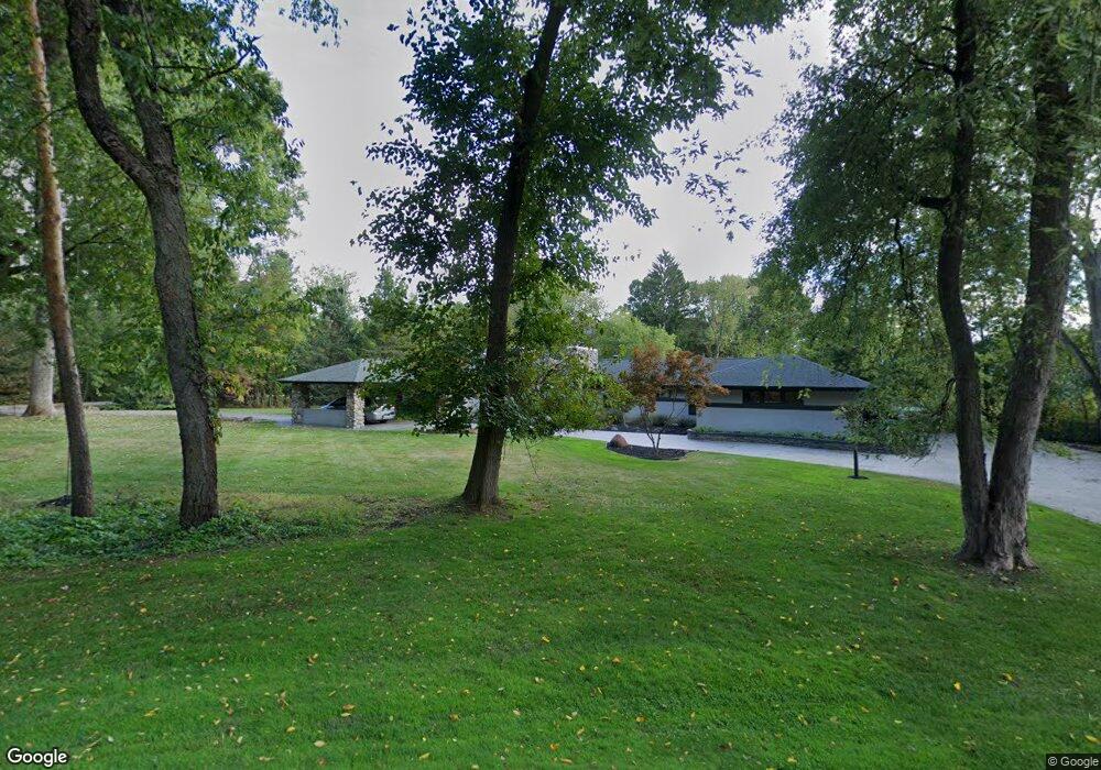
32710 Redfern St Franklin, MI 48025
Estimated Value: $995,000 - $1,849,000
2
Beds
5
Baths
3,755
Sq Ft
$389/Sq Ft
Est. Value
About This Home
This home is located at 32710 Redfern St, Franklin, MI 48025 and is currently estimated at $1,461,787, approximately $389 per square foot. 32710 Redfern St is a home located in Oakland County with nearby schools including Wylie E. Groves High School, West Maple Elementary School, and Berkshire Middle School.
Ownership History
Date
Name
Owned For
Owner Type
Purchase Details
Closed on
Apr 29, 2013
Sold by
West Bloomfield Property Llc
Bought by
Patel Chetan and Patel Mona
Current Estimated Value
Purchase Details
Closed on
Mar 22, 2011
Sold by
Suntrust Mortgage Inc and Alsalem Jackie
Bought by
U S Bank National Association
Purchase Details
Closed on
Mar 8, 2011
Sold by
Suntrust Mortgage Inc
Bought by
U S Bank National Association
Purchase Details
Closed on
Jan 5, 2010
Sold by
Levin Jan
Bought by
Suntrust Mortgage Inc
Purchase Details
Closed on
Oct 28, 1999
Sold by
Levin Steve
Bought by
Levin Jan
Purchase Details
Closed on
Dec 26, 1996
Sold by
Levin Steven L
Bought by
Levin Steven L
Create a Home Valuation Report for This Property
The Home Valuation Report is an in-depth analysis detailing your home's value as well as a comparison with similar homes in the area
Home Values in the Area
Average Home Value in this Area
Purchase History
| Date | Buyer | Sale Price | Title Company |
|---|---|---|---|
| Patel Chetan | -- | None Available | |
| U S Bank National Association | -- | Stewart Title Agency | |
| U S Bank National Association | -- | None Available | |
| Suntrust Mortgage Inc | $647,606 | None Available | |
| Levin Jan | -- | -- | |
| Levin Steven L | -- | -- |
Source: Public Records
Tax History Compared to Growth
Tax History
| Year | Tax Paid | Tax Assessment Tax Assessment Total Assessment is a certain percentage of the fair market value that is determined by local assessors to be the total taxable value of land and additions on the property. | Land | Improvement |
|---|---|---|---|---|
| 2024 | $11,201 | $582,730 | $0 | $0 |
| 2023 | $10,621 | $593,260 | $0 | $0 |
| 2022 | $11,493 | $511,150 | $0 | $0 |
| 2021 | $11,446 | $444,340 | $0 | $0 |
| 2020 | $9,767 | $424,070 | $0 | $0 |
| 2019 | $8,898 | $421,220 | $0 | $0 |
| 2018 | $11,533 | $446,390 | $0 | $0 |
| 2017 | $11,688 | $446,390 | $0 | $0 |
| 2016 | $10,791 | $438,740 | $0 | $0 |
| 2015 | -- | $424,230 | $0 | $0 |
| 2014 | -- | $369,680 | $0 | $0 |
| 2011 | -- | $248,150 | $0 | $0 |
Source: Public Records
Map
Nearby Homes
- 25635 River Dr
- 32890 Whatley Rd
- 25690 W 14 Mile Rd
- 32696 Ravine Dr
- 4428 Old Trinity Ct
- 7100 Wing Lake Rd
- 4647 Private Lake Dr
- 26075 Woodlore Rd
- 25325 Devon Ln
- 26565 Scenic Hwy
- 26377 Willowgreen Dr
- 7005 Cathedral Dr
- 6940 Wing Lake Rd
- 25265 Canterbury Rd
- 7200 Telegraph Rd
- 31050 Briarcliff Rd
- 6940 Castle Dr
- 6952 Sandalwood Dr
- 7315 Lindenmere Dr
- 27170 W 14 Mile Rd
- 25455 Dennison Rd
- 32845 Whatley Rd Unit Bldg-Unit
- 32845 Whatley Rd
- 32845 Whatley Rd
- 25670 River Dr
- 32695 Redfern St
- 25630 River Dr
- 32715 Redfern St
- 25425 Dennison Rd
- 32677 Redfern St
- 25660 Dennison Rd
- 25675 Dennison Rd
- 32762 Brookwood Ln Unit 4
- 32556 Woodcreek Ct
- 32556 Woodcreek Ct Unit 8
- 25600 River Dr
- 32684 Brookwood Ln
- 32662 Brookwood Ln
- 25525 W 14 Mile Rd
- 32748 Brookwood Ln