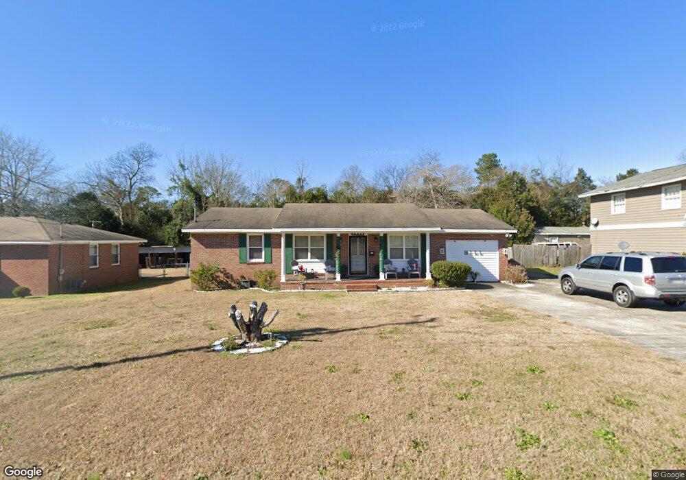
3273 Mckay Dr Macon, GA 31206
Estimated Value: $108,000 - $113,000
3
Beds
2
Baths
1,485
Sq Ft
$74/Sq Ft
Est. Value
About This Home
This home is located at 3273 Mckay Dr, Macon, GA 31206 and is currently estimated at $110,366, approximately $74 per square foot. 3273 Mckay Dr is a home located in Bibb County with nearby schools including Southfield Elementary School, Southwest High School, and Cirrus Charter Academy.
Ownership History
Date
Name
Owned For
Owner Type
Purchase Details
Closed on
Oct 24, 2018
Sold by
Mears Brian Eugene
Bought by
Hill Audrey
Current Estimated Value
Home Financials for this Owner
Home Financials are based on the most recent Mortgage that was taken out on this home.
Original Mortgage
$52,380
Outstanding Balance
$46,066
Interest Rate
5%
Mortgage Type
Adjustable Rate Mortgage/ARM
Estimated Equity
$64,300
Purchase Details
Closed on
Apr 28, 1978
Sold by
Comer 1214 Bruce E and Comer 1214 Yvonne W
Bought by
Mears Maurice L - Loretta
Create a Home Valuation Report for This Property
The Home Valuation Report is an in-depth analysis detailing your home's value as well as a comparison with similar homes in the area
Home Values in the Area
Average Home Value in this Area
Purchase History
| Date | Buyer | Sale Price | Title Company |
|---|---|---|---|
| Hill Audrey | $54,000 | None Available | |
| Mears Maurice L - Loretta | $31,900 | -- |
Source: Public Records
Mortgage History
| Date | Status | Borrower | Loan Amount |
|---|---|---|---|
| Open | Hill Audrey | $52,380 |
Source: Public Records
Tax History Compared to Growth
Tax History
| Year | Tax Paid | Tax Assessment Tax Assessment Total Assessment is a certain percentage of the fair market value that is determined by local assessors to be the total taxable value of land and additions on the property. | Land | Improvement |
|---|---|---|---|---|
| 2025 | $756 | $37,752 | $2,300 | $35,452 |
| 2024 | $691 | $34,227 | $2,300 | $31,927 |
| 2023 | $184 | $32,234 | $2,070 | $30,164 |
| 2022 | $717 | $27,698 | $2,300 | $25,398 |
| 2021 | $553 | $21,548 | $2,300 | $19,248 |
| 2020 | $565 | $21,548 | $2,300 | $19,248 |
| 2019 | $569 | $21,548 | $2,300 | $19,248 |
| 2018 | $597 | $20,849 | $2,300 | $18,549 |
| 2017 | $250 | $20,849 | $2,300 | $18,549 |
| 2016 | $221 | $20,849 | $2,300 | $18,549 |
| 2015 | $320 | $20,849 | $2,300 | $18,549 |
| 2014 | $345 | $31,109 | $3,285 | $27,824 |
Source: Public Records
Map
Nearby Homes
- 3254 Markwood Dr
- 3339 Markwood Dr
- 3445 Travis Blvd
- 3446 Tamplin Terrace
- 1664 Randall Rd
- 3480 Travis Blvd
- 1527 Hurley Cir
- 1504 Berkshire Dr
- 1740 Downing Cir
- 3778 Spencer Cir
- 3881 Spencer Cir
- 3751 Travis Blvd
- 3935 Travis Blvd
- 3819 Frances Dr
- 3158 Brownell Ave
- 1254 W Grenada Terrace
- 1196 Harley St
- 3391 Pio Nono Cir
- 3281 Mckay Dr
- 3251 Mckay Dr
- 3293 Mckay Dr
- 1673 Walker Rd
- 3296 Mckay Dr
- 3237 Mckay Dr
- 1715 Walker Rd
- 1641 Walker Rd
- 1725 Walker Rd
- 3229 Mckay Dr
- 3229 Mckay Dr Unit 185
- 3300 Placid Place
- 1662 Walker Rd
- 1633 Walker Rd
- 3209 Mckay Dr
- 1741 Walker Rd
- 1648 Walker Rd
- 1621 Walker Rd
- 3312 Placid Place
- 3312 Placid Place Unit A