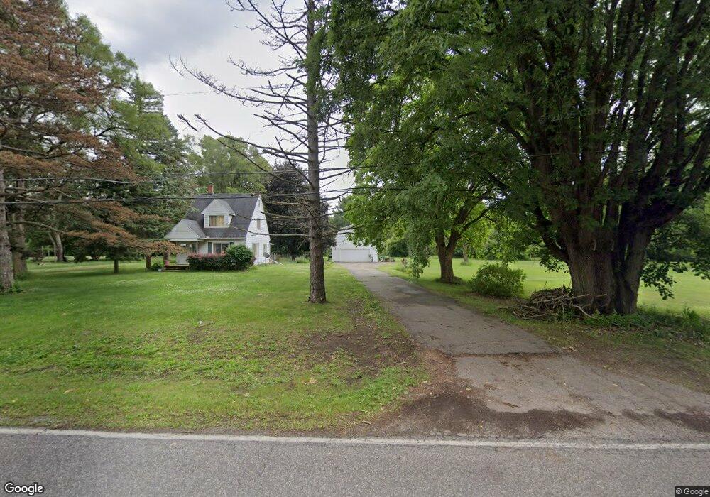
3274 E Pierson Rd Unit Bldg-Unit Flint, MI 48506
Northeast Flint NeighborhoodEstimated Value: $102,000 - $166,000
Studio
2
Baths
1,407
Sq Ft
$102/Sq Ft
Est. Value
About This Home
This home is located at 3274 E Pierson Rd Unit Bldg-Unit, Flint, MI 48506 and is currently estimated at $144,174, approximately $102 per square foot. 3274 E Pierson Rd Unit Bldg-Unit is a home located in Genesee County with nearby schools including Weston Elementary School, Kate Dowdall Elementary School, and Leota Fiedler Elementary School.
Ownership History
Date
Name
Owned For
Owner Type
Purchase Details
Closed on
Apr 19, 2018
Sold by
Fannie Mae
Bought by
Gerow Billy
Current Estimated Value
Home Financials for this Owner
Home Financials are based on the most recent Mortgage that was taken out on this home.
Original Mortgage
$65,960
Outstanding Balance
$56,724
Interest Rate
4.44%
Mortgage Type
Purchase Money Mortgage
Estimated Equity
$87,450
Purchase Details
Closed on
Jul 29, 2016
Sold by
Heavner Deborah Ann
Bought by
Fannie Mae and Federal National Mortgage Association
Create a Home Valuation Report for This Property
The Home Valuation Report is an in-depth analysis detailing your home's value as well as a comparison with similar homes in the area
Home Values in the Area
Average Home Value in this Area
Purchase History
| Date | Buyer | Sale Price | Title Company |
|---|---|---|---|
| Gerow Billy | $68,000 | None Available | |
| Fannie Mae | -- | None Available |
Source: Public Records
Mortgage History
| Date | Status | Borrower | Loan Amount |
|---|---|---|---|
| Open | Gerow Billy | $65,960 |
Source: Public Records
Tax History
| Year | Tax Paid | Tax Assessment Tax Assessment Total Assessment is a certain percentage of the fair market value that is determined by local assessors to be the total taxable value of land and additions on the property. | Land | Improvement |
|---|---|---|---|---|
| 2025 | $2,647 | $62,200 | $0 | $0 |
| 2024 | $583 | $59,300 | $0 | $0 |
| 2023 | $556 | $58,800 | $0 | $0 |
| 2022 | $2,193 | $52,300 | $0 | $0 |
| 2021 | $2,178 | $46,700 | $0 | $0 |
| 2020 | $508 | $46,000 | $0 | $0 |
| 2019 | $500 | $43,100 | $0 | $0 |
| 2018 | $1,245 | $42,300 | $0 | $0 |
| 2017 | $1,639 | $40,500 | $0 | $0 |
| 2016 | $1,183 | $38,000 | $0 | $0 |
| 2015 | $1,044 | $37,000 | $0 | $0 |
| 2014 | $348 | $34,900 | $0 | $0 |
| 2012 | -- | $29,100 | $29,100 | $0 |
Source: Public Records
Map
Nearby Homes
- 3299 E Pierson Rd
- 3364 E Pierson Rd
- 4907 Delta Dr
- 3456 E Pierson Rd
- 3294 Huggins Ave
- 2825 Eaton Place
- 2802 Eaton Place
- 2727 Eaton Place
- 2710 Eaton Place
- 2919 Hampstead Dr
- 5919 Western Rd
- 00 Richfield Rd
- 4127 Coggins Ave
- 4923 Alpha Way
- 4808 Alpha Way
- 4081 Hidden View Dr
- 3307 S Kearsley Blvd
- 2935 Richfield Rd
- 4141 Hidden View Dr
- 3705 Aldon Ln
- 3274 E Pierson Rd
- 3288 E Pierson Rd
- 3310 E Pierson Rd
- 3248 E Pierson Rd
- 3296 E Pierson Rd
- 3280 E Pierson Rd
- 3236 E Pierson Rd
- 3226 E Pierson Rd
- 3235 E Pierson Rd
- 3320 E Pierson Rd
- 3227 E Pierson Rd
- 3215 E Pierson Rd
- 3218 E Pierson Rd
- 3336 E Pierson Rd
- 3203 E Pierson Rd
- 3200 E Pierson Rd
- 3209 E Pierson Rd
- 3342 E Pierson Rd
- 3344 E Pierson Rd
- 3333 E Pierson Rd