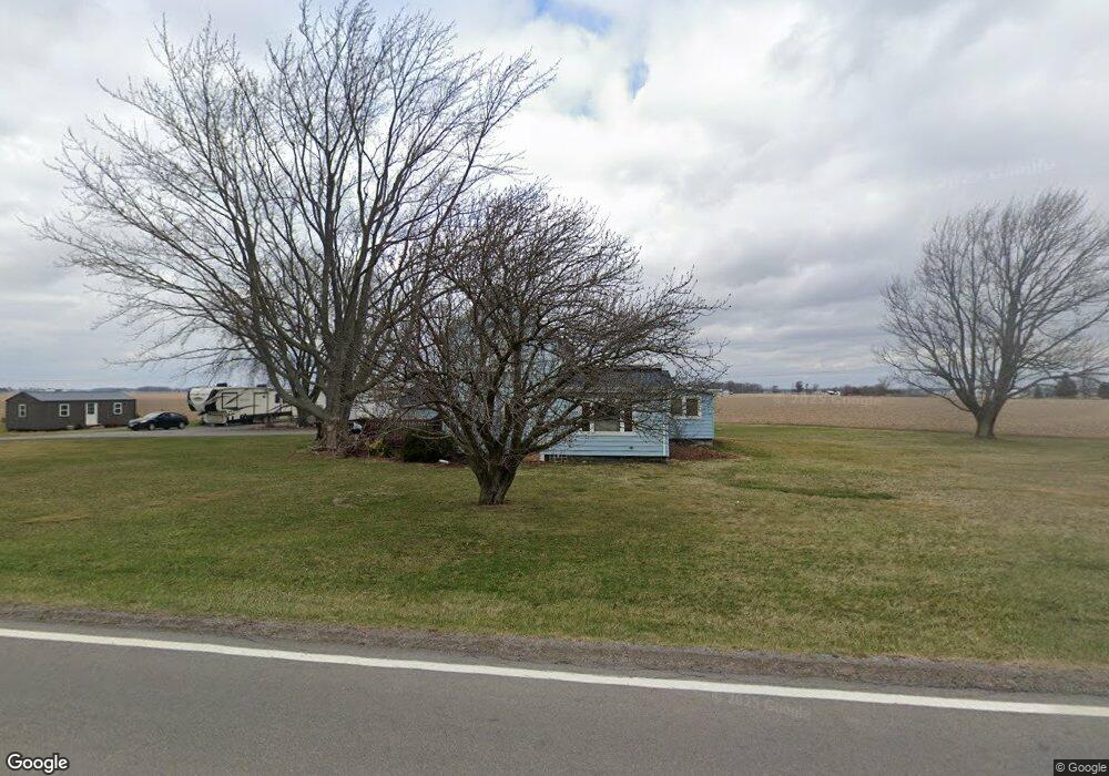
3276 State Route 12 Mount Cory, OH 45868
Estimated Value: $240,186 - $301,000
3
Beds
2
Baths
2,203
Sq Ft
$126/Sq Ft
Est. Value
About This Home
This home is located at 3276 State Route 12, Mount Cory, OH 45868 and is currently estimated at $277,797, approximately $126 per square foot. 3276 State Route 12 is a home located in Hancock County with nearby schools including Cory-Rawson Elementary School and Cory-Rawson High School.
Ownership History
Date
Name
Owned For
Owner Type
Purchase Details
Closed on
Nov 22, 2017
Sold by
Linhart Steven A and Linhart Debra S
Bought by
Cates Kimberly and Cates James
Current Estimated Value
Home Financials for this Owner
Home Financials are based on the most recent Mortgage that was taken out on this home.
Original Mortgage
$186,558
Outstanding Balance
$156,409
Interest Rate
3.87%
Mortgage Type
FHA
Estimated Equity
$121,388
Purchase Details
Closed on
Mar 1, 1983
Bought by
Linhart Steven A and Linhart Debra S
Purchase Details
Closed on
May 19, 1982
Bought by
Stokes David M
Purchase Details
Closed on
Jan 23, 1981
Bought by
Stokes David M and Stokes Kathleen
Create a Home Valuation Report for This Property
The Home Valuation Report is an in-depth analysis detailing your home's value as well as a comparison with similar homes in the area
Home Values in the Area
Average Home Value in this Area
Purchase History
| Date | Buyer | Sale Price | Title Company |
|---|---|---|---|
| Cates Kimberly | $190,000 | Flag City Title | |
| Linhart Steven A | $40,000 | -- | |
| Stokes David M | -- | -- | |
| Stokes David M | -- | -- |
Source: Public Records
Mortgage History
| Date | Status | Borrower | Loan Amount |
|---|---|---|---|
| Open | Cates Kimberly | $186,558 |
Source: Public Records
Tax History Compared to Growth
Tax History
| Year | Tax Paid | Tax Assessment Tax Assessment Total Assessment is a certain percentage of the fair market value that is determined by local assessors to be the total taxable value of land and additions on the property. | Land | Improvement |
|---|---|---|---|---|
| 2024 | $1,998 | $54,800 | $15,890 | $38,910 |
| 2023 | $1,950 | $54,800 | $15,890 | $38,910 |
| 2022 | $1,931 | $54,800 | $15,890 | $38,910 |
| 2021 | $1,710 | $42,870 | $15,460 | $27,410 |
| 2020 | $1,724 | $42,870 | $15,460 | $27,410 |
| 2019 | $1,692 | $42,870 | $15,460 | $27,410 |
| 2018 | $1,365 | $38,170 | $13,440 | $24,730 |
| 2017 | $1,408 | $38,170 | $13,440 | $24,730 |
| 2016 | $1,376 | $38,170 | $13,440 | $24,730 |
| 2015 | $1,248 | $33,980 | $13,440 | $20,540 |
| 2014 | $1,252 | $33,770 | $13,440 | $20,330 |
| 2012 | $1,309 | $33,770 | $13,440 | $20,330 |
Source: Public Records
Map
Nearby Homes
- 11698 Township Rd
- 132 Main St
- 307 Lincoln St
- 16134 Township Road 56
- 9984 State Route 235
- 17297 Township Road 51
- 101 Maplewood Dr
- 208 E Monroe St
- 110 Magnolia Ln
- 106 Riley St
- 349 Sycamore Ct
- 222 N Lawn Ave
- 210 N Jackson St
- 0 Ohio 103
- 17429 Road 5
- 18101 County Road 12
- 212 S Lawn Ave
- 152 Chestnut Ln
- 11741 Township Road 10
- 222 Grove St
- 3283 State Route 12
- 12707 Township Road 51
- 1240 State Route 12
- 1530 Ohio 12 Unit 4
- 12754 Township Road 51
- 0 State Route 12 Unit 130304
- 0 State Route 12 Unit 6115324
- 0 State Route 12
- 12490 Township Road 51
- 12282 Township Road 51
- 1702 State Route 12
- 1815 St Route
- 1815 Ohio 12
- 1815 State Route 12
- 13250 Township Road 51
- 913 County Road 78
- 12515 Township Road 53
- 1590 County Road 78
- 864 Ohio 12
- 864 State Route 12