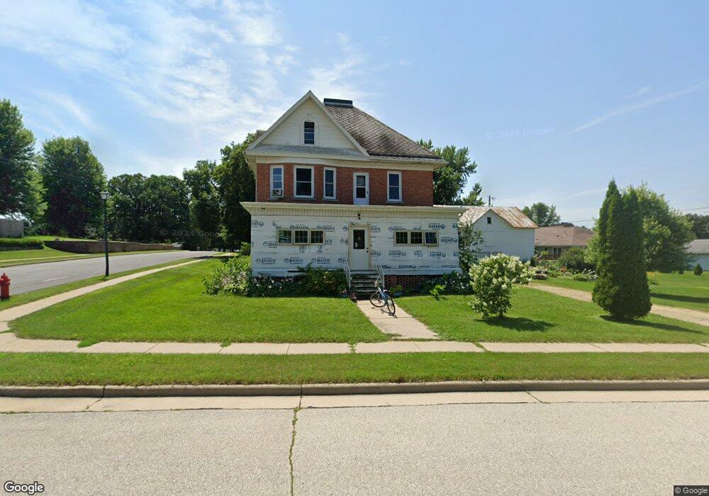
328 E Griffith St Hustisford, WI 53034
Estimated Value: $281,594 - $348,000
Studio
--
Bath
--
Sq Ft
21,649
Sq Ft
About This Home
This home is located at 328 E Griffith St, Hustisford, WI 53034 and is currently estimated at $311,899. 328 E Griffith St is a home with nearby schools including John Hustis Elementary School, Hustisford High School, and Bethany Lutheran School.
Ownership History
Date
Name
Owned For
Owner Type
Purchase Details
Closed on
Sep 6, 2018
Sold by
Priebe Kenneth A
Bought by
Daak Andrew and Terlann Margaret
Current Estimated Value
Home Financials for this Owner
Home Financials are based on the most recent Mortgage that was taken out on this home.
Original Mortgage
$93,000
Outstanding Balance
$80,273
Interest Rate
4.6%
Mortgage Type
New Conventional
Estimated Equity
$231,626
Purchase Details
Closed on
Dec 1, 2015
Sold by
Stegbauer Matthew J
Bought by
Priebe Kenneth A
Create a Home Valuation Report for This Property
The Home Valuation Report is an in-depth analysis detailing your home's value as well as a comparison with similar homes in the area
Purchase History
| Date | Buyer | Sale Price | Title Company |
|---|---|---|---|
| Daak Andrew | $104,500 | Knight Barry Title Advantage | |
| Priebe Kenneth A | $100,000 | Heritage Title Services Inc |
Source: Public Records
Mortgage History
| Date | Status | Borrower | Loan Amount |
|---|---|---|---|
| Open | Daak Andrew | $93,000 |
Source: Public Records
Tax History
| Year | Tax Paid | Tax Assessment Tax Assessment Total Assessment is a certain percentage of the fair market value that is determined by local assessors to be the total taxable value of land and additions on the property. | Land | Improvement |
|---|---|---|---|---|
| 2025 | $3,596 | $249,100 | $41,000 | $208,100 |
| 2024 | $3,209 | $249,100 | $41,000 | $208,100 |
| 2023 | $3,143 | $133,700 | $30,300 | $103,400 |
| 2022 | $3,608 | $133,700 | $30,300 | $103,400 |
| 2021 | $3,697 | $133,700 | $30,300 | $103,400 |
| 2020 | $3,760 | $133,700 | $30,300 | $103,400 |
| 2019 | $3,857 | $133,700 | $30,300 | $103,400 |
| 2018 | $3,180 | $133,700 | $30,300 | $103,400 |
| 2017 | $3,214 | $133,700 | $30,300 | $103,400 |
| 2016 | $3,360 | $133,700 | $30,300 | $103,400 |
| 2015 | $3,339 | $133,700 | $30,300 | $103,400 |
| 2014 | $3,332 | $133,700 | $30,300 | $103,400 |
Source: Public Records
Map
Nearby Homes
- 304 S Lake St
- 109 S Lake St
- 127 S Lake St
- 244 S Ridge St
- 699 Spruce St
- N4554 Lakeview Rd
- N4973 Lake Dr
- N4958 Arrowhead Trail
- N5413 County Rd S
- 0 Burkwald Ave
- 120 Highland Ave
- 106 Rayome Dr
- 234 Watertower Cir
- Lt1 Lilly Rd
- Lt1 W Horseshoe Rd
- N6436 County Road Tw
- Lt0 E Neda Rd
- 0 County Rd N
- Lt11 Cross St
- 238 South St
- 237 S Mill St
- 237 S Mill St Unit 239
- 410 E Griffith St
- 236 S Wales St
- 222 S Wales St
- 236 S Mill St
- 249 S Mill
- 249 Mill St
- 238 S Wales St
- 305 E Griffith St
- 252 S Wales St
- 319 E Anthony St
- 550 W Griffith St
- 254 S Mill St
- 227 S Wales St
- 327 E Anthony St
- 303 Anthony St
- 249 Wales St
- 266 Mill St
- 226 S Ann St
Your Personal Tour Guide
Ask me questions while you tour the home.