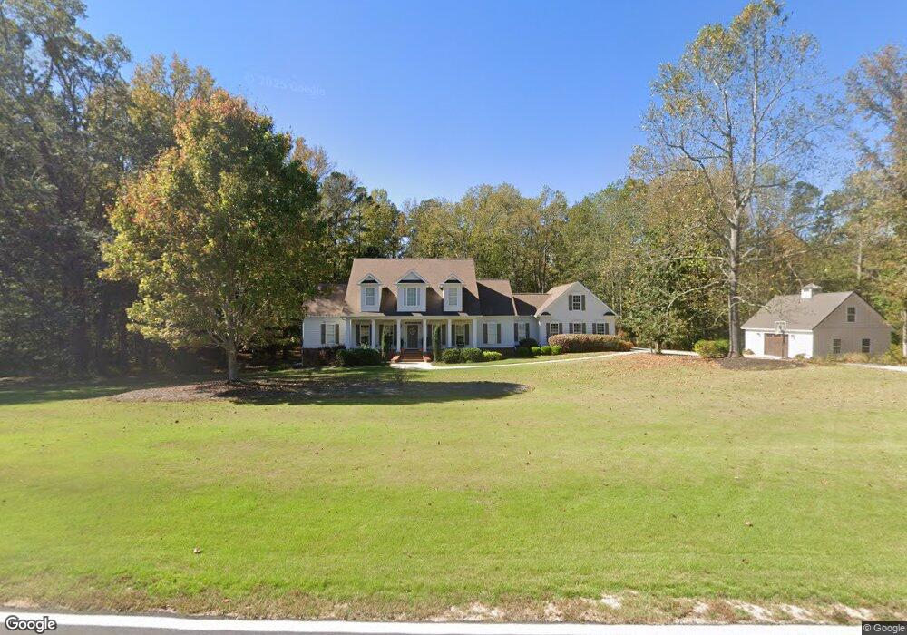
328 J W Thompson Rd Moreland, GA 30259
Estimated Value: $768,000 - $880,085
4
Beds
4
Baths
2,592
Sq Ft
$318/Sq Ft
Est. Value
About This Home
This home is located at 328 J W Thompson Rd, Moreland, GA 30259 and is currently estimated at $824,043, approximately $317 per square foot. 328 J W Thompson Rd is a home with nearby schools including Moreland Elementary School, Smokey Road Middle School, and Newnan High School.
Ownership History
Date
Name
Owned For
Owner Type
Purchase Details
Closed on
Dec 19, 2003
Sold by
Fouts Jane H
Bought by
Fouts Michael D and Fouts Jane
Current Estimated Value
Home Financials for this Owner
Home Financials are based on the most recent Mortgage that was taken out on this home.
Original Mortgage
$285,000
Outstanding Balance
$131,851
Interest Rate
5.97%
Mortgage Type
New Conventional
Estimated Equity
$692,192
Purchase Details
Closed on
Nov 30, 1986
Bought by
Hunter Roy Albert
Create a Home Valuation Report for This Property
The Home Valuation Report is an in-depth analysis detailing your home's value as well as a comparison with similar homes in the area
Home Values in the Area
Average Home Value in this Area
Purchase History
| Date | Buyer | Sale Price | Title Company |
|---|---|---|---|
| Fouts Michael D | -- | -- | |
| Hunter Roy Albert | -- | -- |
Source: Public Records
Mortgage History
| Date | Status | Borrower | Loan Amount |
|---|---|---|---|
| Open | Fouts Michael D | $285,000 |
Source: Public Records
Tax History Compared to Growth
Tax History
| Year | Tax Paid | Tax Assessment Tax Assessment Total Assessment is a certain percentage of the fair market value that is determined by local assessors to be the total taxable value of land and additions on the property. | Land | Improvement |
|---|---|---|---|---|
| 2025 | $6,635 | $287,640 | $72,795 | $214,845 |
| 2024 | $6,430 | $281,597 | $68,033 | $213,564 |
| 2023 | $6,430 | $268,914 | $64,253 | $204,661 |
| 2022 | $4,597 | $191,326 | $36,781 | $154,545 |
| 2021 | $4,593 | $179,160 | $35,030 | $144,130 |
| 2020 | $4,623 | $179,160 | $35,030 | $144,130 |
| 2019 | $3,465 | $123,190 | $27,812 | $95,378 |
| 2018 | $3,326 | $118,226 | $27,812 | $90,414 |
| 2017 | $3,325 | $118,226 | $27,812 | $90,414 |
| 2016 | $3,183 | $114,635 | $27,812 | $86,822 |
| 2015 | $3,132 | $114,635 | $27,812 | $86,822 |
| 2014 | $3,110 | $114,635 | $27,812 | $86,822 |
Source: Public Records
Map
Nearby Homes
- 04 Bears Bend
- 1234 Haynie Rd
- 2486 Highway 54 Unit LOT 4
- 59 Akers Lake Dr
- 24 Deer Creek Ct
- 30 Deer Creek Ct
- 120 Bexton Rd
- 0 Lamb Rd Unit 10571369
- 0 Highway 54 Unit 10561313
- 0 Highway 54 Unit 7613124
- 92 Gordon Oaks Way
- 79 Lamb Rd
- 152 Bear Creek Rd
- 2725 Gordon Rd
- 188 Ball St
- 276 Lee Thompson Rd
- 145 E Camp St
- 8 Cameron St
- 3486 S Highway 29
- 223 Donald Lamb Rd
- 331 J W Thompson Rd
- 639 Haynie Rd
- 265 J W Thompson Rd
- 770 Haynie Rd
- 583 Haynie Rd
- 692 Haynie Rd
- 216 J W Thompson Rd
- 640 Haynie Rd
- 565 Haynie Rd
- 199 J W Thompson Rd
- 800 Haynie Rd
- 790 Haynie Rd
- 544 Haynie Rd
- 549 Haynie Rd
- 100 J W Thompson Rd
- 531 Haynie Rd
- 863 Haynie Rd
- 134 J W Thompson Rd
- 499 Haynie Rd
- 497 Haynie Rd