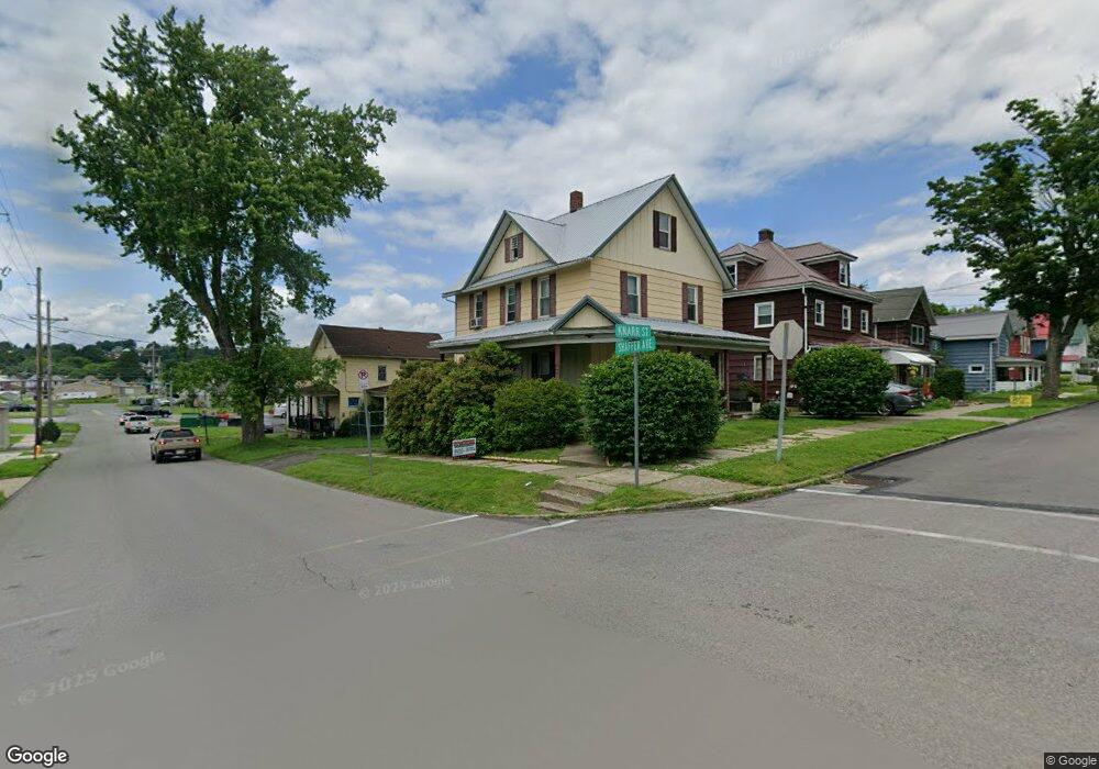
328 Knarr St Du Bois, PA 15801
Estimated Value: $112,231 - $184,000
--
Bed
--
Bath
--
Sq Ft
4,356
Sq Ft Lot
About This Home
This home is located at 328 Knarr St, Du Bois, PA 15801 and is currently estimated at $137,558. 328 Knarr St is a home located in Clearfield County with nearby schools including DuBois Area Senior High School, Central Catholic Elementary School, and DuBois Christian Schools.
Ownership History
Date
Name
Owned For
Owner Type
Purchase Details
Closed on
Mar 10, 2014
Sold by
Dressler Mark A and Dressler Kathy
Bought by
Eby Carole
Current Estimated Value
Purchase Details
Closed on
May 16, 2011
Sold by
Andrekovich Mark S and Andrekovich Timothy D
Bought by
Dressler Mark A
Home Financials for this Owner
Home Financials are based on the most recent Mortgage that was taken out on this home.
Original Mortgage
$92,591
Interest Rate
4.75%
Mortgage Type
FHA
Purchase Details
Closed on
Apr 25, 2009
Sold by
Andrekovich Donald J and Andrekovich Marlene I
Bought by
Andrekovich Donald J and Andrekovich Marlene I
Create a Home Valuation Report for This Property
The Home Valuation Report is an in-depth analysis detailing your home's value as well as a comparison with similar homes in the area
Home Values in the Area
Average Home Value in this Area
Purchase History
| Date | Buyer | Sale Price | Title Company |
|---|---|---|---|
| Eby Carole | $95,000 | None Available | |
| Dressler Mark A | $95,000 | None Available | |
| Andrekovich Donald J | -- | None Available |
Source: Public Records
Mortgage History
| Date | Status | Borrower | Loan Amount |
|---|---|---|---|
| Previous Owner | Dressler Mark A | $92,591 |
Source: Public Records
Tax History Compared to Growth
Tax History
| Year | Tax Paid | Tax Assessment Tax Assessment Total Assessment is a certain percentage of the fair market value that is determined by local assessors to be the total taxable value of land and additions on the property. | Land | Improvement |
|---|---|---|---|---|
| 2025 | $1,440 | $19,750 | $2,900 | $16,850 |
| 2024 | $247 | $9,875 | $1,450 | $8,425 |
| 2023 | $1,420 | $9,875 | $1,450 | $8,425 |
| 2022 | $1,367 | $9,875 | $1,450 | $8,425 |
| 2021 | $1,367 | $9,875 | $1,450 | $8,425 |
| 2020 | $1,367 | $9,875 | $1,450 | $8,425 |
| 2019 | $1,366 | $9,875 | $1,450 | $8,425 |
| 2018 | $0 | $9,875 | $1,450 | $8,425 |
| 2017 | $1,348 | $9,875 | $1,450 | $8,425 |
| 2016 | -- | $9,875 | $1,450 | $8,425 |
| 2015 | -- | $9,875 | $1,450 | $8,425 |
| 2014 | -- | $9,875 | $1,450 | $8,425 |
Source: Public Records
Map
Nearby Homes
- 1237 1/2 & 1239 S Brady St
- 510 S Church St
- 136 Tozier Ave
- 549 Locust St
- 125 Penn Ave
- 101 W Weber Ave
- 9 South Ave
- 216 E Long Ave
- 159 E Long Ave
- 107 S Main St
- 417 Spring Ave
- 0 Hospital Ave
- 525 W Weber Ave
- 204 E Park Ave
- 500 Rainbow Dr
- 0 Rudy Ave
- 12 Hubert St
- 0 Turtle Alley Unit 4-14209
- 400 S 4th St
- 626 W Long Ave