Estimated Value: $193,000 - $231,000
--
Bed
1
Bath
1,128
Sq Ft
$183/Sq Ft
Est. Value
About This Home
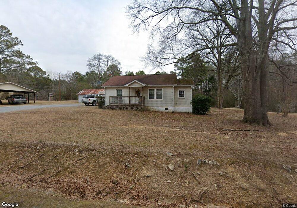
This home is located at 328 Morrison Camp Ground Rd NE, Rome, GA 30161 and is currently estimated at $205,930, approximately $182 per square foot. 328 Morrison Camp Ground Rd NE is a home located in Floyd County with nearby schools including Model Middle School and Model High School.
Ownership History
Date
Name
Owned For
Owner Type
Purchase Details
Closed on
Feb 5, 2021
Sold by
Lankford Christopher
Bought by
Lankford Chris and Lankford Deana
Current Estimated Value
Home Financials for this Owner
Home Financials are based on the most recent Mortgage that was taken out on this home.
Original Mortgage
$116,000
Outstanding Balance
$85,303
Interest Rate
2.65%
Mortgage Type
New Conventional
Estimated Equity
$120,627
Purchase Details
Closed on
Mar 15, 2004
Sold by
Lankford Charles H
Bought by
Lankford Christopher Lee
Purchase Details
Closed on
Dec 12, 2001
Bought by
P and R
Purchase Details
Closed on
Aug 26, 1980
Sold by
Lankford Charles H
Bought by
Lankford Charles H
Purchase Details
Closed on
Aug 21, 1980
Sold by
Lankfords C H
Bought by
Lankford Charles H
Purchase Details
Closed on
Jan 1, 1938
Bought by
Lankfords C H
Create a Home Valuation Report for This Property
The Home Valuation Report is an in-depth analysis detailing your home's value as well as a comparison with similar homes in the area
Home Values in the Area
Average Home Value in this Area
Purchase History
| Date | Buyer | Sale Price | Title Company |
|---|---|---|---|
| Lankford Chris | $116,000 | -- | |
| Lankford Christopher Lee | -- | -- | |
| P | -- | -- | |
| Lankford Charles H | -- | -- | |
| P | -- | -- | |
| Lankford Charles H | -- | -- | |
| Lankfords C H | -- | -- |
Source: Public Records
Mortgage History
| Date | Status | Borrower | Loan Amount |
|---|---|---|---|
| Open | Lankford Chris | $116,000 |
Source: Public Records
Tax History Compared to Growth
Tax History
| Year | Tax Paid | Tax Assessment Tax Assessment Total Assessment is a certain percentage of the fair market value that is determined by local assessors to be the total taxable value of land and additions on the property. | Land | Improvement |
|---|---|---|---|---|
| 2024 | $2,545 | $103,423 | $17,741 | $85,682 |
| 2023 | $2,086 | $87,089 | $16,128 | $70,961 |
| 2022 | $1,752 | $69,547 | $13,339 | $56,208 |
| 2021 | $1,408 | $53,971 | $12,136 | $41,835 |
| 2020 | $1,227 | $45,908 | $10,554 | $35,354 |
| 2019 | $848 | $28,222 | $9,412 | $18,810 |
| 2018 | $796 | $26,463 | $8,964 | $17,499 |
| 2017 | $754 | $25,013 | $8,300 | $16,713 |
| 2016 | $745 | $24,417 | $8,280 | $16,137 |
| 2015 | $729 | $24,417 | $8,280 | $16,137 |
| 2014 | $729 | $24,417 | $8,280 | $16,137 |
Source: Public Records
Map
Nearby Homes
- 567 Fred Kelley Rd NE
- 818 Morrison Camp Ground Rd NE
- 406 Fred Kelly Rd NE
- 158 Sproull Rd SE
- 1849 Morrison Camp Ground Rd NE
- 30 Mountain Creek Dr SE
- 0 Mountain Creek Dr SE Unit 10436191
- 127 Branson Rd SE
- 21 Everwood Ct SE
- 96 Collins Rd NE
- 0 Fallen Branch Cir SE Unit 7397536
- 0 Fallen Branch Cir SE Unit 10311756
- 0 Fallen Branch Cir SE Unit 7234792
- 0 Fallen Branch Cir SE Unit 10172755
- 16 Fallen Branch Cir SE
- 12 Winterberry Ln SE
- 7 Trimble Way SE
- 1 Outpost Trail SE
- 3 Outpost Trail SE
- 6 Hideaway Dr NE
- 328 Morrison Camp Ground Rd NE
- 17 Price Rd NE
- 327 Morrison Camp Ground Rd NE
- 375 Morrison Camp Ground Rd NE
- 345 Morrison Camp Ground Rd NE
- 298 Morrison Camp Ground Rd NE
- 41 Price Dr
- 41 Price Rd NE
- 52 Price Rd NE
- 400 Morrison Camp Ground Rd NE
- 64 Price Rd NE
- 63 Price Rd NE
- 321 Morrison Camp Ground Rd NE
- 71 Price Rd NE
- 286 Morrison Camp Ground Rd NE
- 414 Morrison Camp Ground Rd NE
- 273 Morrison Camp Ground Rd NE
- 415 Morrison Camp Ground Rd NE
- 415 Morrison Camp Ground Rd NE
- 415 Morrison Camp Ground Rd NE