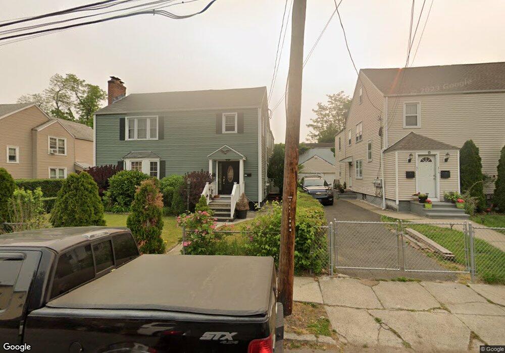
328 Pacific St Bridgeport, CT 06604
Brooklawn-Saint Vincent NeighborhoodEstimated Value: $443,000 - $594,000
4
Beds
2
Baths
2,738
Sq Ft
$190/Sq Ft
Est. Value
About This Home
This home is located at 328 Pacific St, Bridgeport, CT 06604 and is currently estimated at $521,283, approximately $190 per square foot. 328 Pacific St is a home located in Fairfield County with nearby schools including Geraldine Johnson School, Bassick High School, and Merkaz Community High School for Judaic Studies.
Ownership History
Date
Name
Owned For
Owner Type
Purchase Details
Closed on
Sep 30, 2003
Sold by
Perillo Joyce C
Bought by
Pacheco Ferdis
Current Estimated Value
Home Financials for this Owner
Home Financials are based on the most recent Mortgage that was taken out on this home.
Original Mortgage
$207,000
Interest Rate
6.29%
Create a Home Valuation Report for This Property
The Home Valuation Report is an in-depth analysis detailing your home's value as well as a comparison with similar homes in the area
Home Values in the Area
Average Home Value in this Area
Purchase History
| Date | Buyer | Sale Price | Title Company |
|---|---|---|---|
| Pacheco Ferdis | $230,000 | -- | |
| Pacheco Ferdis | $230,000 | -- |
Source: Public Records
Mortgage History
| Date | Status | Borrower | Loan Amount |
|---|---|---|---|
| Open | Pacheco Ferdis | $240,000 | |
| Closed | Pacheco Ferdis | $207,000 |
Source: Public Records
Tax History
| Year | Tax Paid | Tax Assessment Tax Assessment Total Assessment is a certain percentage of the fair market value that is determined by local assessors to be the total taxable value of land and additions on the property. | Land | Improvement |
|---|---|---|---|---|
| 2025 | $8,429 | $194,000 | $80,280 | $113,720 |
| 2024 | $8,429 | $194,000 | $80,280 | $113,720 |
| 2023 | $8,429 | $194,000 | $80,280 | $113,720 |
| 2022 | $8,429 | $194,000 | $80,280 | $113,720 |
| 2021 | $8,429 | $194,000 | $80,280 | $113,720 |
| 2020 | $7,627 | $141,260 | $48,640 | $92,620 |
| 2019 | $7,627 | $141,260 | $48,640 | $92,620 |
| 2018 | $7,680 | $141,260 | $48,640 | $92,620 |
| 2017 | $7,680 | $141,260 | $48,640 | $92,620 |
| 2016 | $7,680 | $141,260 | $48,640 | $92,620 |
| 2015 | $7,859 | $186,230 | $51,520 | $134,710 |
| 2014 | $7,859 | $186,230 | $51,520 | $134,710 |
Source: Public Records
Map
Nearby Homes
- 1285 Norman St
- 366 Brooklawn Ave
- 61 Astoria Ave
- 30-32 Pacific St
- 91 Algonquin Rd
- 860 Briarwood Ave
- 84 Algonquin Rd
- 2370 North Ave Unit 3F
- 493 W Taft Ave
- 2078 Park Ave Unit 2082
- 660 W Jackson Ave
- 523 W Jackson Ave
- 700 Laurel Ave
- 697 Laurel Ave
- 74 Carleton Ave
- 80 Cartright St Unit 5D
- 80 Cartright St Unit PHA
- 100 Lorraine St
- 1515 Capitol Ave Unit 1517
- 25 Cartright St Unit 5D
- 342 Pacific St Unit 344
- 314 Pacific St Unit 316
- 38 Somers St
- 306 Pacific St Unit 308
- 358 Pacific St Unit 360
- 32 Somers St
- 309 Pacific St
- 311 Pacific St
- 325 Pacific St
- 24 Somers St
- 341 Pacific St
- 305 Pacific St
- 368 Pacific St Unit 370
- 359 Pacific St
- 299 Pacific St
- 853 Wood Ave
- 845 Wood Ave
- 291 Pacific St
- 909 Wood Ave
- 315 Wade St
Your Personal Tour Guide
Ask me questions while you tour the home.