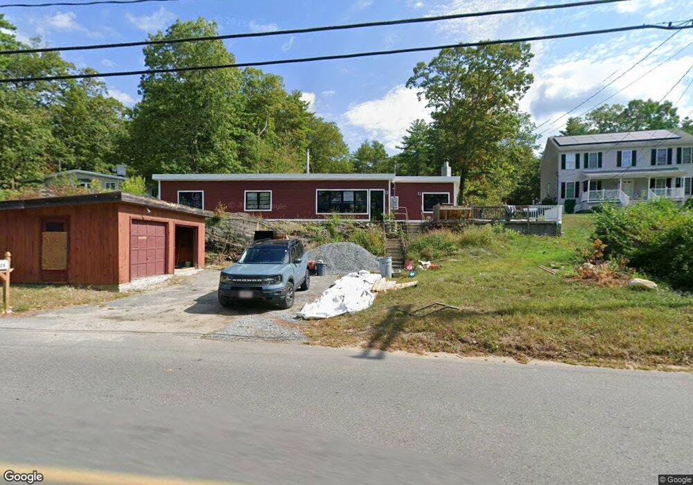
328 Townsend Harbor Rd Lunenburg, MA 01462
Estimated Value: $370,000 - $508,000
3
Beds
1
Bath
1,640
Sq Ft
$269/Sq Ft
Est. Value
About This Home
This home is located at 328 Townsend Harbor Rd, Lunenburg, MA 01462 and is currently estimated at $441,093, approximately $268 per square foot. 328 Townsend Harbor Rd is a home located in Worcester County with nearby schools including Lunenburg Primary School and Lunenburg High School.
Ownership History
Date
Name
Owned For
Owner Type
Purchase Details
Closed on
Dec 30, 2011
Sold by
Household Finance Corp
Bought by
Daley Frederick F
Current Estimated Value
Home Financials for this Owner
Home Financials are based on the most recent Mortgage that was taken out on this home.
Original Mortgage
$116,860
Outstanding Balance
$81,707
Interest Rate
4.4%
Mortgage Type
FHA
Estimated Equity
$359,386
Purchase Details
Closed on
Apr 4, 2011
Sold by
Musselman Erika H
Bought by
Household Finance Corp
Create a Home Valuation Report for This Property
The Home Valuation Report is an in-depth analysis detailing your home's value as well as a comparison with similar homes in the area
Home Values in the Area
Average Home Value in this Area
Purchase History
| Date | Buyer | Sale Price | Title Company |
|---|---|---|---|
| Daley Frederick F | $119,000 | -- | |
| Household Finance Corp | $197,829 | -- |
Source: Public Records
Mortgage History
| Date | Status | Borrower | Loan Amount |
|---|---|---|---|
| Open | Daley Frederick F | $116,860 |
Source: Public Records
Tax History
| Year | Tax Paid | Tax Assessment Tax Assessment Total Assessment is a certain percentage of the fair market value that is determined by local assessors to be the total taxable value of land and additions on the property. | Land | Improvement |
|---|---|---|---|---|
| 2025 | $5,374 | $374,200 | $118,900 | $255,300 |
| 2024 | $7,047 | $499,800 | $291,500 | $208,300 |
| 2023 | $10,430 | $713,400 | $509,500 | $203,900 |
| 2022 | $6,377 | $371,000 | $216,600 | $154,400 |
| 2020 | $6,465 | $356,800 | $216,800 | $140,000 |
| 2019 | $6,105 | $326,800 | $197,100 | $129,700 |
| 2018 | $5,622 | $285,400 | $187,900 | $97,500 |
| 2017 | $5,636 | $282,100 | $189,400 | $92,700 |
| 2016 | $5,226 | $266,500 | $177,600 | $88,900 |
| 2015 | $4,556 | $248,700 | $161,500 | $87,200 |
Source: Public Records
Map
Nearby Homes
- 91 Valley Rd
- 367 Mulpus Rd
- 4 Koski Way
- 36 Gilchrest St
- 12 Cortland Cir Unit 12
- 35 Leominster Rd
- 114 Chestnut St
- 63 Holman St
- 319 Highland St
- 00 Tyler Rd
- Lot 10 Christian Cir
- 2 Gabes Place
- 711 Massachusetts Ave Unit 2
- 189 Electric Unit A
- 105 Townsend Rd Unit 1
- 110 Burrage St
- 45 Maplewood Dr
- 7 Balsam Dr
- 22 Townsend Rd
- 24 Townsend Rd
- 334 Townsend Harbor Rd
- 322 Townsend Harbor Rd
- 338 Townsend Harbor Rd
- 314 Townsend Harbor Rd
- 344 Townsend Harbor Rd
- 312 Townsend Harbor Rd
- 352 Townsend Harbor Rd
- 358 Townsend Harbor Rd
- 7-11 Mulpus Rd
- 7 Mulpus Rd Unit 11
- 362 Townsend Harbor Rd
- 31 Mulpus Rd
- 90 Mulpus Rd
- 368 Townsend Harbor Rd
- 21 Mulpus Rd
- 10 Mulpus Rd
- 372 Townsend Harbor Rd
- 20 Mulpus Rd
- 379 Townsend Harbor Rd
- 26 Mulpus Rd
Your Personal Tour Guide
Ask me questions while you tour the home.