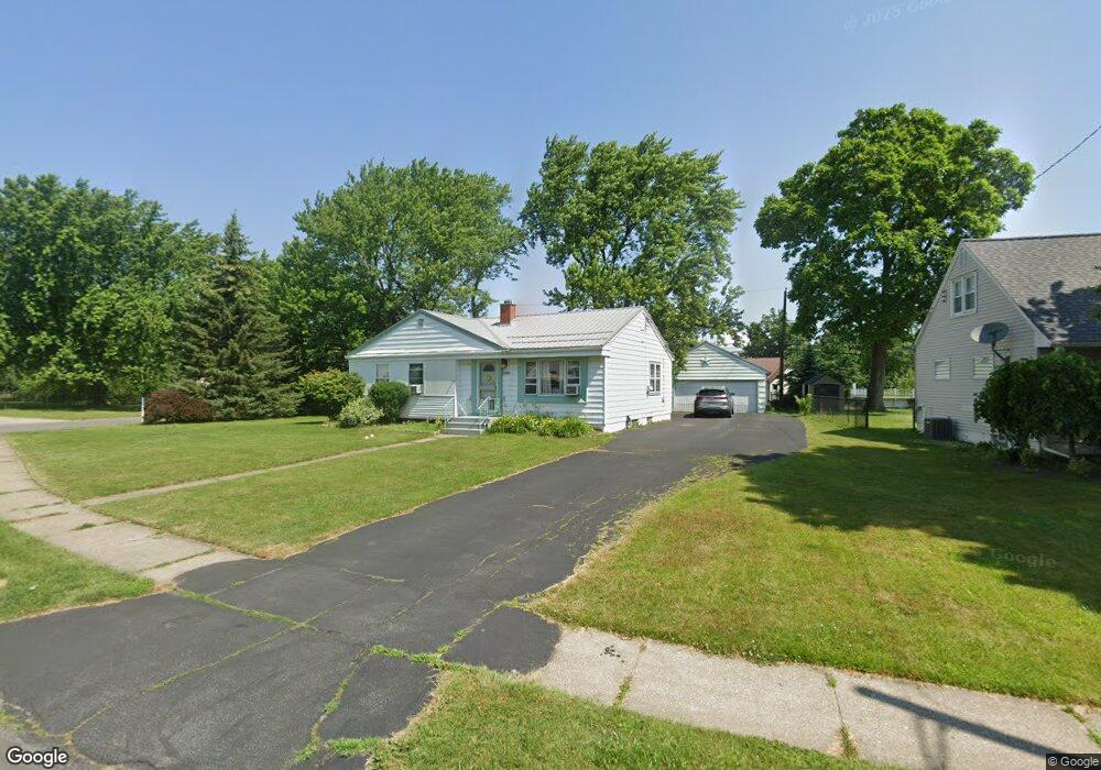
3281 Bethford Dr Buffalo, NY 14219
Estimated Value: $226,000 - $265,042
3
Beds
1
Bath
1,168
Sq Ft
$211/Sq Ft
Est. Value
About This Home
This home is located at 3281 Bethford Dr, Buffalo, NY 14219 and is currently estimated at $246,761, approximately $211 per square foot. 3281 Bethford Dr is a home located in Erie County with nearby schools including Blasdell Elementary School, Frontier Middle School, and Frontier Senior High School.
Ownership History
Date
Name
Owned For
Owner Type
Purchase Details
Closed on
Apr 7, 2017
Sold by
Swann Angeline M
Bought by
Swann Angeline M and Swann David A
Current Estimated Value
Purchase Details
Closed on
Jul 10, 2013
Sold by
Swann David
Bought by
Swann Angeline M Angeline M
Home Financials for this Owner
Home Financials are based on the most recent Mortgage that was taken out on this home.
Original Mortgage
$80,000
Outstanding Balance
$56,999
Interest Rate
3.45%
Mortgage Type
New Conventional
Estimated Equity
$189,762
Purchase Details
Closed on
Jan 17, 2013
Sold by
Swann Angeline M and Swann Leslie J
Bought by
Swann David A
Create a Home Valuation Report for This Property
The Home Valuation Report is an in-depth analysis detailing your home's value as well as a comparison with similar homes in the area
Home Values in the Area
Average Home Value in this Area
Purchase History
| Date | Buyer | Sale Price | Title Company |
|---|---|---|---|
| Swann Angeline M | -- | None Available | |
| Swann Angeline M Angeline M | -- | -- | |
| Swann David A | -- | None Available |
Source: Public Records
Mortgage History
| Date | Status | Borrower | Loan Amount |
|---|---|---|---|
| Open | Swann Angeline M Angeline M | $80,000 |
Source: Public Records
Tax History Compared to Growth
Tax History
| Year | Tax Paid | Tax Assessment Tax Assessment Total Assessment is a certain percentage of the fair market value that is determined by local assessors to be the total taxable value of land and additions on the property. | Land | Improvement |
|---|---|---|---|---|
| 2024 | $4,742 | $71,400 | $7,700 | $63,700 |
| 2023 | $4,604 | $71,400 | $7,700 | $63,700 |
| 2022 | $4,445 | $71,400 | $7,700 | $63,700 |
| 2021 | $4,396 | $71,400 | $7,700 | $63,700 |
| 2020 | $4,885 | $71,400 | $7,700 | $63,700 |
| 2019 | $2,457 | $71,400 | $7,700 | $63,700 |
| 2018 | $2,477 | $71,400 | $7,700 | $63,700 |
| 2017 | $1,495 | $71,400 | $7,700 | $63,700 |
| 2016 | $2,502 | $71,400 | $7,700 | $63,700 |
| 2015 | -- | $71,400 | $7,700 | $63,700 |
| 2014 | -- | $71,400 | $7,700 | $63,700 |
Source: Public Records
Map
Nearby Homes
- 3341 Carol Ct
- 3295 Mckinley Pkwy
- 3387 Bethford Dr
- 3396 Bethford Dr
- 3457 Dolphin Dr
- 3055 Mckinley Pkwy
- 0 Milestrip Rd N Unit B1635861
- 4328 Oakwood Ave
- 3209-3211 Abbott Rd Unit 3209
- 5113 Lake Ave
- VL Milestrip Rd
- 4952 Tim Tam Trail
- 4939 Tim Tam Trail
- 52 Kennedy Dr
- 4241 Elmwood Ave
- 3648 S Park Ave
- 5244 Lake Ave
- 4218 Salem Dr
- 169 Edison St
- 58 Kent Ave
- 3289 Bethford Dr
- 3293 Bethford Dr
- 3278 Bethford Dr
- 4629 Lake Ave
- 4641 Lake Ave
- 3284 Ashley Dr
- 3284 Bethford Dr
- 3299 Bethford Dr
- 3288 Bethford Dr
- 3283 Ashley Dr
- 4655 Lake Ave
- 4617 Lake Ave
- 3294 Bethford Dr
- 3309 Cox Dr
- 3292 Ashley Dr
- 3303 Bethford Dr
- 3311 Cox Dr
- 4603 Lake Ave
- 3300 Bethford Dr
- 4667 Lake Ave