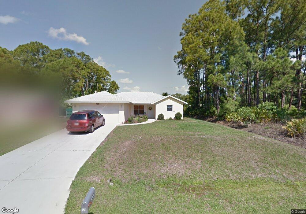
3281 Rogue St North Port, FL 34291
Estimated Value: $254,973 - $286,000
3
Beds
2
Baths
1,303
Sq Ft
$212/Sq Ft
Est. Value
About This Home
This home is located at 3281 Rogue St, North Port, FL 34291 and is currently estimated at $276,743, approximately $212 per square foot. 3281 Rogue St is a home located in Sarasota County with nearby schools including Glenallen Elementary School, North Port High School, and Heron Creek Middle School.
Ownership History
Date
Name
Owned For
Owner Type
Purchase Details
Closed on
Oct 30, 2018
Sold by
Hebert Matthew and Hebert Christina L
Bought by
Hebert Christina L
Current Estimated Value
Purchase Details
Closed on
Jun 30, 2006
Sold by
Royal Venice Inc
Bought by
Hebert Matthew and Hebert Christina L
Home Financials for this Owner
Home Financials are based on the most recent Mortgage that was taken out on this home.
Original Mortgage
$115,000
Interest Rate
6.55%
Mortgage Type
Purchase Money Mortgage
Purchase Details
Closed on
Apr 14, 2005
Sold by
Sanders Erma
Bought by
Royal Venice Inc
Create a Home Valuation Report for This Property
The Home Valuation Report is an in-depth analysis detailing your home's value as well as a comparison with similar homes in the area
Home Values in the Area
Average Home Value in this Area
Purchase History
| Date | Buyer | Sale Price | Title Company |
|---|---|---|---|
| Hebert Christina L | $45,800 | Attorney | |
| Hebert Matthew | $187,800 | Chelsea Title Company | |
| Royal Venice Inc | $37,000 | Chelsea Title Company |
Source: Public Records
Mortgage History
| Date | Status | Borrower | Loan Amount |
|---|---|---|---|
| Previous Owner | Hebert Matthew | $115,000 |
Source: Public Records
Tax History Compared to Growth
Tax History
| Year | Tax Paid | Tax Assessment Tax Assessment Total Assessment is a certain percentage of the fair market value that is determined by local assessors to be the total taxable value of land and additions on the property. | Land | Improvement |
|---|---|---|---|---|
| 2024 | $2,777 | $70,043 | -- | -- |
| 2023 | $2,777 | $68,003 | $0 | $0 |
| 2022 | $2,753 | $72,422 | $0 | $0 |
| 2021 | $2,681 | $70,313 | $0 | $0 |
| 2020 | $1,232 | $69,342 | $0 | $0 |
| 2019 | $1,199 | $67,783 | $0 | $0 |
| 2018 | $1,104 | $66,519 | $0 | $0 |
| 2017 | $1,083 | $65,151 | $0 | $0 |
| 2016 | $1,078 | $111,200 | $4,700 | $106,500 |
| 2015 | $1,088 | $95,200 | $3,800 | $91,400 |
| 2014 | $1,067 | $61,935 | $0 | $0 |
Source: Public Records
Map
Nearby Homes
- 7192 N Paragon Rd
- 0 Minardi St Unit MFRC7512307
- 7380 Meroni Blvd
- 4304 Mermell Cir
- 4357 Mermell Cir
- Lot 17 Branham St
- 2821 Embassy Rd
- 3339 Duar Terrace
- 7478 Paragon Rd
- 3435 Duar Terrace
- 2713 Embassy Rd
- 4410 Mermell Cir
- 4427 N Mermell Cir
- 0 Cordova Terrace Unit MFRC7514596
- 0 Cordova Terrace Unit MFRC7514594
- 0 Cordova Terrace Unit MFRC7512529
- 0 Cordova Terrace Unit MFRC7510712
- 0 Cordova Terrace Unit MFRC7504532
- 0 Cordova Terrace Unit MFRC7504531
- 0 Cordova Terrace Unit MFRN6135655