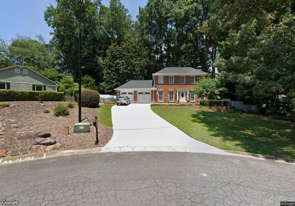
3286 Wetherbyrne Rd NW Unit 1 Kennesaw, GA 30144
Estimated Value: $405,166 - $429,000
3
Beds
3
Baths
1,972
Sq Ft
$210/Sq Ft
Est. Value
About This Home
This home is located at 3286 Wetherbyrne Rd NW Unit 1, Kennesaw, GA 30144 and is currently estimated at $413,792, approximately $209 per square foot. 3286 Wetherbyrne Rd NW Unit 1 is a home located in Cobb County with nearby schools including Kennesaw Elementary School, Big Shanty Elementary School, and Palmer Middle School.
Ownership History
Date
Name
Owned For
Owner Type
Purchase Details
Closed on
Jun 4, 2015
Sold by
Mcdaniel Robert Joseph
Bought by
Strickland Conner and Strickland James
Current Estimated Value
Home Financials for this Owner
Home Financials are based on the most recent Mortgage that was taken out on this home.
Original Mortgage
$90,000
Outstanding Balance
$70,029
Interest Rate
3.88%
Mortgage Type
New Conventional
Estimated Equity
$343,763
Purchase Details
Closed on
Aug 19, 2005
Sold by
Mcdaniel Robert J
Bought by
Mcdaniel Robert J and Mcdaniel Kathy
Home Financials for this Owner
Home Financials are based on the most recent Mortgage that was taken out on this home.
Original Mortgage
$189,000
Interest Rate
5.5%
Mortgage Type
VA
Purchase Details
Closed on
Aug 29, 1996
Sold by
Stroup David
Bought by
Dickson Amy B Kelly D
Purchase Details
Closed on
Jan 25, 1996
Sold by
White Mary L
Bought by
Stroup David
Create a Home Valuation Report for This Property
The Home Valuation Report is an in-depth analysis detailing your home's value as well as a comparison with similar homes in the area
Home Values in the Area
Average Home Value in this Area
Purchase History
| Date | Buyer | Sale Price | Title Company |
|---|---|---|---|
| Strickland Conner | $189,000 | -- | |
| Mcdaniel Robert J | -- | -- | |
| Mcdaniel Robert J | $189,000 | -- | |
| Dickson Amy B Kelly D | $128,800 | -- | |
| Stroup David | $103,100 | -- |
Source: Public Records
Mortgage History
| Date | Status | Borrower | Loan Amount |
|---|---|---|---|
| Open | Strickland Conner | $90,000 | |
| Previous Owner | Mcdaniel Robert J | $189,000 | |
| Closed | Stroup David | $0 |
Source: Public Records
Tax History Compared to Growth
Tax History
| Year | Tax Paid | Tax Assessment Tax Assessment Total Assessment is a certain percentage of the fair market value that is determined by local assessors to be the total taxable value of land and additions on the property. | Land | Improvement |
|---|---|---|---|---|
| 2024 | $3,630 | $153,464 | $32,800 | $120,664 |
| 2023 | $3,087 | $153,464 | $32,800 | $120,664 |
| 2022 | $3,207 | $132,844 | $28,000 | $104,844 |
| 2021 | $2,467 | $99,024 | $20,800 | $78,224 |
| 2020 | $2,467 | $99,024 | $20,800 | $78,224 |
| 2019 | $2,467 | $99,024 | $20,800 | $78,224 |
| 2018 | $2,467 | $99,024 | $20,800 | $78,224 |
| 2017 | $1,844 | $74,696 | $20,800 | $53,896 |
| 2016 | $1,947 | $67,720 | $20,800 | $46,920 |
| 2015 | $1,716 | $67,720 | $20,800 | $46,920 |
| 2014 | -- | $67,720 | $0 | $0 |
Source: Public Records
Map
Nearby Homes
- 3217 Wetherbyrne Rd NW
- 3185 Country Club Ct NW
- 3065 Kings Dr NW
- 3711 Frey Lake Rd NW
- 6 Fairway Dr NW
- 1050 Sand Wedge Cir NW Unit 2
- 3341 Verdi Ln
- 3322 Cranston Ln
- 3748 Creekwood Crossing NW
- The Kennedy Plan at Devin's Shire
- The Kingsley Plan at Devin's Shire
- The Kensington Plan at Devin's Shire
- 2939 Carrie Farm Rd NW Unit 1A
- 1861 Grant Ct NW Unit 2
- 3771 Club Dr NW
- 1282 Shiloh Trail E
- 1871 Grant Ct NW
- 3578 Kennesaw Station Dr NW
- 3709 Shiloh Trail West NW
- 2987 Carrie Farm Rd NW
- 3286 Wetherbyrne Rd NW
- 3284 Wetherbyrne Rd NW Unit 1
- 3285 Wetherbyrne Rd NW
- 1458 Tributary Ct NW Unit 3
- 1460 Tributary Ct NW
- 1444 Tee Ct NW
- 3276 Wetherbyrne Rd NW
- 1456 Tributary Ct NW
- 1462 Tributary Ct NW Unit 27
- 1462 Tributary Ct NW
- 3277 Wetherbyrne Rd NW
- 1464 Tributary Ct NW
- 1443 Tee Ct NW
- 3271 Wetherbyrne Rd NW Unit 1
- 1454 Tributary Ct NW
- 3268 Wetherbyrne Rd NW
- 1442 Tee Ct NW
- 0 Tributary Ct Unit 7008617
- 0 Tributary Ct
- 3259 Wetherbyrne Rd NW