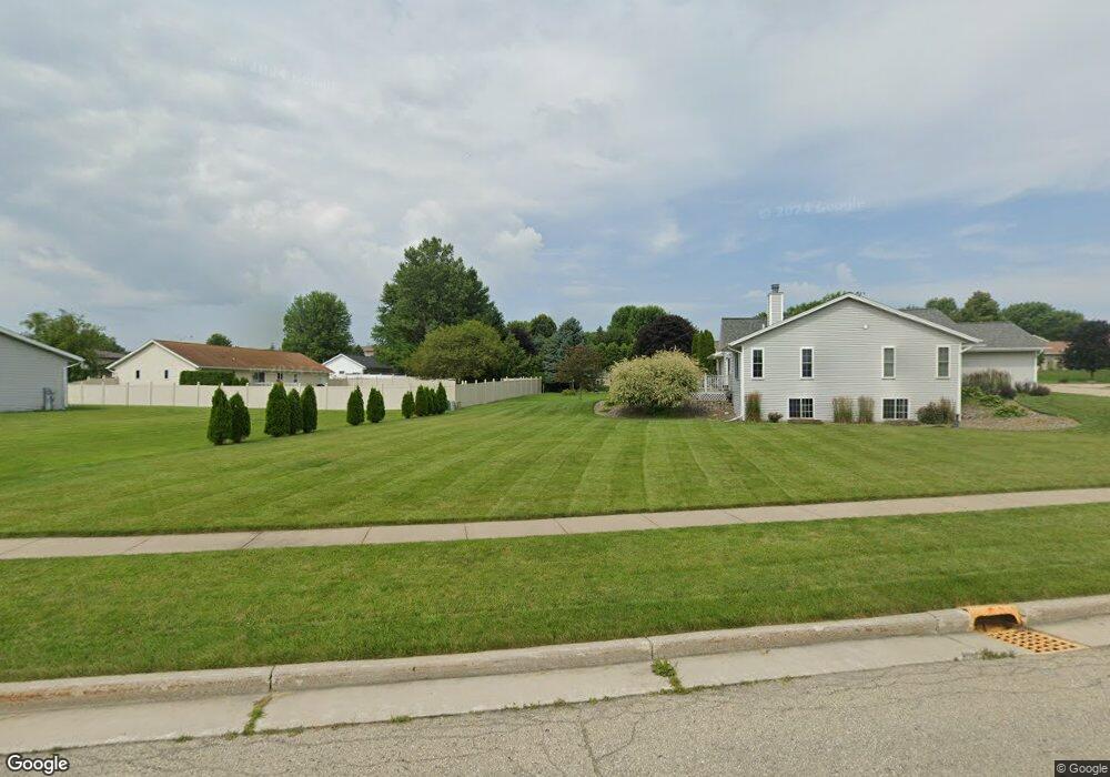
329 Brookside Dr Mayville, WI 53050
Estimated Value: $290,587 - $346,000
3
Beds
2
Baths
1,892
Sq Ft
$167/Sq Ft
Est. Value
About This Home
This home is located at 329 Brookside Dr, Mayville, WI 53050 and is currently estimated at $316,397, approximately $167 per square foot. 329 Brookside Dr is a home located in Dodge County with nearby schools including Parkview Elementary School, Mayville Elementary School, and Mayville Junior/Senior High School.
Ownership History
Date
Name
Owned For
Owner Type
Purchase Details
Closed on
Jun 30, 2017
Sold by
Park Hong-Lim and Park Enunsil A
Bought by
Feucht Christopher R and Feuht Jennifer L
Current Estimated Value
Home Financials for this Owner
Home Financials are based on the most recent Mortgage that was taken out on this home.
Original Mortgage
$101,200
Outstanding Balance
$67,221
Interest Rate
3.94%
Mortgage Type
New Conventional
Estimated Equity
$249,176
Purchase Details
Closed on
May 21, 2014
Sold by
Jpmorgan Chase Bank Na
Bought by
Park Hong-Lim and Park Eunsil Ann
Home Financials for this Owner
Home Financials are based on the most recent Mortgage that was taken out on this home.
Original Mortgage
$68,400
Interest Rate
4.28%
Mortgage Type
New Conventional
Purchase Details
Closed on
Aug 7, 2013
Sold by
Reible Lisa M and Okon Lisa M
Bought by
Jpmorgan Chase Bank N A
Create a Home Valuation Report for This Property
The Home Valuation Report is an in-depth analysis detailing your home's value as well as a comparison with similar homes in the area
Home Values in the Area
Average Home Value in this Area
Purchase History
| Date | Buyer | Sale Price | Title Company |
|---|---|---|---|
| Feucht Christopher R | $126,500 | None Available | |
| Park Hong-Lim | $97,700 | None Available | |
| Jpmorgan Chase Bank N A | $91,800 | None Available |
Source: Public Records
Mortgage History
| Date | Status | Borrower | Loan Amount |
|---|---|---|---|
| Open | Feucht Christopher R | $101,200 | |
| Previous Owner | Park Hong-Lim | $68,400 |
Source: Public Records
Tax History
| Year | Tax Paid | Tax Assessment Tax Assessment Total Assessment is a certain percentage of the fair market value that is determined by local assessors to be the total taxable value of land and additions on the property. | Land | Improvement |
|---|---|---|---|---|
| 2025 | $3,488 | $197,500 | $20,000 | $177,500 |
| 2024 | $3,289 | $197,500 | $20,000 | $177,500 |
| 2023 | $3,231 | $197,500 | $20,000 | $177,500 |
| 2022 | $3,247 | $197,500 | $20,000 | $177,500 |
| 2021 | $2,424 | $103,500 | $17,500 | $86,000 |
| 2020 | $2,465 | $103,500 | $17,500 | $86,000 |
| 2019 | $2,450 | $103,500 | $17,500 | $86,000 |
| 2018 | $2,445 | $103,500 | $17,500 | $86,000 |
| 2017 | $2,459 | $103,500 | $17,500 | $86,000 |
| 2016 | $2,267 | $103,500 | $17,500 | $86,000 |
| 2015 | $2,478 | $103,500 | $17,500 | $86,000 |
| 2014 | $2,405 | $98,500 | $17,500 | $81,000 |
Source: Public Records
Map
Nearby Homes
- 330 Brookside Dr Unit 4
- 520 Dayton St
- Lt2 S Clark St
- 341 N Walnut St
- 117 Taylor St
- 377 Evergreen Dr
- W3730 Decora Rd
- 609 N Cedar St
- W3335 Bauer Rd
- 414 Lynn St
- 611 E Walnut St
- 200 Curry Ln
- Lot 29 Weber View Dr
- 211 Valley St
- 5.06 acres County Rd E
- 225 Juneau St
- N6436 County Road Tw
- 418 Keno Cir
- 1060 W Lake St
- 218 Kilbourne St
- 329 Brookside Dr Unit 2
- 327 Brookside Dr
- 323 Brookside Dr
- 320 N Mountin Dr
- 323 N Mountin Dr
- 335 N Mountin Dr
- 311 Brookside Dr
- 314 N Mountin Dr
- 350 Brookside Dr Unit 2
- 350 Brookside Dr Unit 108
- 350 Brookside Dr Unit 107
- 350 Brookside Dr Unit 106
- 350 Brookside Dr Unit 105
- 350 Brookside Dr Unit 104
- 350 Brookside Dr Unit 103
- 350 Brookside Dr Unit 102
- 350 Brookside Dr Unit 101
- 350 Brookside Dr Unit 7
- 321 N Mountin Dr
- 289 Brookside Dr
Your Personal Tour Guide
Ask me questions while you tour the home.