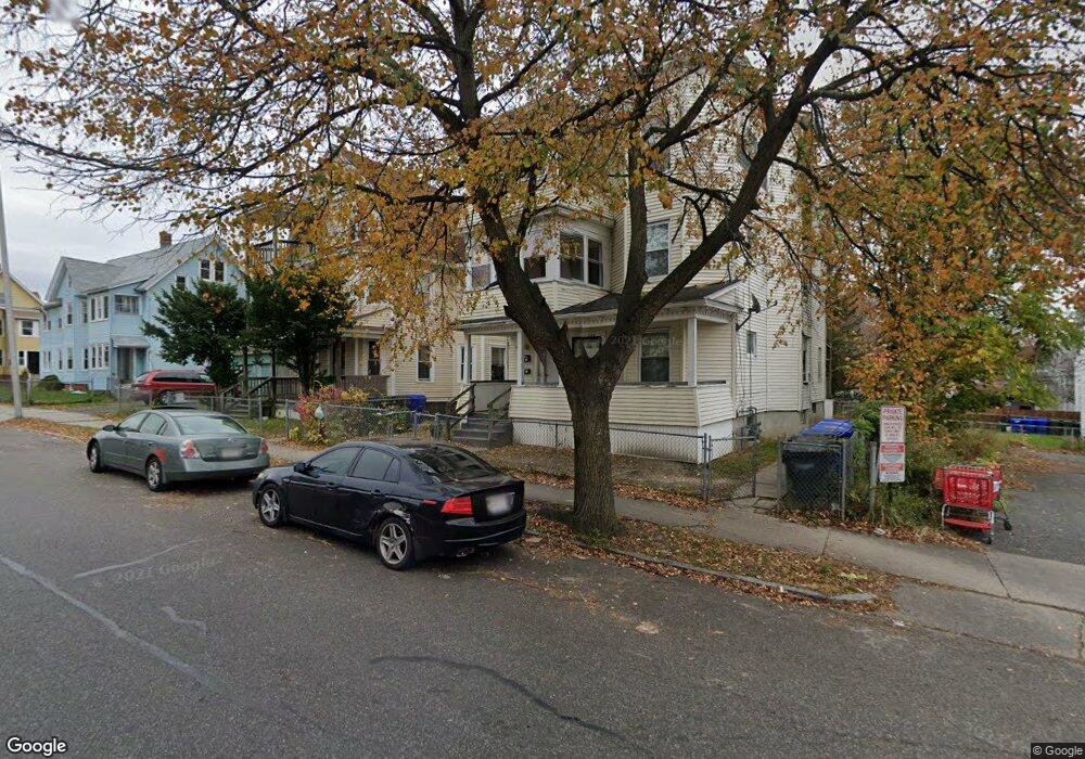
329 Franklin St Springfield, MA 01104
Liberty Heights NeighborhoodEstimated Value: $349,137 - $450,000
6
Beds
3
Baths
3,777
Sq Ft
$107/Sq Ft
Est. Value
About This Home
This home is located at 329 Franklin St, Springfield, MA 01104 and is currently estimated at $403,784, approximately $106 per square foot. 329 Franklin St is a home located in Hampden County with nearby schools including Mary M. Walsh Elementary School, High School Of Commerce, and Springfield High School of Science and Technology.
Ownership History
Date
Name
Owned For
Owner Type
Purchase Details
Closed on
Dec 4, 2025
Sold by
N & W Property Assoc Llc
Bought by
Bernal Nery A
Current Estimated Value
Home Financials for this Owner
Home Financials are based on the most recent Mortgage that was taken out on this home.
Original Mortgage
$150,000
Outstanding Balance
$150,000
Interest Rate
6.22%
Mortgage Type
Commercial
Estimated Equity
$253,784
Purchase Details
Closed on
Apr 26, 2019
Sold by
N & W Associates Inc
Bought by
Bernal Nery A
Purchase Details
Closed on
Feb 23, 2012
Sold by
N & W Assoc Llc
Bought by
N & W Assoc Inc
Purchase Details
Closed on
Jan 22, 2010
Sold by
Bonilla Gerrardo A
Bought by
N & W Assoc Llc
Purchase Details
Closed on
Jun 17, 2005
Sold by
Matrix Rlty Holdings L and Hatwood
Bought by
Bonilla Gerardo A
Home Financials for this Owner
Home Financials are based on the most recent Mortgage that was taken out on this home.
Original Mortgage
$152,000
Interest Rate
5.78%
Mortgage Type
Purchase Money Mortgage
Purchase Details
Closed on
Apr 29, 2005
Sold by
Mcconnell Jamall and Prop Asset Mgmt Inc
Bought by
Matrix Rlty Llc
Home Financials for this Owner
Home Financials are based on the most recent Mortgage that was taken out on this home.
Original Mortgage
$152,000
Interest Rate
5.78%
Mortgage Type
Purchase Money Mortgage
Purchase Details
Closed on
Apr 5, 2004
Sold by
Scoreboard Rlty Corp
Bought by
Mcconnell Jamaal
Purchase Details
Closed on
Dec 23, 2003
Sold by
U S Bank National Asso
Bought by
Scoreboard Rlty Corp
Purchase Details
Closed on
Oct 3, 2003
Sold by
U S Bank Na and Whyte
Bought by
U S Bank Na
Purchase Details
Closed on
Oct 4, 1994
Sold by
Dime Sb Ny
Bought by
Jordan Mattie M
Purchase Details
Closed on
Aug 28, 1992
Sold by
Marsh Winston I
Bought by
Dime Sb Ny
Purchase Details
Closed on
May 8, 1987
Sold by
Jordan John R
Bought by
Marsh Winston I
Create a Home Valuation Report for This Property
The Home Valuation Report is an in-depth analysis detailing your home's value as well as a comparison with similar homes in the area
Home Values in the Area
Average Home Value in this Area
Purchase History
| Date | Buyer | Sale Price | Title Company |
|---|---|---|---|
| Bernal Nery A | -- | -- | |
| N & W Property Assoc Llc | -- | -- | |
| Bernal Nery A | -- | -- | |
| Bernal Nery A | -- | -- | |
| N & W Assoc Inc | -- | -- | |
| N & W Assoc Inc | -- | -- | |
| N & W Assoc Llc | -- | -- | |
| N & W Assoc Llc | -- | -- | |
| Bonilla Gerardo A | $190,000 | -- | |
| Bonilla Gerardo A | $190,000 | -- | |
| Matrix Rlty Llc | $110,100 | -- | |
| Matrix Rlty Llc | $110,100 | -- | |
| Mcconnell Jamaal | $145,000 | -- | |
| Mcconnell Jamaal | $145,000 | -- | |
| Scoreboard Rlty Corp | $90,000 | -- | |
| Scoreboard Rlty Corp | $90,000 | -- | |
| U S Bank Na | $67,661 | -- | |
| U S Bank Na | $67,661 | -- | |
| Jordan Mattie M | $7,900 | -- | |
| Jordan Mattie M | $7,900 | -- | |
| Dime Sb Ny | $46,842 | -- | |
| Dime Sb Ny | $46,842 | -- | |
| Marsh Winston I | $96,000 | -- |
Source: Public Records
Mortgage History
| Date | Status | Borrower | Loan Amount |
|---|---|---|---|
| Open | N & W Property Assoc Llc | $150,000 | |
| Previous Owner | Bonilla Gerardo A | $152,000 | |
| Previous Owner | Bonilla Gerardo A | $38,000 |
Source: Public Records
Tax History
| Year | Tax Paid | Tax Assessment Tax Assessment Total Assessment is a certain percentage of the fair market value that is determined by local assessors to be the total taxable value of land and additions on the property. | Land | Improvement |
|---|---|---|---|---|
| 2025 | $2,993 | $190,900 | $29,100 | $161,800 |
| 2024 | $3,530 | $219,800 | $29,100 | $190,700 |
| 2023 | $2,803 | $164,400 | $26,500 | $137,900 |
| 2022 | $3,344 | $177,700 | $24,700 | $153,000 |
| 2021 | $3,060 | $161,900 | $22,500 | $139,400 |
| 2020 | $3,064 | $156,900 | $22,500 | $134,400 |
| 2019 | $2,505 | $127,300 | $22,500 | $104,800 |
| 2018 | $2,829 | $139,000 | $22,500 | $116,500 |
| 2017 | $2,481 | $126,200 | $16,300 | $109,900 |
| 2016 | $2,334 | $118,700 | $16,300 | $102,400 |
| 2015 | $2,235 | $113,600 | $16,300 | $97,300 |
Source: Public Records
Map
Nearby Homes
- 148-150 Stafford St
- 571-573 Carew St
- 24 Melha Ave
- 69 Winter St
- 78 Prospect St
- 60 Ringgold St
- 138 Magazine St
- 57 Narragansett St
- 13 Ringgold St
- 26 Hebron St
- LOT 3 N S Worthington St
- 211-213 Chapin Terrace
- 40 Byers St
- 140 Chestnut St Unit 706
- 140 Chestnut St Unit 702
- 140 Chestnut St Unit 204
- 140 Chestnut St Unit 819
- 140 Chestnut St Unit 619
- 140 Chestnut St Unit 816
- 140 Chestnut St Unit 604
- 327-329 Franklin St
- 333 Franklin St
- 51 Vinton St
- 53 Webster St
- 57 Webster St Unit 59
- 57-59 Webster St
- 49 Webster St
- 47 Webster St
- 43 Webster St
- 47 Vinton St
- 0 Franklin St
- 39 Webster St
- 358 Franklin St
- 356 Franklin St Unit 358
- 356-358 Franklin St
- 58 Vinton St Unit 60
- 37 Vinton St
- 54-56 Webster St
- 56 Webster St Unit 2
- 56 Webster St
Your Personal Tour Guide
Ask me questions while you tour the home.