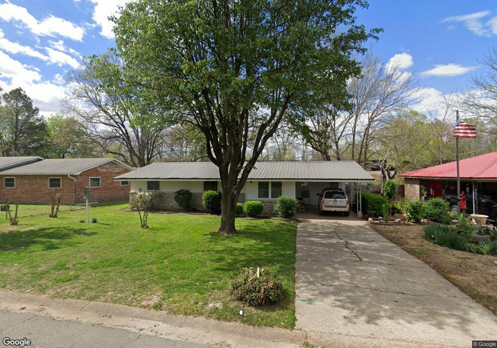
329 Logan St Newport, AR 72112
Estimated Value: $78,672 - $116,000
--
Bed
1
Bath
1,081
Sq Ft
$87/Sq Ft
Est. Value
About This Home
This home is located at 329 Logan St, Newport, AR 72112 and is currently estimated at $93,918, approximately $86 per square foot. 329 Logan St is a home located in Jackson County with nearby schools including Newport Elementary School and Newport High School.
Ownership History
Date
Name
Owned For
Owner Type
Purchase Details
Closed on
Apr 15, 2024
Sold by
Commissioner Of State Lands
Bought by
Trotter Charles and Berkheiser Chad
Current Estimated Value
Purchase Details
Closed on
Jun 18, 2013
Sold by
Generation Mortgage Company
Bought by
Trotter Charles and Berkheiser Chad
Purchase Details
Closed on
May 1, 2013
Sold by
New Millennium Title Group
Bought by
Martin Henrietta
Purchase Details
Closed on
Jun 2, 2011
Sold by
Clayton Ruth Ann
Bought by
Martin Henrietta
Purchase Details
Closed on
Jun 19, 2008
Bought by
Martin Henrietta L and Martin E
Purchase Details
Closed on
Dec 12, 2002
Bought by
Emery Mary L
Create a Home Valuation Report for This Property
The Home Valuation Report is an in-depth analysis detailing your home's value as well as a comparison with similar homes in the area
Home Values in the Area
Average Home Value in this Area
Purchase History
| Date | Buyer | Sale Price | Title Company |
|---|---|---|---|
| Trotter Charles | $1,394 | None Listed On Document | |
| Trotter Charles | -- | -- | |
| Martin Henrietta | $27,500 | -- | |
| Martin Henrietta | $29,000 | -- | |
| Martin Henrietta L | -- | -- | |
| Emery Mary L | -- | -- |
Source: Public Records
Tax History Compared to Growth
Tax History
| Year | Tax Paid | Tax Assessment Tax Assessment Total Assessment is a certain percentage of the fair market value that is determined by local assessors to be the total taxable value of land and additions on the property. | Land | Improvement |
|---|---|---|---|---|
| 2024 | $265 | $11,110 | $570 | $10,540 |
| 2023 | $241 | $4,630 | $190 | $4,440 |
| 2022 | $249 | $4,630 | $190 | $4,440 |
| 2021 | $244 | $4,630 | $190 | $4,440 |
| 2020 | $244 | $4,630 | $190 | $4,440 |
| 2019 | $244 | $4,630 | $190 | $4,440 |
| 2018 | $215 | $4,210 | $190 | $4,020 |
| 2017 | $215 | $4,210 | $190 | $4,020 |
| 2015 | -- | $4,210 | $190 | $4,020 |
| 2014 | -- | $3,894 | $190 | $3,704 |
| 2013 | -- | $3,540 | $380 | $3,160 |
| 2012 | -- | $3,540 | $380 | $3,160 |
Source: Public Records
Map
Nearby Homes
- 604 Mclain St
- 721 Mclain St
- 623 Holden Ave
- 900 Josephine St
- 900 Dill St
- 208 Forrest Dr
- 910 & 914 Dill St
- 000 Forrest Dr
- 318 Wilkerson Dr
- 0 Holmes St Unit 25033630
- 0 Holmes St Unit 25-486
- 1311 Dill St
- 1407 Dill St
- 2001 S Main St
- 4 Virginia Rd
- 418 Pine St
- 315 Pine St
- 203 Alice Ct
- 304 Ash St
- 1016 Front St