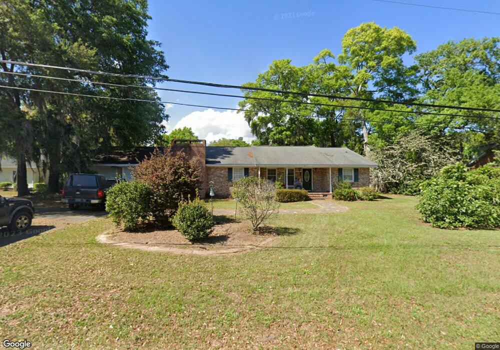
329 Mallard Cir Georgetown, SC 29440
Estimated Value: $314,000 - $529,000
3
Beds
2
Baths
2,232
Sq Ft
$180/Sq Ft
Est. Value
About This Home
This home is located at 329 Mallard Cir, Georgetown, SC 29440 and is currently estimated at $401,906, approximately $180 per square foot. 329 Mallard Cir is a home located in Georgetown County with nearby schools including Maryville Elementary School, Georgetown Middle School, and Georgetown High School.
Ownership History
Date
Name
Owned For
Owner Type
Purchase Details
Closed on
Feb 12, 2010
Sold by
Lasalle Bank Na
Bought by
Carpenter Gregory and Carpenter Kathleen
Current Estimated Value
Purchase Details
Closed on
Jan 23, 2009
Sold by
Jones Lee Y
Bought by
Lasalle Bank Na
Purchase Details
Closed on
Jan 4, 2006
Sold by
Jones Hugh R
Bought by
Jones Lee Y
Home Financials for this Owner
Home Financials are based on the most recent Mortgage that was taken out on this home.
Original Mortgage
$180,000
Interest Rate
7.95%
Mortgage Type
Adjustable Rate Mortgage/ARM
Purchase Details
Closed on
Sep 13, 1999
Sold by
Young Sarah A
Bought by
Jones Hugh R
Create a Home Valuation Report for This Property
The Home Valuation Report is an in-depth analysis detailing your home's value as well as a comparison with similar homes in the area
Home Values in the Area
Average Home Value in this Area
Purchase History
| Date | Buyer | Sale Price | Title Company |
|---|---|---|---|
| Carpenter Gregory | $130,000 | -- | |
| Lasalle Bank Na | $2,500 | -- | |
| Jones Lee Y | -- | None Available | |
| Jones Hugh R | $73,000 | -- |
Source: Public Records
Mortgage History
| Date | Status | Borrower | Loan Amount |
|---|---|---|---|
| Previous Owner | Jones Lee Y | $180,000 |
Source: Public Records
Tax History Compared to Growth
Tax History
| Year | Tax Paid | Tax Assessment Tax Assessment Total Assessment is a certain percentage of the fair market value that is determined by local assessors to be the total taxable value of land and additions on the property. | Land | Improvement |
|---|---|---|---|---|
| 2024 | $971 | $8,069 | $1,118 | $6,951 |
| 2023 | $971 | $8,069 | $1,118 | $6,951 |
| 2022 | $901 | $8,069 | $1,118 | $6,951 |
| 2021 | $3,055 | $0 | $0 | $0 |
| 2020 | $3,052 | $0 | $0 | $0 |
| 2019 | $2,659 | $0 | $0 | $0 |
| 2018 | $2,674 | $0 | $0 | $0 |
| 2017 | $2,401 | $0 | $0 | $0 |
| 2016 | $2,384 | $10,524 | $0 | $0 |
| 2015 | $2,277 | $0 | $0 | $0 |
| 2014 | $2,277 | $173,000 | $34,200 | $138,800 |
| 2012 | -- | $173,000 | $34,200 | $138,800 |
Source: Public Records
Map
Nearby Homes
- 408 Whitehall Ave
- 101 Mayrant Bluff Ln Unit 102
- 18 Canvasback Cove Unit 121
- 18 Canvasback Cove Unit 122
- 31 Little Point Ln Unit 32
- 64 Bamboo Loop Unit 161
- Lot 158 Commanders Island Rd
- Lot 155 Commanders Island Rd
- 805 Commanders Island Rd Unit Lot 177 Custom Plan
- 655 Millbrook Rd Unit Lot 143
- TBD Commanders Island Rd
- Lot 132 Oak Lawn Rd
- 706 Daisy Bank Cir Unit Lot 16 Custom Plan
- 529 Oak Lawn Rd
- 521 Oak Lawn Rd
- 379 Richfield Rd
- Lot 142 Millbank Rd
- 72 Richfield Rd
- 3680 South Island Rd
- 117 George Washington Trail
- 329 Mallard Cir
- 209 Whitehall Ave
- 305 Mallard Cir
- 187 Whitehall Ave Unit Belle Isle
- 187 Whitehall Ave
- 553 Whitehall Ave
- 344 Mallard Cir
- 314 Mallard Cir
- 373 Mallard Cir
- 445 Mallard Cir
- 283 Mallard Cir
- 294 Mallard Cir
- 263 Mallard Cir
- 362 Mallard Cir
- 218 Whitehall Ave
- 188 Whitehall Ave
- 244 Mallard Cir
- 245 Mallard Cir
- 166 Whitehall Ave
- 579 Whitehall Ave