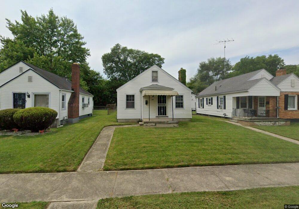
329 N Upland Ave Dayton, OH 45417
Westwood NeighborhoodEstimated Value: $64,145 - $87,000
3
Beds
1
Bath
1,273
Sq Ft
$62/Sq Ft
Est. Value
About This Home
This home is located at 329 N Upland Ave, Dayton, OH 45417 and is currently estimated at $78,786, approximately $61 per square foot. 329 N Upland Ave is a home located in Montgomery County with nearby schools including International School at Residence Park, Westwood Elementary, and Louise Troy Elementary.
Ownership History
Date
Name
Owned For
Owner Type
Purchase Details
Closed on
Jan 4, 2023
Sold by
Walters Niklaas
Bought by
West Side Property Group Llc
Current Estimated Value
Purchase Details
Closed on
Jan 26, 2018
Sold by
Equity Trust Co and Carey Darrin
Bought by
Walters Niklaas
Purchase Details
Closed on
Oct 6, 2017
Sold by
Deizeith Michael
Bought by
Equity Trust Co and Darrin Carey Ira
Purchase Details
Closed on
Sep 17, 2003
Sold by
Delzeith Leroy J
Bought by
Delzeith Michael
Create a Home Valuation Report for This Property
The Home Valuation Report is an in-depth analysis detailing your home's value as well as a comparison with similar homes in the area
Home Values in the Area
Average Home Value in this Area
Purchase History
| Date | Buyer | Sale Price | Title Company |
|---|---|---|---|
| West Side Property Group Llc | $1,000 | -- | |
| Walters Niklaas | $7,500 | None Available | |
| Equity Trust Co | $1,000 | None Available | |
| Delzeith Michael | -- | -- |
Source: Public Records
Tax History Compared to Growth
Tax History
| Year | Tax Paid | Tax Assessment Tax Assessment Total Assessment is a certain percentage of the fair market value that is determined by local assessors to be the total taxable value of land and additions on the property. | Land | Improvement |
|---|---|---|---|---|
| 2024 | $833 | $7,530 | $2,150 | $5,380 |
| 2023 | $833 | $7,530 | $2,150 | $5,380 |
| 2022 | $537 | $6,140 | $1,750 | $4,390 |
| 2021 | $473 | $6,140 | $1,750 | $4,390 |
| 2020 | $472 | $6,140 | $1,750 | $4,390 |
| 2019 | $1,297 | $8,260 | $1,750 | $6,510 |
| 2018 | $682 | $8,260 | $1,750 | $6,510 |
| 2017 | $677 | $8,260 | $1,750 | $6,510 |
| 2016 | $710 | $8,260 | $1,750 | $6,510 |
| 2015 | $672 | $8,260 | $1,750 | $6,510 |
| 2014 | $672 | $8,260 | $1,750 | $6,510 |
| 2012 | -- | $11,920 | $2,860 | $9,060 |
Source: Public Records
Map
Nearby Homes
- 314 N Upland Ave Unit 312
- 222 N Decker Ave
- 309 Leland Ave
- 524 Crestmore Ave
- 227 Walton Ave
- 532 Crestmore Ave
- 712 N Gettysburg Ave
- 320 Huron Ave
- 432 N Gettysburg Ave
- 605 N Gettysburg Ave
- 79 N Alder St
- 71 N Alder St
- 911 N Gettysburg Ave
- 3602 Hoover Ave Unit 3600
- 4126 Sylvan Dr
- 221 Brooklyn Ave
- 308 Brooklyn Ave
- 548 Huron Ave
- 733 Leland Ave
- 728 Leland Ave
- 333 N Upland Ave
- 325 N Upland Ave
- 319 N Upland Ave
- 337 N Upland Ave
- 3529 Delphos Ave
- 313 N Upland Ave
- 341 N Upland Ave
- 3535 Delphos Ave
- 345 N Upland Ave
- 3545 Delphos Ave
- 328 N Upland Ave
- 31000 Delphos Ave
- 0 Delphos Ave Unit 735462
- 324 N Upland Ave
- 332 N Upland Ave
- 336 N Upland Ave
- 2722 Edison St
- 316 N Upland Ave
- 340 N Upland Ave
- 344 N Upland Ave